When Is Drone Photography Worth It for a Real Estate Listing?
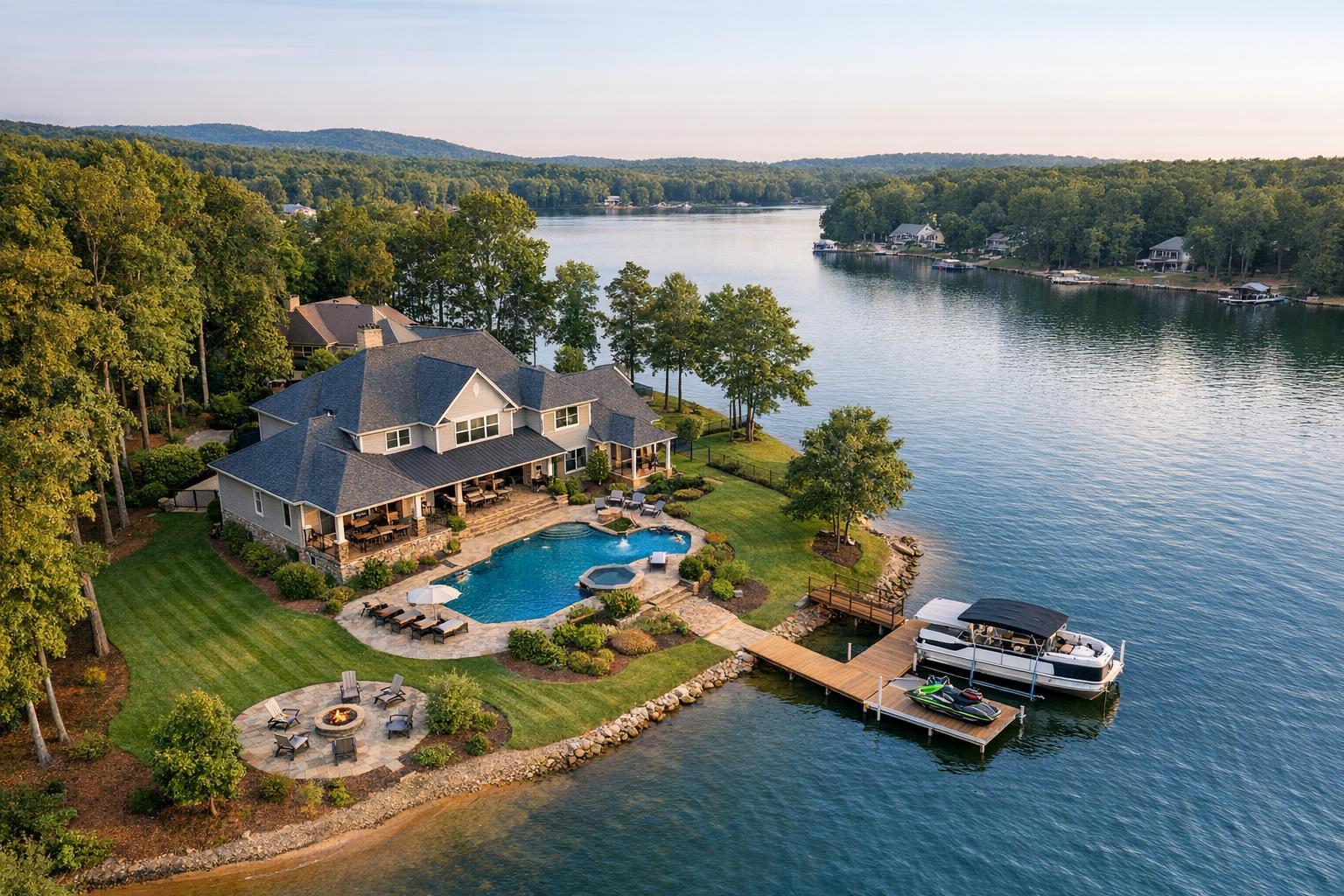
A stunning piece of real estate captured by drone photography showcases a luxurious lakeside home with manicured lawns, a large swimming pool, and a private dock.
When Is Drone Photography Worth It for a Real Estate Listing?
Drone photography real estate has become a frequent topic of conversation for agents, brokers, and property marketers across NYC, New Jersey, and beyond. The short answer: it’s worth considering when an aerial perspective actually clarifies, reveals, or explains something that ground-level images cannot.
Aerial Context: When the View from Above Matters
Every real estate listing tells a story, and sometimes, the property’s relationship to its surroundings is central to that narrative. Drone photography isn’t about novelty—it’s about context. For the right listing, aerial media can help a potential buyer or tenant see how a home is positioned on its lot, enjoy an unobstructed look at a roof deck, understand the proximity to water, or visualize access points for a commercial property. Sometimes, only a shot from above can communicate lot size, outdoor features, or intricate site layouts.
Yet, not every property benefits equally. A compact city apartment with no meaningful outdoor space, or a building where exterior relationships are simple and self-explanatory, may not gain much from an aerial perspective. The real test is practical: will this perspective help a prospective buyer or tenant understand the offering better?
What Aerial Media Adds—And When It’s Not Essential
Standard ground-level photography is foundational for any listing. It’s how the architectural details, entrance, landscaping, and curb appeal are presented. Aerial real estate photography steps in when you need to convey something extra: the big-picture layout, the interplay among structures, or features that are hard to appreciate from the street.
A few scenarios where aerial media shines:
- Wide, wooded, or irregular lots: A single image can reveal the true spread of land, the shape of the parcel, or the privacy gained by mature trees.
- Pools, patios, and gardens: Outdoor entertaining areas, especially those tucked behind a home or shielded from the street, are more easily understood from above.
- Waterfront frontage and access: Whether it’s a dock, marina, or a long shoreline, nothing compares to an elevated view for showing the property’s relationship to the water.
- Multiple structures: Guest houses, detached garages, or accessory buildings can look disconnected at ground level but appear coherent from the air.
- Proximity to parks, golf courses, or commercial hubs: If access to amenities is a selling point, aerials can show just how close—and accessible—these features are.
- Distinctive architectural features: Some homes or buildings have rooflines, terraces, or courtyards that can’t be captured meaningfully from the entry.
Consider a large New Jersey home on a wooded lot. Standard photos may highlight curb appeal, but aerials reveal the scope of the grounds, the placement of a pool or sports court, and the privacy offered by the landscape. At the shore, aerials bring clarity to how a property connects to water access and surrounding amenities.
By contrast, in New York City’s dense neighborhoods, exterior drone imagery is rarely the main attraction for a typical apartment. Instead, penthouses with roof decks or townhomes with private terraces may warrant an aerial look—but only if airspace, roof access, and local safety rules allow.
Listings Where Drone Photography Is a Good Fit
Aerial real estate photography isn’t just for sprawling estates. The best fit is a listing where exterior scale, setting, or architectural features meaningfully affect the property’s value or experience.
- Larger residential properties: Suburban homes and estates with notable outdoor features, long driveways, and guest structures benefit from a single sweeping view that ties the scene together.
- Waterfront and view-oriented homes: Properties with valuable water access, docks, terraces, or panoramic skyline views are ideal candidates for aerial imagery.
- Commercial, multifamily, and development sites: The layout of parking, loading zones, building footprints, and surrounding infrastructure is often central to decision-making for these listings. Aerial coverage helps viewers grasp how everything connects before they ever set foot on site.
For agents and property managers, these categories stand out because they present situations where ground-level photos simply can’t convey the same story.
Knowing When Ground-Level Photography Is Enough
It’s easy to assume more media is always better, but in practice, aerial shots should have a real job to do. Drone imagery isn’t necessary when it adds little more than a different angle. Apartment units in dense buildings, listings where the primary value is inside, or properties where outdoor areas are minimal may be better served by a classic, well-composed set of ground-level photos.
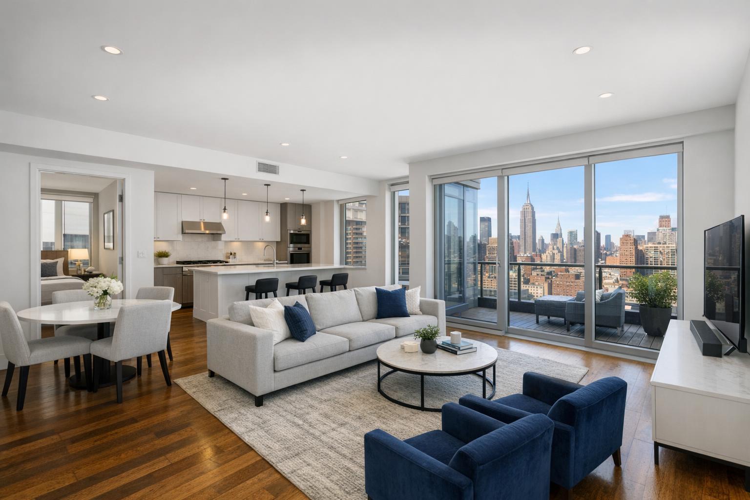
In these cases, focusing on interiors, building amenities, and any practical outdoor features tells the story more efficiently. This is especially true in Manhattan and Brooklyn, where many apartments simply do not benefit from an exterior aerial and may even be restricted by airspace or building rules.
Aerial Photos vs. Drone Video: When to Use Each
Aerial still photos and drone video serve different purposes, even though they use similar flight techniques. Understanding the difference can help you make the right call for your property.
- Aerial stills are best for gallery images, print marketing, and web listings. They freeze a scene and allow viewers to study specific boundaries, site features, or context—perfect for showing lot lines, nearby parks, roof decks, and pool areas.
- Drone video adds a sense of movement, helping the viewer experience the approach to the property, rise up for a panoramic view, or follow a path along a shoreline or cityscape. Used within a broader listing video or in social media, drone video can provide a sense of motion and arrival that a still simply cannot.
For most residential and many commercial listings, carefully chosen aerial stills provide the right level of context. For larger developments, dynamic sites, or view-driven properties, brief drone videos can add an immersive experience.
Real-World Operational Considerations
NYC and New Jersey each present distinct operational challenges. In Manhattan and some parts of Brooklyn, tall buildings, limited outdoor launch points, controlled airspace, and roof access logistics all affect whether an aerial shoot is feasible. Even with access to a roof or terrace, every flight requires a review of airspace, safety, and required permissions.
New Jersey, meanwhile, tends to offer more flight-friendly environments—particularly in suburban areas, along the waterfront, and on commercial sites. But even here, local factors matter: trees, power lines, nearby airports, property access rules, and weather all play a role in what’s possible.
Professional drone service always puts feasibility ahead of the shot list. Regulatory compliance, airspace checks, weather, and safety are essential steps before any flight can proceed. Not every location is technically or legally possible for aerial work, and drone operations are always conducted at the pilot’s discretion following FAA rules. If the location or address requires city-held permits (like some sites in NYC), those are the responsibility of the client, and some projects may need to be declined.
A few practical points from on-the-ground production:
- Outdoor spaces benefit most when driveways, patios, and pool areas are tidy and free of clutter.
- If roof decks or shared amenities are featured, early communication to arrange access with building management prevents on-site delays.
- The best results come when the drone shoot is scheduled alongside ground-level capture, so the team can prioritize sun direction, shadows, and desired features during optimal lighting.
- For urban properties, even a single elevated shot may require, or benefit from, a planning discussion ahead of time.
Planning, Pricing, and Local Expertise
Aerial media is always created on site; it’s not something that can be fabricated from existing photos or floor plans. If drone work is important for your listing, include it in the initial planning conversation. You’ll want to discuss which features matter most—dock access, roof views, parking, or amenities—and verify early if flight is likely to be permitted for your address.
At RealtaSnap, drone service options are offered for both still photography and video (or a combination of both), with pricing starting at $209 for 10 aerial photos. Combining both still photos and video brings different contexts to the listing for an expanded presentation. You can find details about packages and scheduling on our drone photography and videography services page.
Deciding If Drone Media Is the Right Move
If you’re evaluating whether to book aerial coverage for a listing, consider these three questions:
- Is there a feature or context that’s hard to show from ground level? Think in terms of lot boundaries, water access, roof terraces, or commercial site plans.
- Will a buyer or tenant actually benefit from seeing the broader setting? If the surroundings, access, or views are key selling points, the answer is usually yes.
- Is a safe, legal, and practical flight possible at this address? Each location in NYC or New Jersey carries its own logistics and constraints—verify before the shoot.
When the answer to all three is clear, drone photography can add real value to a listing’s marketing package. When it isn’t, putting your energy into clean, impactful ground-level coverage may be the smartest approach.
For more about aerial or listing media, practical booking details, and area-specific guidance, visit www.RealtaSnap.com.
FAQ
Question: How do I know if my listing is a good candidate for drone photography?
Answer: If there’s a feature like a large lot, water access, roof deck, multiple structures, or close proximity to appealing amenities that is hard to appreciate from the ground, drone imagery can often help. A quick conversation with your media provider can help confirm practicality and feasibility for your address.
Question: Can drone photos or video be created from my existing still images or floor plans?
Answer: No. All drone imagery is produced by flying a drone on site at the property. Existing ground-level photos or architectural drawings cannot be turned into genuine aerial images.
Question: Are all properties in NYC and New Jersey eligible for drone coverage?
Answer: Not every location is flyable. Factors like airspace restrictions, weather, physical access, building management, and pilot safety assessment determine what’s possible. Properties in dense areas or near airports often require more planning and, in some cases, may be ruled out for drone use. RealtaSnap handles each request case by case and can help assess feasibility when you provide your address.