The Impact of Drone Photography on Real Estate Marketing in New York City
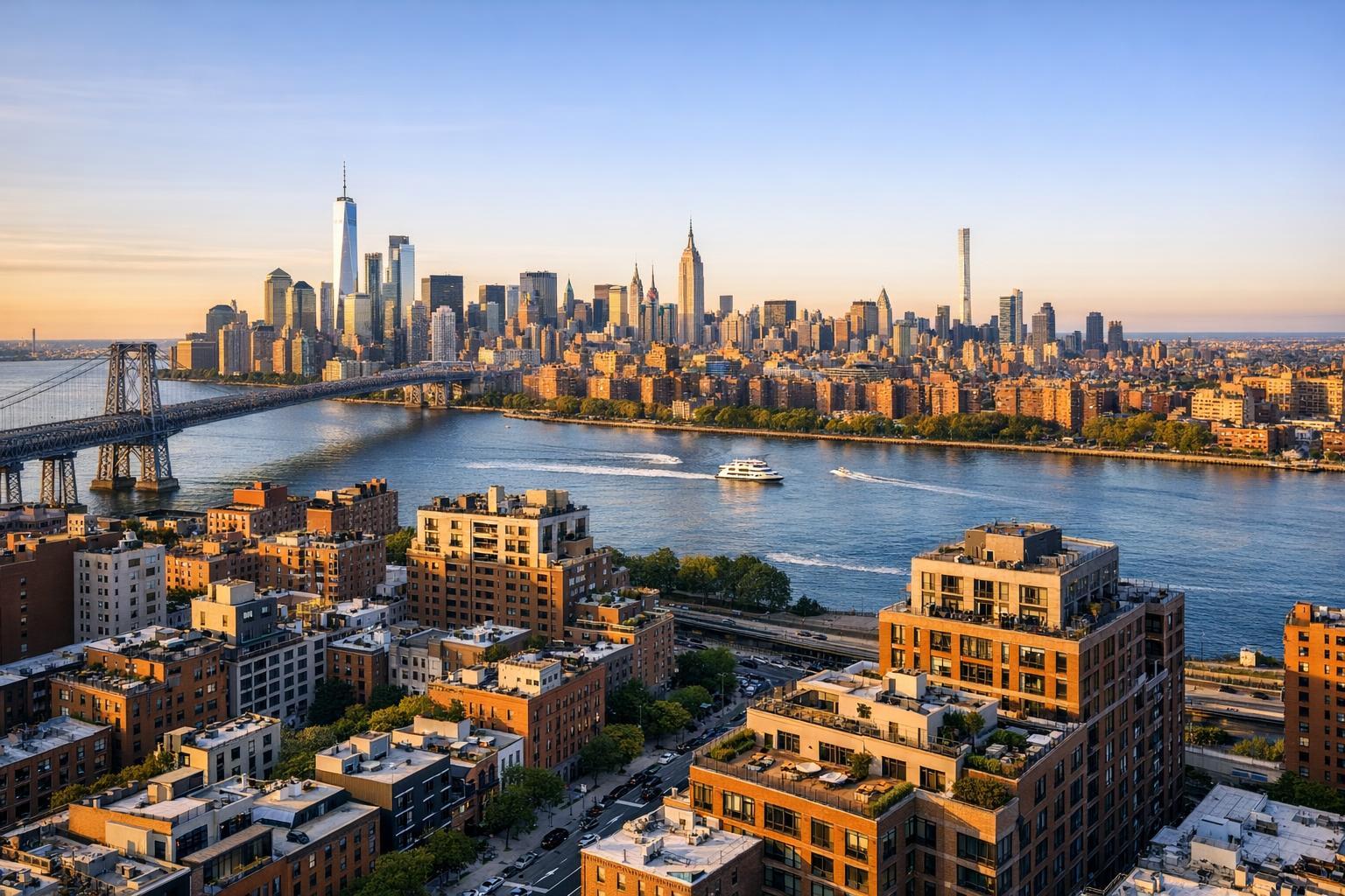
A stunning drone photography captures the NYC skyline at sunset, showcasing the city's towering buildings and the East River.
How Drone Photography in NYC is Transforming Real Estate Marketing
Introduction
Drone photography in NYC isn’t just a trendy add-on—it’s now a strategic necessity for real estate agents and property owners who want listings to stand out in ultra-competitive markets. In this article, we’ll show you exactly how aerial real estate photography unlocks buyer attention, brings context to every frame, and changes how properties are perceived online. Drawing from our in-the-field experience at RealtaSnap, you’ll get a candid look at the problems facing NYC and NJ agents, how top-tier media teams solve them, and why next-level visuals are reshaping real estate marketing across the city.
The Real-World Problem
Ask any busy New York City agent about the challenge of marketing real estate, and you’ll hear the same frustrations: countless quality listings struggle to get noticed because their visuals fall flat. Empty rooms, underexposed windows, and uninspired street shots can sabotage an otherwise stellar property. We’ve walked into more than a few apartments and townhomes where natural light is limited to a single, narrow window, or where city views are only hinted at from the ground. As listing competition surges—especially on platforms like StreetEasy and Zillow—a weak first impression can mean weeks longer on the market, lower click-through rates, and less foot traffic at showings.
Traditional listing photos also struggle to capture unique selling points: proximity to the park, roof access, skyline vistas, or the vibe of an entire block. Media shot in haste, without context or imagination, leaves buyers scrolling for something better. For brokers and hosts, the mental checklist is exhausting: Is the view shown off? Is the scale right? Does the space look inviting, or just…empty? Without the right visual story, your property competes on price alone—never a winning strategy in NYC.
What Experienced Media Teams Know
After years shooting listings from Harlem brownstones to Jersey City high-rises, our team has learned a few hard truths:
- Timing is everything: For outdoor aerial shots, midday isn’t always best. We plan drone sessions for late morning or golden hour, balancing ambient sunlight with real architectural detail. This helps prevent harsh overhead shadows that flatten building façades and diminishes glare on glass.
- Framing and vertical lines matter: There’s a vast difference between a quick drone fly-by and a thoughtfully composed series that highlights roof decks, landscaped courtyards, or neighborhood streetscapes. We make sure all verticals are corrected in post, so exteriors look true-to-life and appealing—not distorted or toy-like.
- Details tell the story: Buyers don’t just want to see where a property sits—they want to feel what it’s like to live there. Capturing amenities like proximity to subways, popular cafes, or green spaces from above provides instant lifestyle appeal that ground-level photography cannot deliver.
- Workflow counts: Organizing access with building management, ensuring FAA compliance, and prepping a property (closing toilet lids, moving cars, clearing balconies) are all non-negotiables—because rushed shoots always show.
Professional real estate photographers know that every detail from window light balance to skyline framing affects buyer perception. Aerial real estate photography done right doesn’t just show— it sells an experience buyers can imagine themselves stepping into.
How RealtaSnap Solves It
At RealtaSnap, every drone photography real estate session is grounded in genuine street-level experience and tuned for busy NYC and NJ agents. Our process is as seamless as it is detail-oriented:
- FAA-Certified Pilots: All aerial shoots are flown by licensed professionals with local airspace expertise, including knowledge of NYC’s unique flight restrictions.
- Fast Turnaround: Every package includes next-business-day digital delivery. Our editors process, color grade, and optimize every aerial photo and video clip before your morning meeting.
- All-in-One Booking: Schedule a drone shoot in minutes at https://www.realtasnap.com/drone-photography-videography-nyc. We coordinate access and keep you updated every step of the way, so no detail falls through the cracks.
- Transparent Pricing: Drone photography starts at $199 for 8–12 high-res aerial images, with video add-ons available. For most New York and New Jersey listings, this includes all processing and licensing for MLS and marketing use.
All prices and information are subject to change. Information is deemed reliable but not guaranteed.
- Visual Consistency: We deliver finished media designed for modern listing platforms—colors pop, views are crisp, and presentation stays consistent across every property, every agent, every time.
Our team has flown drones everywhere from boutique walk-ups in the West Village to luxury compounds in Bergen County—and with every flight, we bring technical skill, creative direction, and boots-on-the-ground logistics that basic vendors miss.
Benefits of Choosing RealtaSnap
- FAA-certified drone pilots for peace of mind
- Next-business-day delivery on all final media
- Strategic composition for NYC/NJ property types
- Booking and updates handled online, start to finish
- Image and video licensing included, ready for MLS
- Clear, competitive pricing—no surprises
- Seamless service for both small and large properties
Why This Matters in the NYC / NJ Market
In New York City and New Jersey, property marketing isn’t just about what’s inside four walls—it’s about location, atmosphere, and unique context. Listings here compete head-to-head with dozens of similar properties in a five-block radius. Aerial real estate photography reveals what buyers really care about: the terrace’s sunset view, the tree-lined avenue below, the commute to Manhattan, or how the building tucks into its neighborhood landscape.
In big multi-family buildings, drone shots can demonstrate scale in a way standard photos can't. Urban townhouse sellers benefit from perspective that showcases garden space or proximity to landmarks. In outlying areas, drone media captures property acreage or curb appeal that gets lost in tight, ground-level frames. Fast turnaround and rock-solid reliability are especially vital—because in NYC and NJ, every day on the market counts.
Comparison with Traditional or Lower-Quality Alternatives
Phone snapshots, hasty “walk-through” videos, and media rushed out by generalists put listings at risk of being overlooked. We’ve seen too many agents regret:
- Window glare that obscures million-dollar park views
- Tilted vertical lines that make high-rises appear unstable
- Shadows masking outdoor amenities
- “Flat” colors that drain energy from otherwise lively properties
- Delayed delivery that costs critical momentum after launch
Less experienced providers may miss crucial shots, deliver underwhelming edits, or struggle with NYC’s flight rules—all adding stress instead of value. RealtaSnap’s workflow is laser-focused on avoiding these pitfalls. From pre-flight preparation (checking weather, ensuring flight permits, prepping rooftops) to careful post-production (color correction, distortion removal, watermarking only as requested), our real estate drone photography is purpose-built for the demands and nuances of the local market.
Conclusion & Call to Action
Great property marketing in NYC and NJ demands media that delivers immediate impact, context, and a sense of place that buyers remember. Drone photography has become the “difference-maker” that elevates listings—and RealtaSnap’s blend of experience, reliability, and next-day delivery means you never have to choose between speed and quality.
If you’re ready to transform your listing visuals and capture attention from the first click, schedule your next RealtaSnap drone shoot today, or explore all services at www.realtasnap.com. See how professional, thoughtful media can move your property from seen to sold.
Frequently Asked Questions
1. Will drone photography work for smaller or indoor properties in NYC?
Aerial photography is most dramatic for exterior shots—think rooftops, terraces, or unique locations. However, even modest buildings with roof access or nearby parks can benefit from context-rich images. For indoor spaces or listings with limited outdoor highlights, we blend aerials with traditional interior photography for a complete visual story. Our team will help you decide the best media mix for your specific property.
2. What’s included with my RealtaSnap drone package, and are there hidden fees?
Every RealtaSnap drone session includes FAA-certified flight, 8–12 fully edited aerial images, online proofing, and next-business-day delivery. Video and expanded packages are available à la carte. Pricing starts at $199, with no hidden charges for standard licensing.
All prices and information are subject to change. Information is deemed reliable but not guaranteed.
3. Can you work with tight schedules and building access constraints common in Manhattan or Jersey City?
Absolutely. Our team is used to navigating complex property access, superintendents, and local airspace regulations. We’ll coordinate scheduling and permissions alongside you, streamlining the process so listing launches aren’t delayed. RealtaSnap is built for fast-moving urban markets.