The Expert’s Guide to Drone Photography for NYC Real Estate Listings
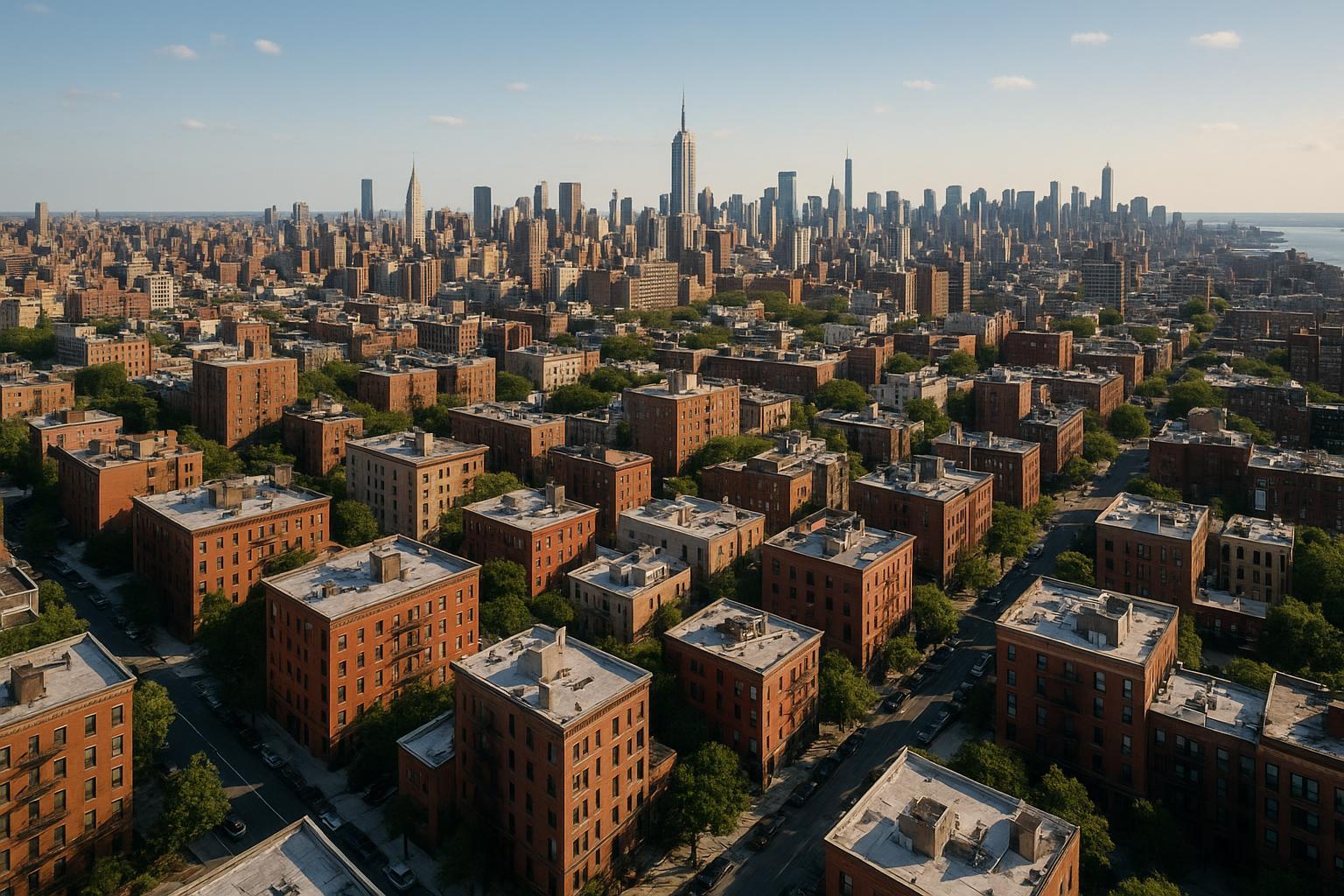
Drone photography captures the expansive view of NYC's urban landscape, showcasing a sea of brownstone buildings with the iconic skyline in the background.
Drone Photography NYC: Elevating Real Estate Listings with Expert Aerial Imaging
In today’s hyper-competitive property market, drone photography NYC is quickly becoming an essential tool for attracting buyers and renters in both residential and commercial real estate. Combining New York City real estate’s visual storytelling needs with professional drone services, marketing teams, agents, and property owners can transform first impressions, showcase scale, and capture the unique energy of every neighborhood. In this post, you’ll learn how aerial real estate photography works, key regulations in NYC, creative advantages that set listings apart, and why a thorough, field-tested approach from a dedicated team like RealtaSnap makes a measurable difference. You’ll also find actionable best practices, real pricing details, and an authoritative FAQ from true NYC and NJ real estate media professionals.
The Real-World Problem: Why Conventional Listing Media Struggles in NYC
Traditional photography often falls short in a city like New York. Without expert visual content—especially aerial imagery—agents, hosts, and sellers face some persistent challenges:
- Weak First Impressions: In dense markets, listings with ordinary photos often blend in, leaving buyers underwhelmed and scrolling past.
- Low Click-Through Rates: Listings with uninspired media are ignored on crowded platforms, costing critical buyer attention in the first seconds.
- Poor Light and Space Perception: Ground-level shots cannot tell the full story—overshadowed skylines, claustrophobic courtyards, hidden amenities, and unique architecture are lost.
- Difficult-to-Visualize Context: Buyers can’t appreciate proximity to parks, key intersections, transit hubs, or skyline views.
- Inconsistent Branding: Multiple agents using piecemeal or DIY imagery create listings that feel generic and forgettable.
- Lost Value on Investment and Commercial Properties: For larger footprints, hotel portfolios, or mixed-use buildings, traditional media fails to highlight scale, condition, or location advantages.
- Regulatory Oversights: In NYC, improper drone use can halt marketing or result in unusable footage, if done by unqualified providers who ignore airspace and legal rules.
As a result, properties linger—buyers or tenants see only what’s inside four walls, and listings miss the chance to stand out with confident, elevated storytelling.
What Experienced Media Teams Know: Behind the Lens in NYC and NJ
Media professionals who shoot in New York City and across New Jersey develop a sharp sense of what works—and what consistently goes wrong—because every neighborhood, building, and listing site presents unique challenges. A few things professionals never forget:
- Timing and Lighting Are Everything: Drones need to work with local weather, airspace windows, and optimal sun angles—especially with tall shadows or busy streetscapes. We often advise early morning or late afternoon for “golden hour” aerials that highlight exterior warmth.
- Urban Complexity: Logistics matter—roof access, proximity to no-fly zones, rooftop obstacles, wind forecasts, and FAA/NYC permitting all have to be managed in advance. We pre-plan with building management to avoid last-minute surprises.
- Framing and Perspective: Not every building looks best from overhead. Vertical correction and perspective control are vital to ensure high-rises don’t appear distorted and facades look natural.
- Consistent Quality Standards: From HDR processing to blue sky replacement when weather doesn’t cooperate, every delivered image must match high production standards and reflect the real property—no over-editing or misleading staging.
- Turnaround and Workflow: Buyers expect fast updates. We’ve built editorial pipelines to process drone photos and footage within industry-leading timeframes, even for complex shoots with retouching or multiple deliverables.
In the fast-moving NYC area, experience means anticipating these variables and ensuring property media always showcases value—never leaving anything to chance.
How RealtaSnap Solves It: Professional, Compliant NYC Drone Photography
At RealtaSnap, we approach drone photography real estate with hands-on expertise, deep regulatory knowledge, and a commitment to visual storytelling. Here’s how our NYC drone team delivers:
- Compliant, FAA-Certified Operations: Every drone flight adheres to FAA Part 107 and NY/NJ-specific airspace laws. We assess location, secure site access, and ensure flight safety before scheduling—a must in a city with complex no-fly zones【20:12†RealtaSnap_Service_Execution_Policy_MASTER.docx】.
- Expert Framing and Aerial Cinematography: We select angles that accentuate building lines, skyline context, and amenity layouts. Photos and 4K videos are edited for true color, balanced sky, and sharp architectural detail.
- Scalable Offerings: Whether you need ten polished photos or a combined photo & video shoot for a whole development, our process is streamlined for residential, retail, office space, and hospitality listings. For example: 10 HDR drone photos start at $209, or combine photos and a 1-minute video for $299—all with next-business-day delivery as the standard goal*【20:0†RealtaSnap_Rate_Sheet_MASTER.docx】.
- Reliable Results: We provide a smooth booking process (all online or via app), fast scheduling (<24hr notice for most shoots), and access to value-added options like blue sky replacement, object removal, and alt video cuts for social media.
- No Hidden Surprises: Clients are informed upfront about site requirements, possible airspace limitations, and their responsibility for any non-standard special permits, ensuring compliance and peace of mind.
- Service Area: RealtaSnap directly serves NYC (all boroughs), NJ, Westchester County, and select Upstate NY areas, covering everything from brownstone walk-ups to commercial skyscrapers【20:13†RealtaSnap_Service_Areas_MASTER.docx】.
*All prices and information are subject to change. Information is deemed reliable but not guaranteed.
Discover our full range of NYC drone services here: Drone Photography & Videography NYC.
Benefits of Choosing RealtaSnap
- • FAA-certified drone pilots on every NYC shoot
- • HDR & 4K imaging for maximum detail
- • Fast turnaround—often within 24–48 hours
- • Advanced editing (blue sky, perspective correction)
- • Smooth, all-digital scheduling and payment
- • Turnkey photo, video, and add-on options
- • Detailed pre-flight compliance for stress-free shoots
- • Transparent pricing with no surprise fees
- • Consistent quality across all property types
- • Local expertise in NYC, NJ, and surrounding markets
Why This Matters in the NYC / NJ Market
Urban listings must instantly outshine fierce competition: Manhattan buyers compare a dozen penthouses before choosing one, while renters in Jersey City demand proof of view, amenity access, and walkability in seconds. In suburban NJ, drone photography can set a home apart by showing its generous lot, proximity to schools, or nearby parks—all at a glance. Commercial brokers need to convey traffic patterns, parcel size, and visibility in ways only aerial images can.
Platforms like StreetEasy, Zillow, and Realtor.com reward listings with visually rich media; search ranking and buyer engagement both spike for properties with professional aerial content. In this region, routine photography simply doesn’t match buyer expectations—or the emotional impact of a well-crafted drone shot.
Comparison: RealtaSnap vs. Traditional or Lower-Quality Alternatives
- Phone Photos/DIY Drones: Low dynamic range, awkward angles, blurry results; banned or blocked in many controlled zones.
- Rushed Vendor Media: Inconsistent framing, poor color, incomplete coverage—no building-wide context or scale.
- Delayed Delivery: Missed marketing windows, stale listings, and lost leads.
- Unvetted Operators: Regulatory violations, unusable video/photos, or legal risk to broker/seller.
- Generic Providers: Not NYC-specific; unfamiliar with building access, airspace, or the unique needs of luxury/urban clients.
RealtaSnap’s team brings hands-on experience—navigating tight townhome lots, creating twilight magic in urban canyons, staging clean rooftops, and collaborating directly with leasing offices, HOAs, and city administrators. It’s a difference that shows in every image.
Conclusion & Call to Action
When it comes to listing a property in New York City or New Jersey, only the highest quality, most creative, and perfectly compliant media will deliver the competitive edge your investment deserves. RealtaSnap’s drone photography services combine deep market experience, regulatory savvy, and a relentless eye for detail—ensuring every listing, whether a Tribeca penthouse or a Jersey City office complex, makes a bold, lasting impression.
Ready to elevate your property? Explore RealtaSnap’s comprehensive NYC aerial real estate photography options and book your next shoot effortlessly at www.realtasnap.com. Let our team show your listing from a new perspective.
Frequently Asked Questions
1. Is drone photography legal in all areas of NYC?
Not every NYC location is drone-eligible due to strict FAA airspace and city regulations. Some sites may require specific rooftop access or additional permits. At RealtaSnap, we assess each location in advance and only recommend drone services where flight and compliance are safe and possible—so you’ll never be surprised by cancellations or unusable footage.
2. What if I need both photos and videos for my property?
You can bundle aerial photos and 4K videos into a single RealtaSnap package. This saves time, simplifies booking, and guarantees visually cohesive results with matching edits and branding. Combining services also speeds up delivery so you can launch your listing with a complete, high-impact media set.
3. How soon will I receive my finished drone photos and video?
Turnaround is a top priority. Most RealtaSnap clients receive fully edited drone media within 24–48 hours of the shoot. Our workflow is built for speed and consistency across busy NYC and NJ schedules—helping you engage buyers right away and move fast on listings.
Ready to see the city from above? Book your next shoot with a certified, local NYC/NJ team who knows real estate—and what it takes to stand out: Drone Photography & Videography NYC.