The Evolving Role of Drone Photography in New York City Real Estate Marketing
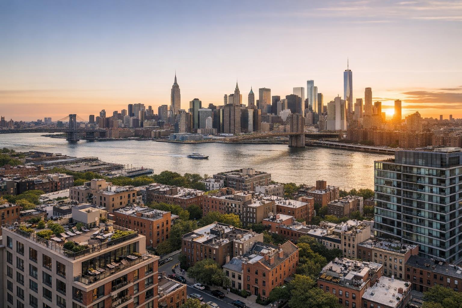
Drone photography in NYC captures a stunning aerial view of the city skyline during a glowing sunset over the river.
Introduction
Drone photography in NYC is fundamentally redefining real estate marketing for agents and sellers who need their listings to stand out. For anyone listing a property in New York, New Jersey, or competitive metro markets, there’s a new visual language that buyers expect: high-impact, aerial imagery that showcases the true scale, placement, and appeal of a property from perspectives that ground-level photos can’t supply. In this article, you’ll learn how drone photography gives professionals a leading edge, the real challenges it solves for real estate marketing in NYC, and how to access these high-resolution visuals with a team that understands both the artistry and the regulatory landscape.
The Real-World Problem
In a dense, fast-moving market like NYC, real estate marketing faces a very real dilemma: listings must deliver a strong first impression in less than three seconds. Without striking photos, agents and sellers face:
- Low click-through rates as listings look generic among hundreds of others.
- Weak first impressions due to poor lighting, awkward angles, or empty rooms.
- Media that underrepresents scale, making urban properties appear cramped.
- The inability to accurately convey a property’s unique amenities, outdoor space, or proximity to city highlights.
- Lost buyer engagement, where potential customers quickly scroll past and never come back.
We see it again and again—simple phone photos or dim, rushed images simply don’t do justice to the nuances of an NYC loft terrace or a New Jersey estate with historic grounds. It’s not just a technical issue; it’s a missed opportunity to spark both curiosity and emotional connection in an instant. Inconsistent branding and media that fail to reflect a property’s true value can even harm reputation, particularly for agents aiming for a luxury market or professional hosts needing to maximize occupancy.
What Experienced Media Teams Know
As real estate media professionals with years of on-location experience in NYC and NJ, we know the difference between “taking a nice shot” and producing imagery that fuels a property’s story. Seasoned crews have a working knowledge of the real-world logistics that shape every shoot:
- In Manhattan, roof access often means the difference between a spectacular skyline shot and a limited side street view.
- The magic hour for exterior shots is brief—just 30–40 minutes when window glare and shadows are in perfect balance for high-impact visuals.
- Preparation is everything: furniture must be staged, personal items moved, and window treatments adjusted to find that ideal blend of interior and cityscape.
- For drone work, professionals always check for FAA restrictions, coordinate with building management for roof access, and evaluate real-time weather to ensure safety and compliance.
- Consistent editing is essential—vertical lines are kept true to prevent distorted buildings, and window exposures are carefully layered so that interiors look inviting, not washed out or murky.
We’ve observed how high-quality drone photos change the flow of a buyer's experience: visitors linger longer on listings, agents get more qualified inquiries, and even rental platforms reward visually compelling content with increased visibility.
How RealtaSnap Solves It
RealtaSnap approaches drone photography and aerial real estate photography with the practical expertise that only comes from hands-on production throughout NYC, New Jersey, and adjacent markets. Here’s how we address real estate marketing’s toughest visual obstacles:
- Every drone shoot is planned for optimal lighting and timing—the goal is to present each property at its best, whether capturing sunrise over the Hudson or highlighting private rooftops in Brooklyn.
- We handle all key logistics: FAA Part 107-certified pilots, thorough pre-checks for airspace restrictions, and on-the-ground safety coordination. Our process ensures that every flight is both compliant and safe, with explicit awareness of New York’s complicated regulatory landscape.
- RealtaSnap guarantees high-resolution, HDR drone images (with blue sky replacement as needed) and cinematic 4K video, letting buyers see not just the building but the block, the skyline, and all-important context like nearby parks or water views.
- Our editing workflow corrects every detail before delivery: we check for vertical accuracy, enhance colors, balance window exposures, and keep photo branding subtle but clear.
- With a typical turnaround time of 24–48 hours, our clients don’t have to wait days for highlights: photos and video are delivered polished, sized for MLS, and ready for multi-platform syndication.
- We make booking easy—simply choose your drone photo or video package at RealtaSnap’s Drone Photography NYC page, select extras like virtual twilight or social media cuts, and lock in your desired time with as little as 24 hours' notice.
All prices and information are subject to change. Information is deemed reliable but not guaranteed.
Benefits of Choosing RealtaSnap
- FAA-certified, safety-focused pilots with NYC/NJ local expertise
- True 4K aerial photography and HDR imaging
- High-speed edits and guaranteed on-time delivery
- Blue sky replacement and digital retouching included where needed
- Compliance with all relevant NYC drone regulations
- In-house editing for consistent branding and vertical line correction
- Easy online scheduling and transparent package pricing
- No hidden licensing issues—media is MLS- and social-ready
- Responsive support and clear communication before and after every shoot
Why This Matters in the NYC / NJ Market
New York City and New Jersey represent some of the tightest, most visually-saturated real estate arenas in America. Urban homes, condos, and commercial spaces are evaluated at a distance—often online before buyers even consider a walkthrough. Aerial real estate photography instantly adds scale and gravitas: tall buildings look prestigious, brownstones show their proximity to parks and transit, and waterfront properties truly “own” their placement. With diverse inventory—from glassy high-rises to historic rowhouses—there’s no single formula for success. Agents and hosts who rely on ground-only shots risk losing buyers before the first showing.
In NJ’s competitive suburb-to-city pipeline, the ability to highlight large yards, private pools, or easy NYC access is a huge differentiator. Even more, rental competition is fierce: building owners and Airbnb superhosts turn to drone visuals to drive higher occupancy rates and premium bookings, not just fast sales. MLS and major rental platforms now surface listings with strong visuals higher, directly impacting exposure and engagement.
Comparison with Traditional or Lower-Quality Alternatives
Here’s the plain truth: in our field experience, listings shot on phone cameras (or by non-specialists) rarely hold attention. Vertical lines look warped, exterior shots end up dull and compressed, and interiors lack the dynamic lighting that brings spaces to life. Rushed media often skips the crucial prep steps—untidy rooms, poor weather conditions, or wrong angles. Inconsistent editing can lead to mismatched color tones from photo to photo, which buyers notice even if it’s subconscious.
In contrast, RealtaSnap delivers aerial photography that’s visually coherent, context-rich, and guaranteed to elevate the mood and professionalism of every listing. Rather than posting “okay” photos and hoping for a response, agents equipped with compelling aerial and ground-level visuals present listings that feel premium, trustworthy, and thoughtfully marketed.
Conclusion & Call to Action
Drone photography in NYC has quickly moved from being a luxury add-on to an essential tool for serious real estate marketing. If you want your listings to rise above the ordinary—literally and figuratively—professional aerial imagery is no longer optional. RealtaSnap’s team combines technical expertise with a deep understanding of what buyers, renters, and hosts need to see to take action. Explore the full range of aerial and drone photography solutions designed specifically for NYC and surrounding markets at our Drone Photography & Videography services page, or simply visit www.realtasnap.com to see how our process helps you maximize every listing’s impact.
Frequently Asked Questions
1. Is drone photography really necessary for my NYC listing, or is it just a luxury?
Many agents find that listings with aerial photography consistently get more clicks and longer viewing times, especially on sites where buyers have endless scroll options. Drone photos aren’t just for mansions—they help showcase condos, rooftops, and even neighborhood context in ways that ground-level shots can’t. If you want to give buyers a full sense of the property’s value, aerial imagery is now a must-have, not a luxury.
2. How does RealtaSnap handle NYC’s strict drone regulations and safety issues?
All RealtaSnap drone flights are performed by FAA-certified operators who conduct thorough airspace and safety checks before each shoot. We always prioritize legal compliance and property safety, and we’re upfront about any locations where flying isn’t feasible due to NYC’s unique regulations. You’ll never have to worry about surprise permit issues—our team handles these logistics from start to finish.
3. What happens if my building or neighborhood has airspace restrictions or needs special permits?
Some NYC and NJ locations require special permission or may restrict drone use entirely. RealtaSnap always checks these requirements in advance. While we don’t pull municipal or NYPD permits ourselves, we’ll guide you on what’s needed and let you know right away if a shoot isn’t possible—so there are no surprises. This transparent, honest approach ensures your listing process stays smooth and stress-free.