The Benefits of Drone Photography for NYC Real Estate Listings
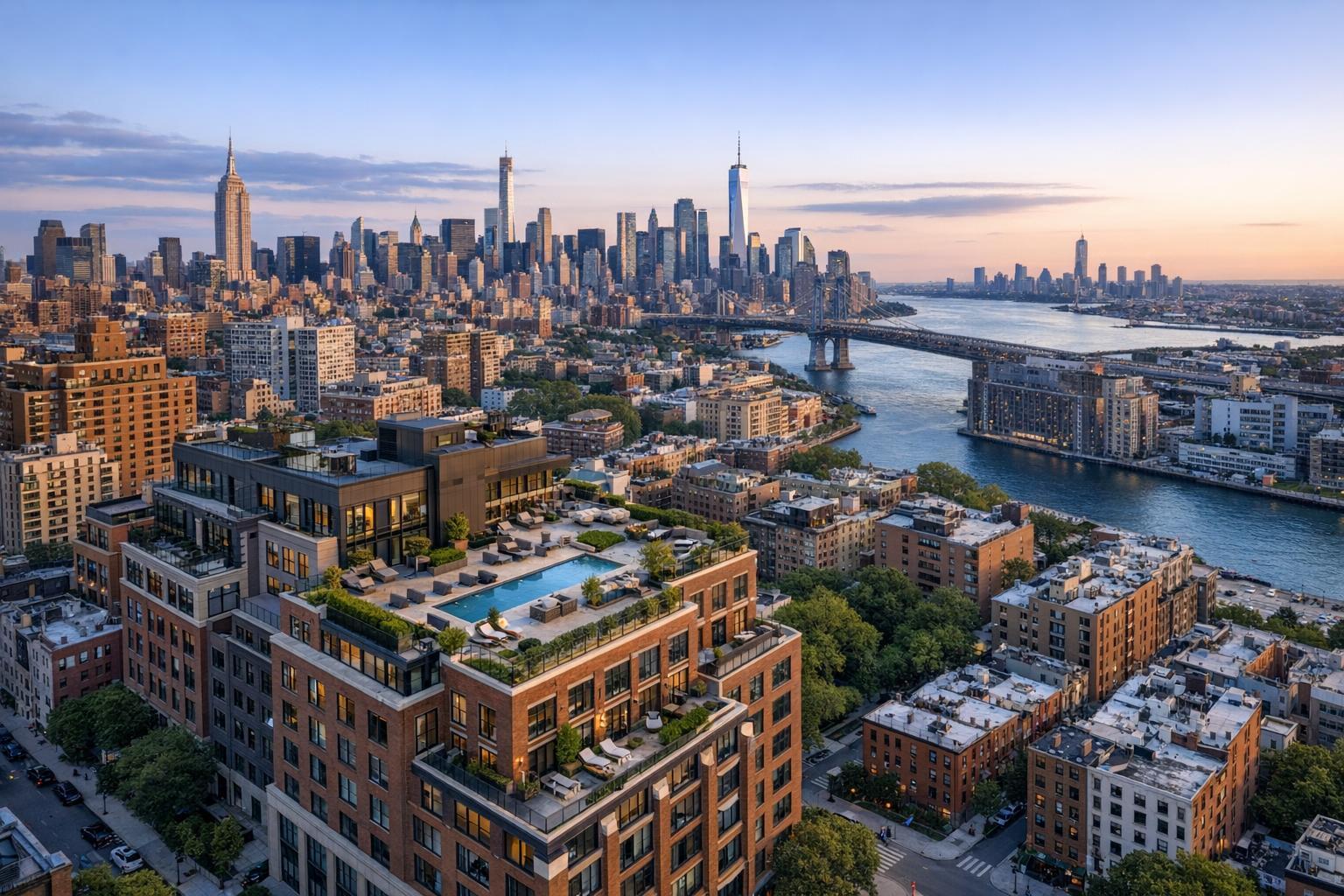
Drone photography captures a stunning view of NYC, showcasing skyscrapers, bridges, and rooftop terraces at sunset.
The Benefits of Drone Photography for NYC Real Estate Listings
Drone photography in NYC has shifted from being a “nice-to-have” to a real factor in how many real estate professionals present properties with genuine exterior stories. From brownstones in Brooklyn to luxury penthouses in Manhattan and commercial sites across New Jersey, aerial photography provides not just a new angle—but a fuller understanding of the property in its urban or suburban context.
Why Aerial Media Matters for City Real Estate
Street-level photos do an excellent job of showing interior space, natural light, and finishes. But for many listings, especially in New York City, something crucial gets lost when you can’t see where a building sits in its neighborhood, how a roof deck actually relates to neighboring buildings, or the way nearby transit, parks, and city landmarks interact with the property. Drone photography real estate services step in where regular coverage leaves off, delivering a vertical perspective that can answer questions a potential buyer or tenant hasn’t even asked yet.
In a market where listings compete with dozens or even hundreds of nearby properties, being able to clearly present location and exterior features is more than a visual upgrade. It’s a way to reduce ambiguity, making it easier for viewers to envision not just the unit itself, but its relationship to everything around it.
What Aerial Photography Reveals
Some elements simply aren’t feasible to capture well from ground level. Aerial photography NYC is especially effective for:
- The complete footprint of a building or multi-structure property
- Terraces, roof decks, gardens, courtyards, pools, or parking areas
- Corner exposure or proximity to cross streets and main avenues
- Access to parks, waterfronts, or visible public spaces
- Architectural details that disappear in claustrophobic city streets
- The setting of a property relative to sky, skyline, and open space
In NYC, where streets can be narrow and sidewalks crowded, a drone can float above the chaos—offering a clean, unobstructed look at façades, upper floors, or private terraces. For New Jersey homes, especially those with large yards, water access, or sprawling lots, an aerial view communicates a sense of opportunity and openness that makes the listing easier to understand at a glance.
Operationally, not every property justifies a drone flight. A small studio apartment with no notable exterior doesn’t usually need the added perspective. Focus aerial media on homes with meaningful architectural presence, accessible outdoor amenities, or a compelling location story.
Practical Observations: Planning for Effective Drone Coverage
A professional shoot starts before the drone even powers up. Based on our experience producing real estate media in dense city blocks and diverse suburban neighborhoods, a few practical considerations stand out:
- Clear priorities: The most effective aerial sessions are guided by a story. Agents and owners should clarify which features are most important to highlight (roof deck, yard, proximity to subway, etc.).
- Access: Gaining access to rooftops, terraces, or private outdoor space can dramatically expand what’s possible, especially in urban locations. But access alone doesn’t guarantee a flight—airspace, weather, and site conditions all matter.
- Time of day: The angle and intensity of sunlight dramatically affect how a building or outdoor space appears from above. Good planning matches shoot time to façade orientation and the desired “feel” of exterior shots.
- Site readiness: The same principles that apply to interior photography—removing clutter, arranging furniture, cleaning surfaces—absolutely apply outdoors. A few well-placed touches can make the difference between a forgettable shot and one that sells the setting.
Aerial media should complement the rest of the listing, not replace it. The strongest listings use an opening drone photo or flyover to establish the property’s location, then invite the viewer inside for room-by-room photography and details.
Location Context and “Sellable” Features in NYC and NJ
Property decisions are influenced by more than just floor plans and finishes. Location context is often just as important.
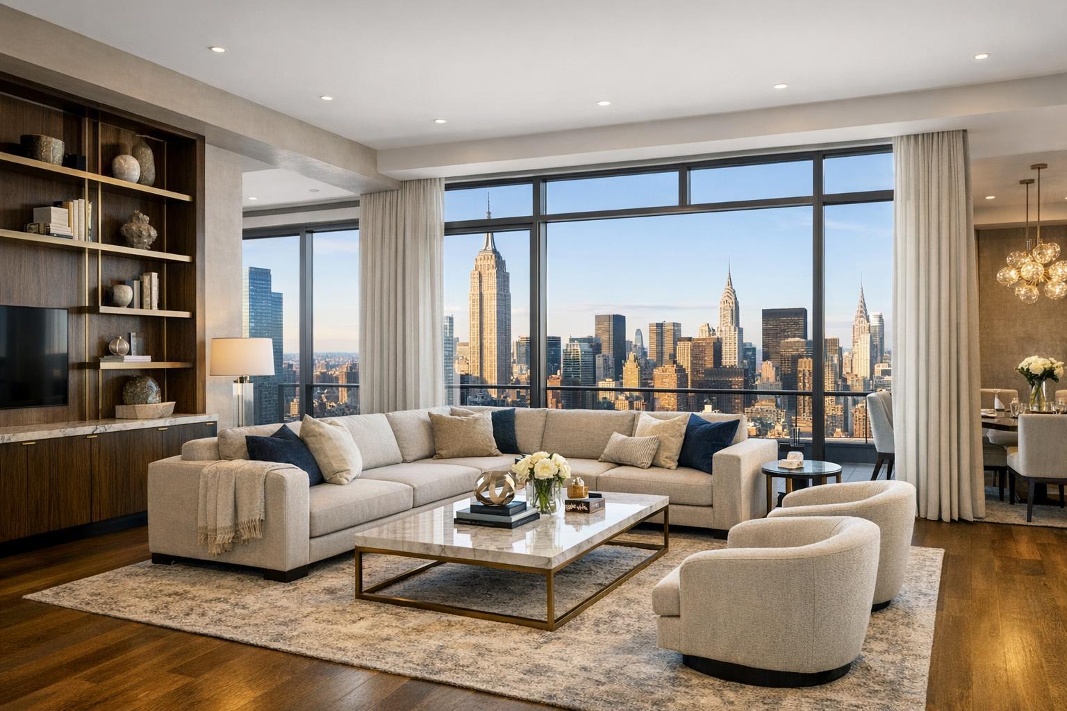
- A Manhattan penthouse might benefit from a drone photo showing its terrace relationship to the iconic skyline.
- A Brooklyn townhouse could use aerial media to clarify the private garden’s size and placement behind the home.
- A retail or commercial property marketed to investors may need to demonstrate high foot traffic, corner exposure, or convenient site access.
For agents targeting New Jersey’s diverse landscape, drone visuals can showcase large yards, garden potential, or water access—features that might otherwise go unappreciated. The same applies to industrial, office, or mixed-use properties where site layout and proximity to major roadways are significant selling points.
Choosing the Right Aerial Services: Photo, Video, or Both?
Not all properties require both drone stills and aerial video. The best approach comes down to the strengths of the listing and how each format contributes:
- Still photography is the go-to for online galleries, property sites, brochures, and most MLS platforms. It lets viewers absorb details—a roof deck, for example—in a single, impactful frame.
- Aerial video is ideal for properties with dynamic exteriors, unique approaches, or an exterior story that unfolds. Video may “fly” into a building from above, circle a distinctive roofline, or transition from the surrounding neighborhood into the listing itself.
Balancing the two depends on the property, its story, and how the finished media will be used. For a home with only minimal exterior appeal, simply having drone options available doesn’t mean they should be used. But for listings where exterior angles provide real informational value, investing in both forms is often justified.
RealtaSnap offers flexible drone photography and videography packages, from a simple set of 10 HDR aerial images to a one-minute cinematic 4K drone video, or a combined package for properties with both needs. Blue sky replacement is available as part of editing when needed.
Safety, Feasibility, and Regulatory Compliance
Drone operations in places like NYC (and nearby New Jersey cities) demand more caution than suburban or rural projects. Airspace restrictions, unpredictable weather, dense pedestrian activity, and building access requirements all play a role in determining feasibility. Even when a property owner or agent wants aerial media, the conditions must be safe, compliant, and genuinely workable for the pilot.
- Flights are always subject to FAA Part 107 regulations, and some areas simply aren’t legally or logistically feasible for real estate drone work—regardless of demand.
- Roof access can help, though it isn’t a guarantee that all desired angles will be possible.
- When extra permitting (beyond standard FAA rules) is required, that responsibility falls to the client, not the media provider.
At RealtaSnap, drone assignments are handled on a case-by-case basis. Safety, weather, and site-specific rules come first. Every flight is treated as a planned professional operation, not a plug-and-play add-on.
What to Look for in a Real Estate Drone Provider
Great aerial media is about more than just flying a drone and taking a snapshot. A professional real estate media team brings more to the table:
- Assessing feasibility based on airspace, weather, building access, safety, and client needs
- Identifying the most informative and attractive angles for real estate marketing—not just a cool skyline
- Coordinating drone shots with traditional photography, video, and floor plans for a visually consistent final listing
- Clear communication about what is and isn’t possible at a specific location, and why
Look for a partner that sees aerial photography as an extension of the overall property narrative, not a disconnected “wow shot.” Finished results should support your listing’s goals and fit seamlessly with the rest of your marketing assets.
Putting Drone Media Into the Property Narrative
Done thoughtfully, aerial photography and video answer big questions that buyers, tenants, and investors actually have: “Where does this building sit relative to its neighbors?”, “How private is this roof deck, terrace, or yard?”, “How close is this property to the park or river?” When built into a complete media package—including interiors, floor plans, and, for the right properties, video or virtual tours—aerials fill in the crucial gaps that ground-level perspectives can’t reach.
For those looking to present their listings with as much clarity and context as possible, adding drone media when the property supports it is a powerful way to give viewers a more complete picture. Interested in learning more or seeing what’s possible for your listing? Find resources and service options at www.RealtaSnap.com.
FAQ
Question: Does every NYC or New Jersey property qualify for drone photography?
Answer: No. Drone sessions always depend on airspace rules, weather, building access, and safety. Busy city environments and specific areas may be off-limits. Each property is evaluated individually for feasibility before any flight is confirmed.
Question: What are the current prices for RealtaSnap’s drone packages?
Answer: RealtaSnap offers 10 high-dynamic-range aerial photos (with blue sky editing if needed) for $209, a 1-minute 4K drone video for $229, or a combined photo/video package for $299. As always, flights require site-specific approval and compliance with all regulations.
Question: Do I need roof access to get drone shots in NYC or New Jersey?
Answer: Roof access can make certain shots possible in denser areas, but it’s not an absolute requirement for every flight. It does improve flexibility and the likelihood that more angles are available, especially when exterior terraces, decks, or rooftops are key to the listing’s appeal. Always confirm access in advance to avoid last-minute changes.