How to Choose Drone Photography Near Me for a Real Estate Listing
Drone photography near me captures a stunning sunset view of a suburban neighborhood with a luxurious home featuring a pool, surrounded by lush greenery and a serene body of water.
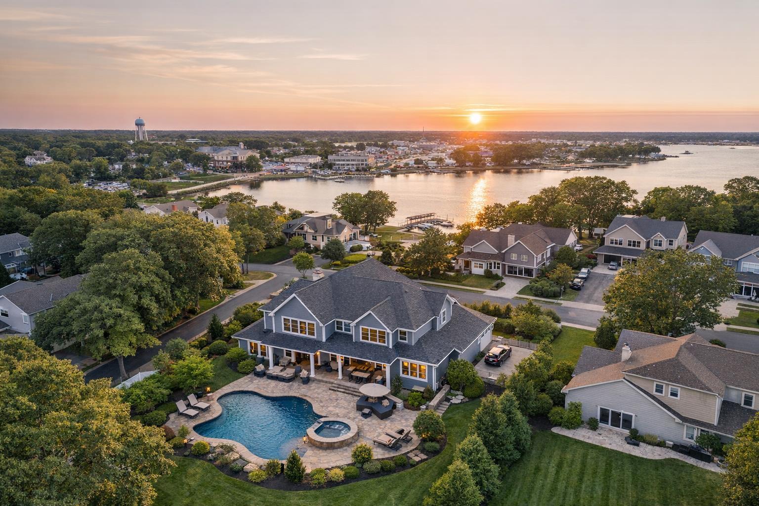
How to Choose Drone Photography Near Me for a Real Estate Listing
Searching for drone photography near me is often the beginning of a more nuanced decision than it might seem, especially when listing a property in complex markets like NYC or New Jersey. While the promise of an aerial perspective sparks immediate interest, not every listing—or location—truly benefits from drone media, and not every provider can (or should) promise a flight before understanding the specifics.
Let’s walk through how to approach aerial real estate photography like a professional, what to consider before booking, and how to set your listings up for visual success.
When an Aerial Perspective Matters Most
The impulse to find local drone photography usually signals that there’s a story best told from above—a unique property line, a striking rooftop, a prominent view, or a context that’s hard to communicate from the ground.
A well-timed aerial image can anchor a listing by visually answering buyer questions that regular photography leaves open. These might include:
- How much usable land or outdoor space is truly available?
- Where does the home sit in relation to parks, water, or local amenities?
- How does a terrace, balcony, or rooftop connect to those views buyers care about?
- What architectural qualities or scale set the property apart?
- How close is transit, commercial activity, or recognizable landmarks?
For brokers marketing distinctive architecture, homes with significant land, waterfront properties, or listings with rare views in Brooklyn, Hoboken, or the Jersey Shore, aerial imagery can quickly establish context that’s practically impossible to match with ground-based photography.
When Drone Media Adds Less Value
That said, not every listing benefits equally from aerial coverage—and a thoughtful approach means asking whether drone is truly needed for the story you want to tell.
Drone photography may be less impactful when:
- Outdoor features blend into surroundings or lack clear visual separation
- Dense street layouts, overhead wires, or pedestrian congestion make safe flight unattainable
- Strict airspace or building management policies limit legal access or launch points
- The property’s best features are exclusively interior and have no meaningful exterior angle
- Unpredictable weather, wind, or low visibility could compromise the quality or safety of the shoot
For an NYC condo without a terrace or a New Jersey townhouse with limited outdoor space, it may be more practical to invest in other forms of visual media. The guiding principle: drone content needs a job to do, not just a box to check.
Navigating Feasibility in NYC and New Jersey
New York City’s Unique Constraints
Despite frequent search demand for drone photography NYC, urban aerial capture is never routine. Local airspace regulations, proximity to airports or heliports, and the intricate logistics of rooftop and exterior access complicate even the best-planned projects.
What can appear workable on a map might be entirely different on the ground. Co-ops and condos often have rules about roof usage and launch zones, and even when permission is granted, pilots still evaluate conditions like wind, visibility, obstacles, and evolving airspace advisories.
If you're marketing a Manhattan penthouse with grey areas around roof access or a Brooklyn brownstone with challenging airspace, expect a professional drone team to gather full property details and clarify expectations. Before confirming a shoot, collect information like:
- Precise property address
- Specific features or views you hope to capture
- Whether there’s legal and practical access to outdoor or rooftop areas
- Building management or permission protocols
- Required deliverables: stills, video, or both
New Jersey’s Expanded Possibilities
By contrast, much of New Jersey’s residential real estate—especially single-family homes, larger lots, waterfront properties, and new construction—provides greater freedom for aerial composition. Wider access and more substantial land often let drone operators capture features like pools, gardens, driveways, and distinctive rooflines.
But practical realities don’t disappear: trees, wires, neighboring properties, and erratic weather can still limit usable angles. The best providers don’t promise cookie-cutter results, instead offering realistic guidance on which perspectives will work given current site conditions.
Deciding What to Ask a Drone Provider
Finding “drone photography near me” surfaces plenty of search results, but not all providers are equal. Experience, clear communication, and a firm grasp of local and FAA requirements separate real estate specialists from generic drone operators. Before booking, consider the following areas.
Licensing, Compliance, and Safety
Any commercial drone operation must comply with FAA Part 107. Beyond basic certification, the provider should proactively review airspace restrictions, evaluate local rules, and make clear that flights are only confirmed after a case-by-case safety and feasibility check. Questions to consider:
- Are flights conducted under current FAA commercial drone rules?
- How do you handle local airspace reviews or temporary restrictions?
- What is your policy if a site proves unsafe or unavailable on the shoot day?
- How do you address last-minute weather or access issues?
Real Estate Marketing Experience
Drone expertise is important, but context-specific real estate experience is essential. A pilot who knows how listings are marketed will frame exterior images to explain—not exaggerate—the property’s relationship to land, water, views, or context. Useful signs of experience include:
- Portfolios combining aerial media with listing photography and video
- Images that help buyers understand scale and orientation without distortion
- Consistency in quality, composition, and color when aerial assets are delivered alongside ground photography
Scope of Deliverables
“Drone coverage” is an umbrella term that covers photography, video, or both. Clarify what will be captured and how it fits into your wider marketing plan:
- Do you need high-resolution aerial stills, aerial video, or both?
- Are assets delivered digitally, and if so, how quickly?
- Will drone video be integrated into a larger listing video, or delivered separately?
- What happens if only partial coverage is possible due to weather or access constraints?
- Are there specific features that should always be prioritized?
Timing, Access, and Setup
A successful drone shoot relies on more than a good weather forecast. Share all access requirements upfront—gate codes, roof permissions, time restrictions, special events, or factors impacting the best lighting for views or exteriors. For NYC listings, building schedules and street activity can matter just as much as weather.
A professional real estate media team will always confirm logistics before promising a flight, treating responsible planning as standard, not as a sign of reluctance.
What “Local Provider” Should Mean in Practice
Choosing a local drone operator is about more than proximity. The value lies in understanding the unique mix of urban and suburban conditions in NYC and New Jersey—from negotiating building management and launch access in Manhattan, to working safely on large, tree-lined lots in New Jersey, to responding flexibly as weather, events, or new construction change what’s possible onsite.
Local expertise should include:
- Familiarity with dense city environments and complex access
- Comfort planning for a variety of property layouts, from compact condos to sprawling estates
- Realistic communication about what information is needed upfront and which shots are achievable
RealtaSnap’s approach reflects this complexity: every flight is planned based on individual site realities, local airspace, weather, and pilot discretion. For listings in Westchester County or select Upstate New York locations, service availability is determined project by project, always reviewed before confirmation.
Booking is simple through the online scheduling platform. Enter your address, choose drone media options, add relevant notes, and see available times in real-time. Standard appointments require at least 24 hours’ notice.
Integrating Aerials with the Rest of Your Listing Media
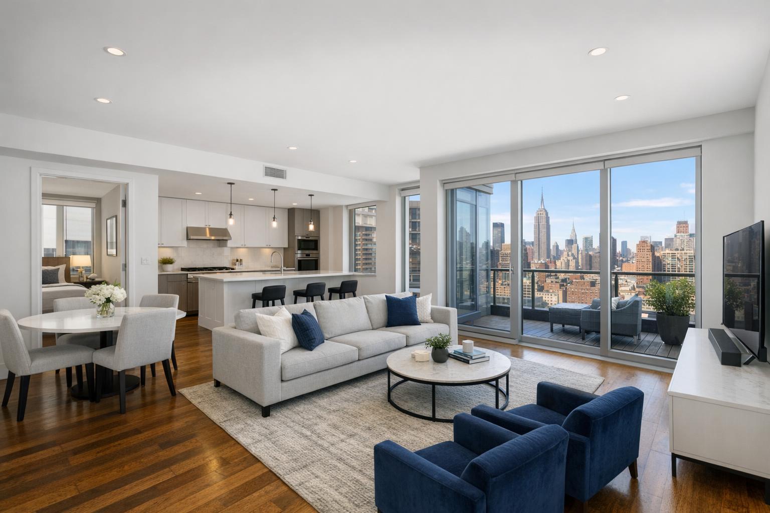
Aerial real estate photography is most valuable when considered as part of the full marketing story. Exterior drone shots establish location and scale. Interior photography explains layout, materials, and lighting. A seamless video can walk viewers through the exterior arrival, room flow, and outdoor features in a way that stills alone do not.
For listings where layout is a question, an onsite floor plan can clarify navigation and room relationships, while virtual staging provides visual cues in otherwise empty spaces. The best results stem from a coordinated media plan, not a checklist of unrelated assets.
If aerial context genuinely supports your listing’s narrative—location, land, water, architectural scale—make it part of the plan. Otherwise, focus resources where they’ll provide the clearest value for buyers.
For professional drone photography and video in NYC or New Jersey, share your listing details with RealtaSnap early to review what’s possible given your property and current conditions. To get started, visit www.RealtaSnap.com.
FAQ
Question: Can drone photography be guaranteed for any listing?
Answer: No. Drone feasibility depends on airspace, weather, building rules, safety, and pilot discretion. Even with rooftop or outdoor access, each flight must be individually approved.
Question: What details help determine if my NYC or New Jersey listing can have drone coverage?
Answer: Providing a full property address, a list of exterior features, and clear notes on access (like terraces, roofs, or yards) allows for a more realistic assessment. Sharing building management requirements or restrictions early also helps.
Question: Is aerial media always better than interior photography for real estate listings?
Answer: Not always. Aerial coverage adds most value when it helps answer visual questions about the property’s setting, land, or views. For listings where interior features are the main selling point, prioritize strong interior photography and video over drone.