How to Choose Drone Photography Near Me for a Real Estate Listing
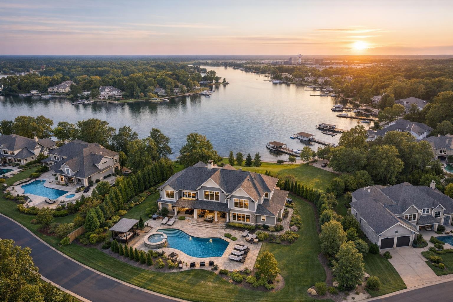
Drone photography near me captures luxurious lakeside homes with swimming pools and scenic sunset views.
How to Choose Drone Photography Near Me for Your Real Estate Listing
Searching for drone photography near me usually means you’re already considering an aerial perspective to help market a property. But finding the right fit goes beyond simply picking a nearby drone operator. The most effective real estate aerial coverage results from a practical, property-first approach—one that blends technical experience, an understanding of local airspace rules, and careful integration with the rest of your listing media.
Whether your project is in New York City, New Jersey, or a neighboring market, here’s how professionals think about when and how to use drone media for real estate—and how to choose a qualified local provider for the job.
When Does Aerial Media Make Sense?
Most people searching for a drone real estate photographer already recognize that certain features are hard to capture from the ground. Aerial media reveals things ground-level photos can’t: the scale of a property, its relationship to the water, a roof deck, unique architectural lines, or simply the overall context within a neighborhood.
But that doesn’t mean every listing needs drone photos or video. In practice, aerial media is most helpful for properties with:
- Extensive outdoor space, landscaped lots, pools, or patios
- Waterfront, riverfront, lakefront, or marina settings
- Roof decks, terraces, balconies, or anywhere with an important exterior view
- Notable architecture or a distinctive building footprint
- Proximity to parks, open space, or city skylines
- Corner lots, gated entries, long driveways, or detached structures
- Commercial locations where parking, scale, access, or site lines matter
- Development projects needing context within nearby streets or amenities
As an example, suburban New Jersey homes with deep lawns or pools often benefit from wide aerial shots, while a waterfront property may call for a lower, slanted image that shows both the building and its relationship to the water. In Manhattan, a flight may be feasible for a penthouse terrace or roof deck if logistics and regulations permit. On the other hand, a typical apartment that’s entirely focused on interiors and lacks unique exterior features is better served by polished ground photography, video, and floor plans.
How Experienced Providers Approach Real Estate Drone Shoots
The main difference between hiring any drone operator and choosing a real estate media professional is experience with listing-driven presentation. Flying is only part of the skillset—a real estate aerial photographer thinks about how their images will fit with your full gallery, whether they’re editing for consistency, and how each shot supports a clear visual story.
Practical Observations from the Field
- Intentional Composition: Strong aerial images have a specific job. They establish setting, highlight usable land, capture architectural form, or showcase a valuable view. Ten nearly identical overheads rarely add value; carefully selected perspectives do.
- Balanced Scale and Framing: Professional photographers ensure images are level, well-composed, and easy to interpret. A good aerial shouldn’t distort the property, make it look small, or isolate it unnecessarily.
- Editing for Integration: Raw drone files almost always require professional editing for color, contrast, and exposure. The goal is for the aerial to feel like a natural extension of the gallery—not a jarring departure—in both tone and quality.
- Grounded in Reality: It’s important to edit for accuracy. The objective is never to invent a new reality for the property; good aerial media simply clarifies what’s there.
Evaluating Flight Feasibility in NYC and New Jersey
If you’re searching for drone photography NYC, you’ve likely noticed there’s more regulatory complexity than standard residential neighborhoods. Tight streets, tall buildings, congested airspace, building rules, and weather make each flight a case-by-case decision.
The same applies to many New Jersey locations, especially near large airports, busy downtowns, or the coast (where wind can be a factor). Even if a property is visually right for aerial coverage, feasibility always depends on:
- Applicable FAA airspace restrictions (Part 107 compliance is a baseline)
- Local rules and building management policies
- Necessary authorization and safety considerations
- Weather, wind, and light conditions on the scheduled day
- Safe site access for takeoff, landing, and operator activity
- Pedestrian, vehicle, and neighboring property activity
- Pilot’s professional and safety assessment
In cities, roof access can increase the odds of a successful flight, especially for rooftops or terraces where street-level launches are challenging. Still, access alone doesn’t guarantee a flight—final decisions are based on location, current conditions, published regulations, and pilot discretion. If a project requires municipal, NYPD, or special-event permits, those are a separate process and typically must be arranged by the client (RealtaSnap does not obtain these permits).
Choosing Between Aerial Still Photos, Video, or Both
Aerial coverage isn’t one-size-fits-all. What works best depends on the specific property and how you want to market it.
- Choose Stills When Context is Key: A few strong drone photos can do a lot to communicate lot size, amenities, or unique placement—whether that’s waterfront, skyline, or extensive grounds. Stills are flexible assets within your main listing gallery.
- Choose Video for Properties That Benefit from Motion: A moving shot can help establish scale or tell a story that stills can’t—a slow fly-in to a waterfront home, or a sweeping reveal of a commercial site.
- Consider Both for High-Impact Exteriors: Properties with several exterior selling points often benefit from a mix. Stills give you placement flexibility in the gallery; video adds emotional context to the full listing presentation.
RealtaSnap offers single drone photo, drone video, and combined packages tailored for eligible listings. If you’re trying to determine the right format, think about what you want buyers or tenants to understand that standard media won’t fully show. Drone services should always align with the listing’s story and be feasible for the site—not just added because they’re available.
You can see more about RealtaSnap’s aerial media options and book directly at RealtaSnap drone photography and video.
What to Ask a Local Drone Media Provider
To help make your selection process smoother, these are some practical questions we recommend asking before booking:
- How often do you capture aerial media for real estate listings?
- Based on my address, what features would you recommend highlighting?
- Would stills, video, or both add the most value for this listing?
- How do you check airspace and site access prior to the shoot?
- What happens if weather or conditions make flying unsafe?
- Can drone media be scheduled with the listing photography session?
- Are there particular access or building details I should confirm in advance?
- Is your work focused on marketing, or do you do inspection or architectural surveys?
You’re looking for clear, practical answers—plus professional judgment. Be cautious about anyone who promises a guaranteed flight before seeing your location or discussing conditions. Safe drone work always depends on a site-specific assessment.
Keeping Aerial Media in Proportion
Aerial content should complement, not dominate, your listing’s story. Interior images give the clearest sense of what life in the home or space will feel like. Great exteriors highlight curb appeal and street presence. Floor plans show layout and flow. Video adds movement. Drone media excels at adding exterior context—especially when land, scale, or a view is a key selling point.
For most listings, just a handful of well-chosen drone images are enough. Overusing aerials can distract from the rooms and spaces buyers care about. In urban markets, a rooftop or terrace photo can add value, but the gallery should still center on the interiors.
Local Knowledge for NYC and New Jersey Properties
Choosing a provider who understands the unique logistics of the NYC and NJ markets is more important than many agents first realize. Densely built neighborhoods can limit safe flight options, while suburban properties may call for broader coverage to show lot size or neighboring open spaces. A good local real estate media provider will help you assess feasibility before the shoot, set clear expectations for what’s possible (and what isn’t), and coordinate with your main listing photography when appropriate.
For eligible listings in New York City’s five boroughs and throughout New Jersey, RealtaSnap can evaluate drone feasibility, local airspace constraints, weather, and site access, then proceed when a responsible flight is possible. Review options and start the process at www.RealtaSnap.com.
Conclusion
Deciding on drone photography for real estate should always begin with the property and its story—not the technology. If an elevated view will genuinely clarify a property’s scale, setting, amenities, or architecture better than ground-level photos alone, aerial media has the potential to add value. By partnering with an experienced, locally knowledgeable provider who approaches each flight as a unique project, you can balance striking visuals with a safe, compliant, and smoothly coordinated production.
Ready to find out what aerial media could add to your next listing, or simply want expert guidance on your options? Visit www.RealtaSnap.com for the latest details or to start booking.
FAQ
Question: How can I tell if my listing really needs drone coverage?
Answer: The most telltale signs are exterior features you want to showcase: lots with acreage, notable landscaping, pools, roof decks, dramatic views, corner locations, water access, or unique architectural layouts. If your property’s strongest features can’t be fully seen from the ground, aerial photos or video are worth considering.
Question: Is it always possible to fly a drone at my property?
Answer: Not always. Feasibility depends on airspace, weather, access, building management rules, and safety—especially in New York City and parts of New Jersey. Each project is individually assessed, and sometimes it’s either not legal or not safe to complete a flight on the scheduled day.
Question: What should I do to prepare for a real estate drone shoot?
Answer: Prepare the exterior just as you would for any professional photography. Move cars if needed, tidy outdoor spaces, secure loose items, and make sure access instructions are clear. If roof or gated access is relevant, confirm details before the shoot to make the session efficient for everyone involved.