How Drone Photography Is Transforming Real Estate Marketing in NYC
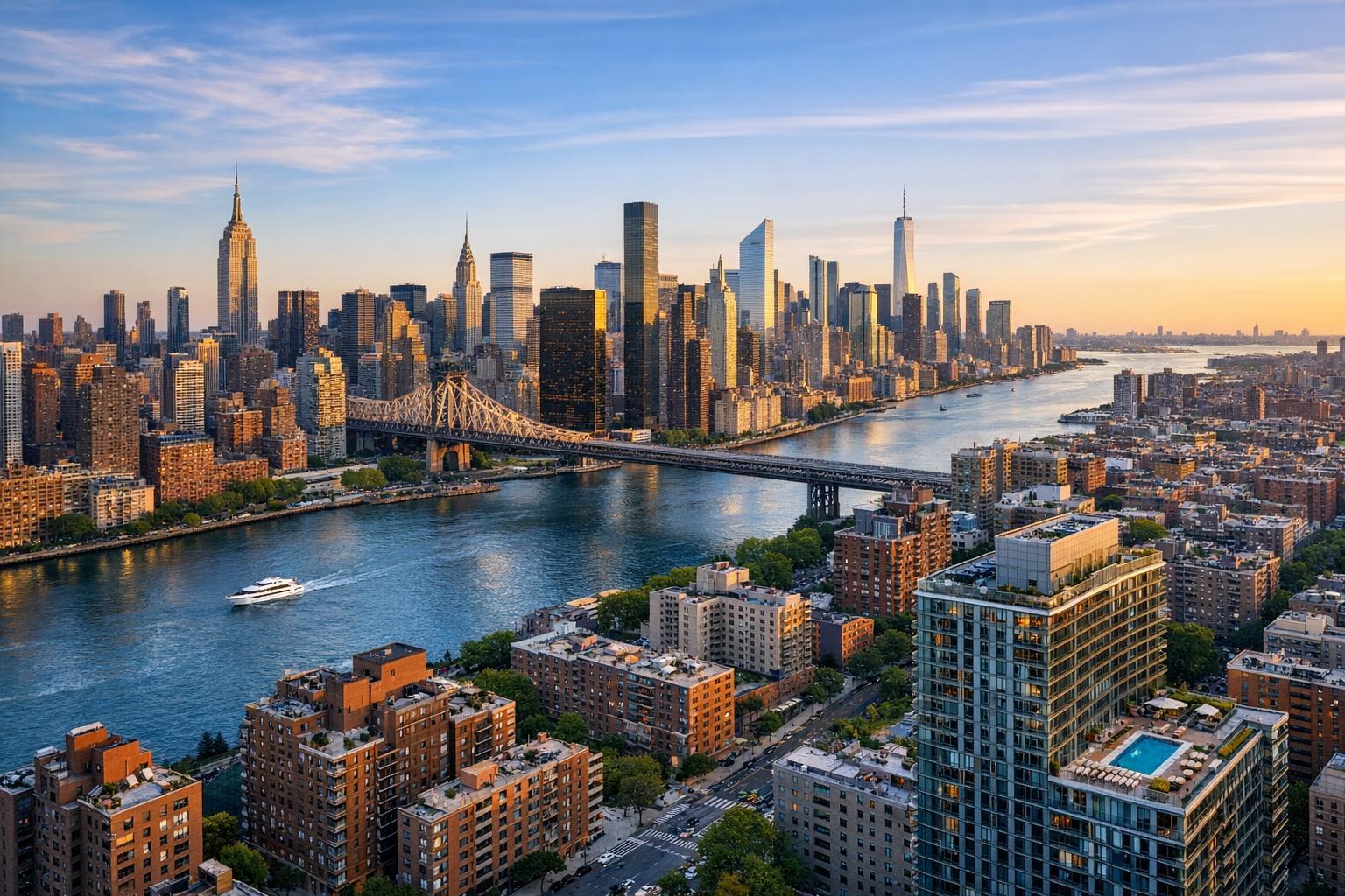
Drone photography captures a stunning aerial view of New York City at sunset, showcasing iconic skyscrapers and a river spanned by a bridge.
How Drone Photography Is Transforming Real Estate Marketing in NYC
Drone photography NYC continues to redefine how properties are marketed, giving real estate listings a visual edge that’s hard to match. In the tightly built neighborhoods of New York City and throughout suburban New Jersey, the use of aerial perspective isn’t just a trend—it’s become one of the most effective ways to showcase a property’s exterior context, layout, and setting. For professionals searching for a better way to answer the question, “What’s special about this property?” aerial media often provides the missing piece.
Aerial Perspective: Why It Matters in NYC and New Jersey
Most buyers begin their property search online, and the images they see are often their first—and perhaps only—impression. Traditional listing photos excel at showing interiors, details, and finishes. But in markets as diverse as Manhattan, Brooklyn, and the stretches of suburban New Jersey, context matters just as much. Aerial photography reveals roof decks perched above the cityscape, deep backyards tucked behind townhouses, waterfront settings, proximity to parks, and amenities that are impossible to capture fully from ground level.
Consider what the aerial view can show that other photos cannot:
- Orientation of the property in relation to the block, water, or green spaces
- Size, scale, and overall footprint, including gardens, decks, and yards
- Distinctive exteriors or architectural elements from above
- The approach to the building, such as gated entries or landscaped driveways
- Setting among neighboring structures or the skyline
For apartments and condos, elevated shots can highlight rooftop features, setback terraces, or the drama of a skyline view. In suburban areas or on larger lots, aerial photos clarify acreage, expansive lawns, or how outdoor entertaining spaces connect with the house. The goal isn’t to replace traditional photography, but to complement it—offering a more comprehensive story that helps buyers understand not just the space, but its setting.
Drone Media Adds Context—When Used Strategically
A successful drone photography real estate strategy isn’t about collecting random flyovers or including as many overhead images as possible. Instead, it’s about answering what prospective buyers want to know: Where is this property? How does it interact with its surroundings? What features set it apart?
Key operational considerations:
- Not every property is a fit for aerial capture. Small urban apartments without outdoor features may gain little from aerials, while listings with roof decks, large yards, notable exteriors, or dramatic approaches frequently benefit.
- Drone flights in NYC require planning for access, roof entry, and safety. Roof access often makes all the difference in dense neighborhoods.
- Weather, airspace rules, and site specifics (such as neighboring construction, limitations on street space, or nearby events) can affect feasibility.
- For multi-unit or commercial properties, drone footage can communicate scale, layout, and proximity to visible amenities, which standard photos often miss.
Aerial media brings out attributes such as:
- Rooftop amenities (decks, HVAC installations, solar arrays)
- Backyards or gardens
- Pools, patios, sports courts
- Private driveways, corner lots, and gated entries
- Relationship to parks, waterfronts, or open space
Common Problems Solved by Aerial Photography
Property buyers frequently mention confusion when it comes to understanding a building’s surroundings. For example:
- A penthouse terrace that looks impressive in a close-up may not convey its panoramic skyline exposure until seen from above.
- A townhouse shot from the sidewalk may inadvertently obscure a surprisingly deep garden or unique roofline.
- A marketing statement like “steps from the park” feels less credible than an aerial shot showing proximity to green space.
By supplementing primary listing photos with aerial content, real estate professionals provide clarity. Strong drone photography accelerates the decision-making process for buyers, encouraging showings from those who already appreciate a property’s context.
Video vs. Still Aerials: Different Media, Different Messages
Real estate drone services now routinely pair aerial photos and short drone video clips, but each serves a unique purpose.
Still aerial photos work well in listing galleries, printed brochures, and presentations. A single compelling elevated shot may be the best “hero” image, especially when a property’s main differentiator is its exterior or setting.
Aerial video introduces movement and a sense of journey. A typical sequence might fly in from a street view, reveal architecture as it circles the building, or arc over landmark surroundings. When paired with interior footage, drone video helps orient the viewer—showing how the property sits within its neighborhood or landscape before moving room to room.
Preparation Basics for Drone Shoots
Even though drones capture exteriors from above, thorough property prep is essential. Cluttered rooftops, neglected landscaping, construction debris, and unintended distractions will be prominently visible in aerial shots—sometimes more so than from the ground.
For a typical property to be drone-ready:
- Remove or arrange outdoor furniture, tools, bins, and unnecessary objects
- Park cars mindfully or move them away from key views
- Ensure roof decks, patios, and terraces are clean and organized
- Tidy up landscaping, sweep driveways, and clear entry paths
- When possible, secure roof access or inform management/building staff of the appointment
- Share any site-specific details that might affect launch or landing zones
In NYC, the logistics of access (think roof doors, security, and time-limited permissions) can impact what’s possible. Early communication about these factors with your media provider is vital.
The Regulatory and Practical Realities of NYC Drone Work
Aerial photography in New York City demands more planning compared to less crowded markets. Commercial drone operations are governed by FAA Part 107, and each location must be evaluated for airspace, site-specific safety, access, and local restrictions. In some cases, flights may be declined due to airspace or safety concerns, even if the demand for drone imagery is high in a given market.
- RealtaSnap does not handle the process for municipal, NYPD, or special event permits beyond typical FAA authorization. If extra permitting is required, it falls to the property owner, management, or agent.
- Feasibility is determined on a case-by-case basis, with final decisions made according to airspace and pilot discretion. Not all NYC properties are guaranteed to be flyable, especially those in sensitive or restricted areas.
Operational tip: In high-rise and dense areas, having roof access can significantly improve the feasibility, safety, and quality of drone work.
Making Smart Use of Aerial Media Without Overdoing It
The most effective use of aerial imagery is selective—it highlights features that a ground-level camera cannot. Balance is key: drone content should support the property’s narrative, not overwhelm it. Buyers still need a full spectrum of images to appreciate kitchens, living spaces, connections between rooms, and finish details.
For a balanced media presentation, consider:
- Professional photography for interiors and curb-appeal exteriors
- One or two strong aerial stills for context, scale, and location
- A concise drone video for listings that benefit from movement or setting
- Floor plans or virtual tours when layout clarity is essential
Adding excessive, repetitive overhead drone images dilutes the value—choose only those frames that provide new information to potential buyers.
RealtaSnap Drone Photography Services: Coverage, Pricing, and Booking
RealtaSnap provides aerial photography and video for real estate listings in all five boroughs of NYC, throughout New Jersey, and select surrounding markets. Our offerings include:
- 10 HDR drone photos (with blue-sky replacement as needed): $209
- One-minute final 4K drone video: $229
- Combo package with 10 HDR photos and one-minute 4K video: $299
To learn more or to book directly, see the RealtaSnap drone services page. The scheduling process includes entering the address, access instructions, selecting your preferred service, and confirming payment. At least 24 hours’ notice is requested, with real-time availability always shown on our online calendar.
Drone media is often paired with professional real estate photography for a comprehensive, coordinated listing presentation.
Bringing Listings to Life: The Takeaway for NYC and NJ Real Estate Professionals
As drone photography in NYC and New Jersey becomes increasingly accessible, its impact is apparent—not because it replaces great interiors, but because it fills crucial gaps in the property’s marketing narrative. Aerial media delivers clarity, perspective, and visual impact that ground-level shots alone cannot provide.
For the best results:
- Use aerial imagery to emphasize setting, amenities, and exterior character
- Prepare properties thoroughly, especially visible surfaces and outdoor spaces
- Communicate early about access, flight feasibility, and project expectations
- Integrate quality drone content into a well-rounded listing presentation
When you’re ready to discuss aerial coverage for an upcoming listing, visit www.RealtaSnap.com.
FAQ
Question: Are drones allowed to fly at every property in New York City or New Jersey?
Answer: Not always. Drone operations are subject to FAA regulations, airspace classifications, local restrictions, pilot discretion, and the specifics of each site. Some locations—especially in dense areas or close to airports—may not be flyable, even if aerial imagery is requested. Roof access and early planning improve feasibility.
Question: How should I prepare my property for an aerial shoot?
Answer: Focus on tidying visible outdoor areas—clear patios, arrange furniture, remove bins and clutter, and park vehicles with photos in mind. For NYC, arrange access in advance and confirm details like roof entry or gate codes to keep things efficient and safe.
Question: Should I book drone photos, drone video, or both for my listing?
Answer: Choose drone photos if you want versatile aerials for galleries and print. Add drone video when movement, “approach” sequences, or showing the property’s relationship to its surroundings is important. Many properties benefit from a combination, especially if exterior features or context are selling points. Booking options and packages are available at RealtaSnap’s drone services page.