Evaluating the Impact of Drone Photography on NYC Real Estate Marketing
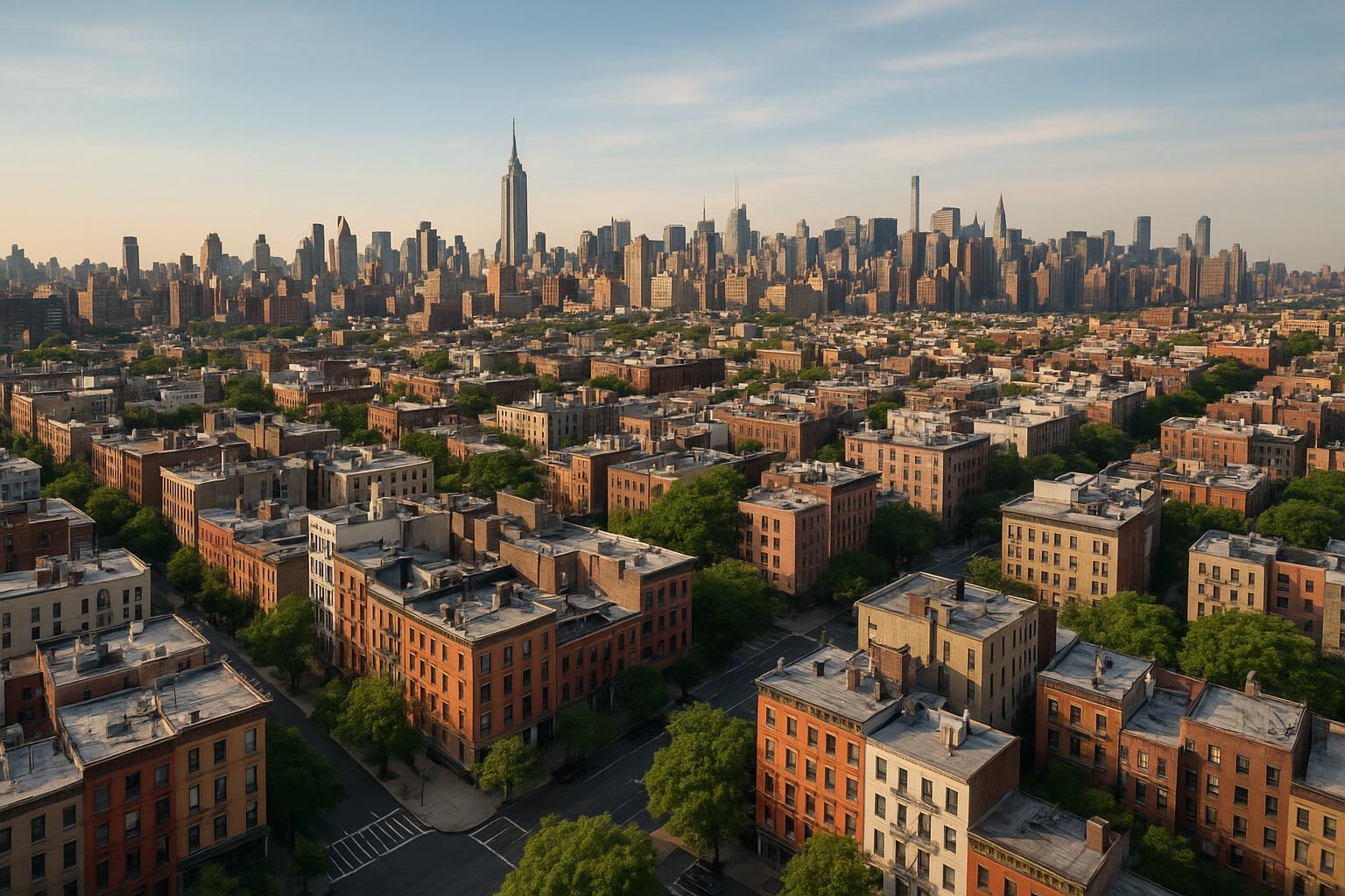
Drone photography captures an extensive view of urban real estate with a mix of brick buildings and distant city skyscrapers under a clear sky.
Introduction
When it comes to maximizing property exposure, drone photography real estate solutions have rapidly become the gold standard—especially in competitive markets like New York City and New Jersey. As interest in aerial real estate photography grows, agents and sellers are searching for expert services that do more than just snap pictures—they want visual assets that actively drive buyer engagement and accelerate sales. In this article, we'll dig into how drone photography is revolutionizing NYC real estate marketing, explore why these stunning aerials matter for your listing’s performance, and outline what you need to know about booking top-tier drone photography nyc services, including the best practices, regulations, and practical steps for working with a proven professional like RealtaSnap.
The Real-World Problem
Despite the digital shift in real estate, too many NYC and NJ listings still use flat, uninspired imagery. The classic problems? Weak first impressions on platforms like Zillow and StreetEasy, or listings lost in a sea of competitors with similar visuals. Agents tell us about low click-through rates, buyers skipping tours, and seemingly great homes overshadowed by poor media—dark rooms, limited views, empty or oddly angled spaces that stifle imagination, or branding that simply doesn’t support the property’s value. When media falls short, listings disengage prospective buyers in just seconds, undermining months of prep work and stalling the sales cycle. Particularly in urban markets, properties with no context—where is it, what does the block look like, how does it sit on the skyline—struggle to spark attention or stand out as soon as buyers open the app.
What Experienced Media Teams Know
Teams with hands-on photography and marketing experience understand the hidden factors behind stunning listings. Drone pilots and real estate photographers know how the timing of natural light impacts not just interior shots, but also how shadows play across rooftops and terraces. Securing roof access in Manhattan can make or break an aerial session—without access, your options shrink quickly. In NYC, airspace can be tightly restricted: pilots must check FAA Part 107 rules, confirm flight feasibility, and manage expectations for controlled airspace.
During a shoot, professionals scout ideal launch points, account for shifting reflections on glass towers, and carefully balance window exposures to keep exterior details visible without blowing out sky or street. Framing is more than just “point and shoot”—seasoned teams compose shots to give a sense of space, highlighting outdoor amenities, building lines, and view corridors, so buyers can visualize the property’s relationship to the cityscape. Editing isn’t just about making things “pop”—it’s about subtle corrections, consistent blue skies, and aligning every image with the client’s branding sensibility, ensuring a cohesive look across all platforms.
How RealtaSnap Solves It
At RealtaSnap, we’ve spent years mastering the real-world complexities of aerial real estate photography in NYC, New Jersey, and surrounding markets. Our approach is built around three things: reliability, quality, and a real understanding of what sells. Every drone operation is compliant with FAA Part 107 and local NYC/NJ restrictions. We rigorously assess flight feasibility—especially in urban locations—review airspace maps, and coordinate with building managers and on-site staff for access, minimizing surprises on shoot day【20:3†RealtaSnap_Service_Execution_Policy_MASTER.docx】.
Our pilots use advanced 4K drones, delivering crisp UHD images and cinematic 4K videos that make any property’s story stand out online. HDR processing ensures every shot captures clear detail and balanced lighting, even in challenging city sunlight or shadowed courtyards. Turnaround time is streamlined for fast-moving markets—most aerials are delivered within 24–48 hours, fully edited, branded, and ready to post.
Booking is simple and transparent: select your address and service, choose from photos, video, or both, and see the real-time schedule. Our drone packages for NYC and NJ real estate marketing are priced simply—$209 for 10 HDR drone photos or $229 for a complete 4K aerial video; both for $299. All prices and information are subject to change. Information is deemed reliable but not guaranteed【20:0†RealtaSnap_Rate_Sheet_MASTER.docx】.
RealtaSnap makes aerial imaging effortless for busy agents and sellers. Our experienced editors provide consistent color and detail across all media, and our process includes clear communication pre- and post-shoot, so you always know what to expect and get the assets you need—every time.
Benefits (Bullet Points)
- Aerial views showcase scale, amenities, and location
- 4K and HDR imaging delivers stunning visual clarity
- Fast, consistent media turnaround for new listings
- FAA-compliant workflows minimize legal risk
- Urban drone expertise for NYC and NJ properties
- Blue sky replacements for perfect day results
- Easy, transparent online booking for fast scheduling
- Media optimized for web, MLS, and social listings
Why This Matters in the NYC / NJ Market
New York City and New Jersey represent some of the most competitive and complex real estate landscapes in the country. In Manhattan and Brooklyn, condos may have rooftop terraces, skyline views, or neighborhood parks—details buyers crave but can’t appreciate in standard ground-level photos. In Jersey City, Hoboken, or Weehawken, drone imagery uniquely positions listings against local landmarks or waterfronts, driving clicks from both city-bound and suburban buyers.
Urban properties deal with tighter regulations, airspace restrictions, and high-rise access issues. Buyers here are savvy and oversaturated with listing media; seeing a property’s placement in the city grid or its proximity to transit hubs and parks can be the tipping point. Over in the New Jersey suburbs, aerial photography highlights expansive yards, pools, or unique lot lines—features lost in flat, uninspired ground-level presentations.
For short-term rental hosts and commercial listers, aerials communicate neighborhood feel, traffic flows, and access points—all crucial for setting realistic expectations before buyers even arrive.
Comparison with Traditional or Lower-Quality Alternatives
The difference couldn’t be clearer: Phone snapshots and rushed media fail to illustrate property scale, block context, and urban amenities—crippling first impressions. Overexposed windows, whitewashed skies, and tilted building lines distract rather than engage. Relying on generic providers or DIY approaches means risking inconsistent image quality, unpredictable delivery, and lack of regulatory compliance.
Delayed media, outdated drone tech, or generic editing ruins your listing’s impact and can actually turn buyers away. When listing competition is fierce and buyer attention is short, the professional edge of RealtaSnap’s aerial real estate photography—built for NYC/NJ and tailored to each property—yields more lasting impressions, higher click-through rates, and, ultimately, faster cycles from showing to closing.
Conclusion & Call to Action
For New York City and New Jersey agents, hosts, brokers, and sellers, drone photography isn’t a luxury—it’s fast becoming a necessity. Aerial imaging brings properties to life, provides much-needed context in crowded markets, and gives your listing that crucial visual edge. RealtaSnap combines uncompromising 4K quality, local expertise, and seamless service to maximize listing potential for every property.
Ready to elevate your listings? Explore RealtaSnap’s drone photography and videography services for NYC and New Jersey real estate. For a complete property marketing solution, or to see all RealtaSnap services in action, visit our main site.
Frequently Asked Questions
1. Is drone photography legal everywhere in NYC or New Jersey?
Not all NYC or NJ locations are flyable; airspace and regulations are strict, especially in Manhattan and near airports. RealtaSnap reviews flight feasibility, always complies with FAA Part 107, and confirms site access in advance, so you get great aerials without legal worry.
2. How much notice do I need to book drone photography with RealtaSnap?
We recommend at least 24 hours. Our online calendar offers real-time availability, and our five-step booking process is transparent—select services, schedule, and pay upfront. Quick turnaround means you’ll have your media ready for launch, even with tight listing deadlines.
3. What makes RealtaSnap’s drone images better than typical listing photos?
It’s more than just a drone shot: Our team balances lighting, corrects vertical lines for professional presentation, and edits each image to reflect true property scale. Consistency, visual clarity, and careful compliance with local rules mean you get aerials that truly elevate your listing in NYC and NJ markets.
Ready to discover how aerial real estate photography can transform your listings? Trust the team that knows the market, the media, and what buyers expect—choose RealtaSnap.