Drone Photography’s Growing Influence on NYC Real Estate Marketing
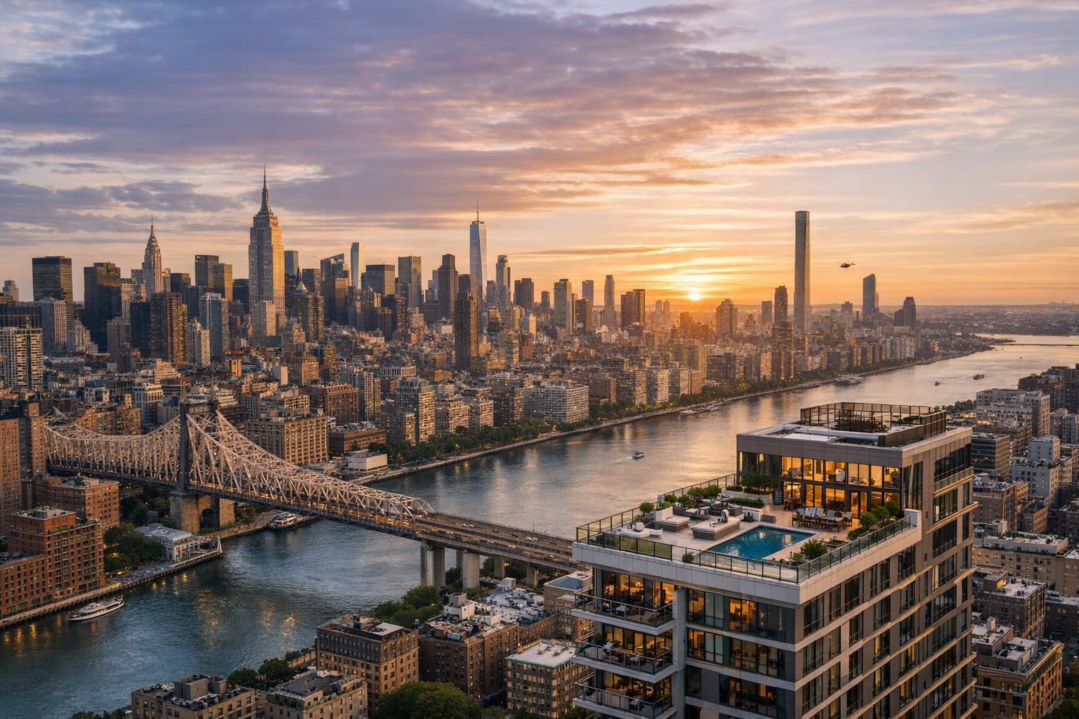
Drone photography captures a stunning view of a river, city skyline, and luxurious real estate at sunset.
Introduction
In today’s hyper-competitive property scene, drone photography real estate solutions are changing how agents and sellers capture attention, especially in markets like New York City and New Jersey. From high-rise condos in Manhattan to townhouses in Brooklyn and mixed-use spaces in Jersey City, leveraging aerial real estate photography isn’t just a trend—it’s a proven way to elevate listings, create stronger first impressions, and reach buyers who demand both beauty and detail. In this guide, we’ll show you how drone technology is revolutionizing real estate marketing in NYC, spotlight the unique advantages for various property types, and outline compliance essentials for safe, effective urban drone operations. You’ll discover why experienced media teams lean on these tools, and how a partner like RealtaSnap provides exceptional value for agents eager to stand out.
The Real-World Problem
Even ambitious NYC and NJ agents face the grind of low listing click-through rates, underwhelming photo galleries, and properties that languish on crowded platforms. Standard phone pics or hurried DSLR shots often miss the mark:
- Rooftop amenities get lost in shadow or perspective.
- Grand lobbies and exterior facades appear cramped or distorted.
- Corner lots, penthouses, and homes with unique outdoor spaces rarely show their true value from ground level.
What’s more, buyers are already making snap judgments—scrolling rapidly through hundreds of nearly identical images. Without compelling aerial real estate photography, it’s almost impossible to highlight spatial context, proximity to parks, water views, outdoor terraces, or the neighborhood feel. That means not just lost listings, but listings that never earn that key second look—let alone a showing appointment.
What Experienced Media Teams Know
Having covered thousands of shoots in NYC, Jersey City, Hoboken, and beyond, our RealtaSnap team understands the unique choreography of great real estate media production:
- Timing Is Everything:
In Manhattan’s dense grid or Jersey’s riverfront, the best light hits building facades between late morning and early afternoon. For aerials, we often schedule around sun direction to avoid long shadows or overexposed rooftops. - Preparation and Coordination:
Securing rooftop or terrace access ahead of time is vital for elevator buildings and luxury condos—urban drone work can’t be improvised. On multifamily or commercial shoots, our pilots coordinate with building management and, when needed, pause for safe pedestrian clearance. - Urban Flight Expertise:
In the NYC real estate market (“drone photography nyc”), FAA Part 107 compliance and airspace-check apps are a must. We assess the feasibility of every drone shot, especially when working near airports, controlled heliports, or military zones. Not every rooftop is immediately flyable—city ordinances, FAA rules, and building-specific restrictions all matter. - Framing and Storytelling:
Shoot plans prioritize aerials that capture not just buildings but their lifestyle context—like showing a Park Slope brownstone’s proximity to Prospect Park, or a Weehawken penthouse’s skyline view. We avoid extreme fisheye distortions and always balance vertical lines in post, so city towers don’t appear to “lean.” - Consistency and Fast Turnaround:
Agents need reliable, next-day delivery on high-res aerials. Our workflow ensures raw files are reviewed and edited immediately, with sky replacement for gloomy days and color correction to create a crisp, inviting look.
How RealtaSnap Solves It
RealtaSnap takes the guesswork—and the stress—out of drone photography real estate campaigns in NYC, New Jersey, and surrounding markets. Here’s how:
- Expert Pilots, Local Knowledge: Our certified pilots have deep experience navigating the region’s dense neighborhoods, restricted airspace, and complex building layouts. Every aerial shoot starts with an in-depth safety and compliance check.
- Tailored Shot Lists: We craft shot lists that emphasize scale, architectural details, and location context—never generic or “template” media.
- Top-Tier Image Quality: Our workflows use 4K and HDR capture (with blue sky replacement as needed) to deliver consistently stunning visuals, even on gray days.
- Integrated Media Packages: Drone stills, video tours, and ground-level images all combine into one cohesive, brand-enhancing media kit—perfect for everything from MLS to Instagram reels.
- Transparent, Efficient Booking: Our streamlined online system allows booking in minutes, with only 24 hours’ advance notice required for most shoots. Pricing for drone services is crystal clear, starting at $209 for 10 HDR aerial photos, $229 for a 1-minute 4K video, or $299 for both—a major value-add for any listing.
All prices and information are subject to change. Information is deemed reliable but not guaranteed.
For more, visit our dedicated drone photography & videography NYC page.
Benefits (Bullet Points)
- FAA-certified pilots for safe, legal urban flights
- Crystal-clear 4K and HDR aerial imagery
- Sky replacement editing for flawless presentation
- Fast, next-day turnaround for most listings
- Customizable shot lists per property type
- Integrated with full media packages
- Easy online booking and clear pricing
- Expert compliance with NYC/NJ airspace and permits
- Flexible scheduling across all boroughs and NJ
- Fully insured and risk-aware operations
Why This Matters in the NYC / NJ Market
The New York metro area presents unique challenges and opportunities for real estate media:
- Property Variety: Listings range from ultra-modern glass towers in Midtown to landmark brownstones in Brooklyn, multifamily walk-ups in Queens, and riverfront developments in Jersey City. Each requires a different visual strategy—especially for exteriors and surrounding amenities.
- Buyer Expectations: NYC buyers are fast-moving, visually sophisticated, and expect to see wide angles and dramatic context (“aerial real estate photography”). Listings lacking aerials may struggle to compete, particularly for luxury or investment properties where the view, block, or skyline matters as much as the floor plan.
- Competitive Pressure: Rental and sales markets move quickly. Owners and agents can’t risk being outshined by peer listings featuring show-stopping drone media. Even mid-level listings see stronger engagement when aerials are used strategically.
Comparison with Traditional or Lower-Quality Alternatives
- Phone Photos: Miss the drama of exteriors, flattening spatial relationships. Rooftop decks, yards, and city-block views essentially disappear.
- Rushed Media Providers: Underexpose, misframe, or skip permitted aerials—leaving your listing looking dull or incomplete.
- Inconsistent Editing: Skyline horizons often come out skewed, while window glare or hard shadows distract from the actual unit.
- Delayed Turnaround/Generic Shops: Listings spend days in a photo “queue,” costing momentum in the first critical hours online.
- Amateur Drone Operators: Miss key regulatory steps, take risky shortcuts, or deliver unusable footage due to wind, sun, or legal problems—which can put your listing, or your business, at risk.
Conclusion & Call to Action
In the fast-paced NYC and NJ markets, properties don’t get a second chance to make a memorable introduction. Partnering with a knowledgeable, experienced team like RealtaSnap ensures every listing shines from the first click, with aerials that reveal the full story—location, scale, neighborhood, and design. Whether you’re promoting a new luxury high-rise, repositioning a classic brownstone, or highlighting hidden amenities in a competitive rental, our aerial real estate photography brings out the best in every property.
Ready to put your portfolio on a higher plane? Learn more and book your next shoot at www.realtasnap.com or discover our drone photography services in NYC.
Frequently Asked Questions
1. Can you get drone photos of any building in NYC or NJ?
Due to complex urban airspace, some NYC and NJ locations have flying restrictions or require special permissions. Our team always starts with a safety and feasibility assessment, and we only fly where legal and permitted. If a location is unavailable for drone photos, we’ll offer creative alternatives—your listing will never be left without an elevated solution.
2. Do drone photos really make a difference in listing performance?
Aerial images consistently attract more online clicks and drive higher engagement because they help buyers visualize the big picture—context, amenities, and views. Agents using RealtaSnap’s drone photography routinely experience stronger initial interest and more qualified showings, especially in dense urban settings where unique angles are everything.
3. What’s the process for booking a drone shoot with RealtaSnap?
Booking is fast and straightforward through our online scheduling system. Just enter the property address, select your drone photo or video options, choose any add-ons, and reserve your slot—often with just 24 hours’ notice. We’ll handle everything from compliance checks to editing, so you can stay focused on clients and negotiations. Your media is delivered ready-to-use, promptly, and professionally.