Drone Photography NYC: When Aerial Media Makes Sense for a Property Listing
Drone photography captures a stunning view of NYC's skyline with modern waterfront buildings and a bridge over a river.
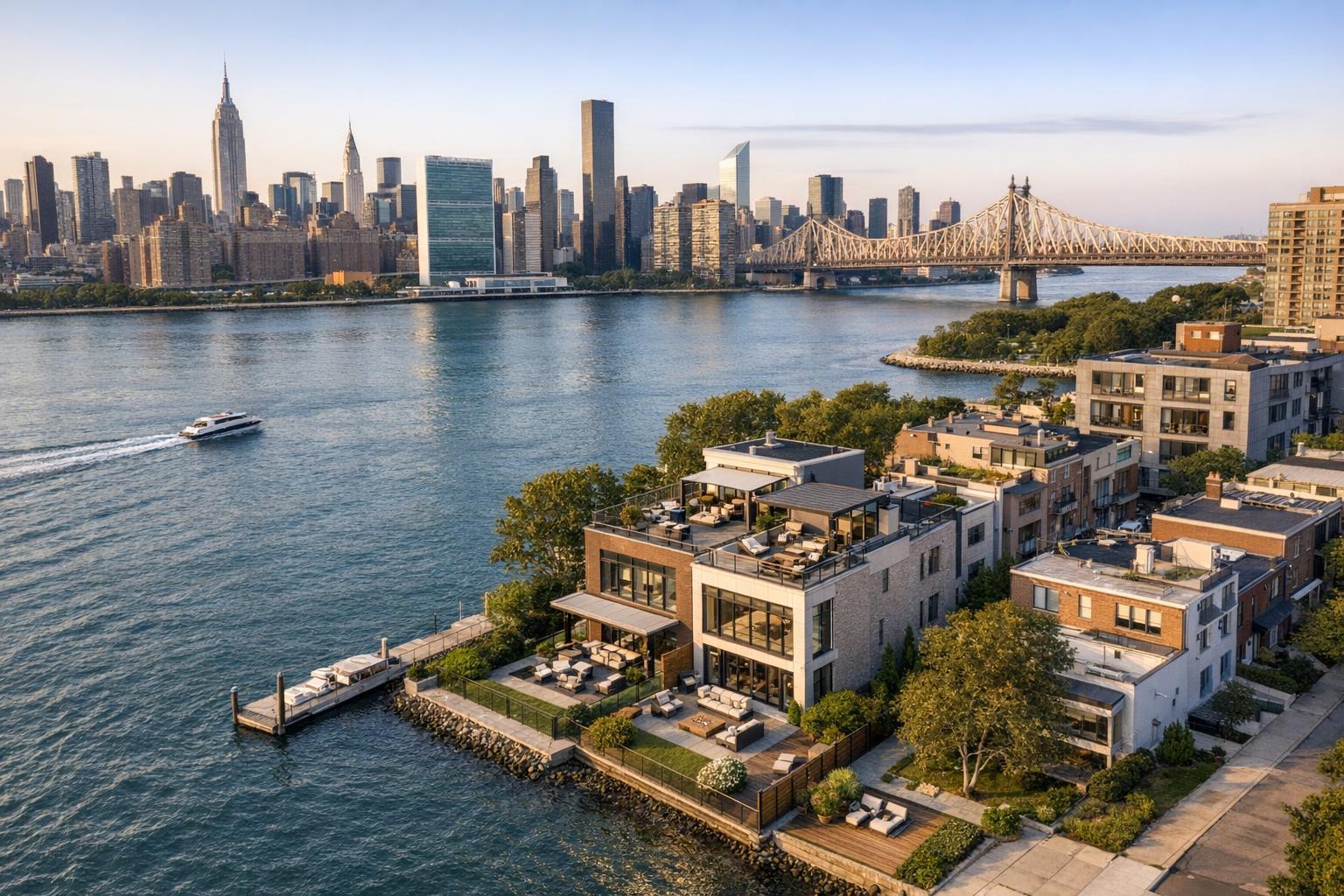
Drone Photography NYC: A Real-World Guide to Aerial Media for Real Estate Listings
Drone photography in NYC continues to shape how agents, brokers, and property professionals approach real estate visual marketing. But while impressive city vistas and sweeping rooftop shots are what often come to mind, the real challenge is knowing when aerial real estate media actually adds value—and when it simply isn’t the right fit. At RealtaSnap, our perspective is rooted in what works for properties across New York City, New Jersey, and surrounding markets. Below, we’ll walk through the practical factors that drive the decision, balancing visual storytelling potential with regulatory, operational, and project-specific realities.
What Aerial Media Can Do That Ground Photography Can’t
Professional property photography remains the starting point for most listings. Clean, well-composed images of interiors and exteriors document a property’s light, finishes, condition, and layout. Aerial real estate media does something fundamentally different: it gives context, showing how a building or home sits within its block, lot, or broader neighborhood.
Some questions aerial photography can answer more clearly than ground-level images:
- What is the footprint and scale of the property or development?
- How does a private roof deck relate to skyline views or outdoor space?
- Is there direct access to waterfront, docks, or parks?
- How unique is a corner lot, setback, or position within a campus?
- Are there architectural elements best appreciated from above?
- Does the neighborhood context enhance or clarify the property’s appeal?
For example, consider a Brooklyn brownstone with a deep garden: the aerial shot can reveal backyard size and the rhythm of adjacent rowhouses. A Manhattan condo with usable rooftop may benefit from perspectives that connect limited outdoor space to sweeping skyline views. Waterfront listings in New Jersey can visually anchor the property with its shoreline and amenities.
Operational Tip: Before scheduling any shoot—interior or drone—plan which visual questions the listing needs to answer. Aerial shots are most effective when they clarify something that would take multiple ground-level images to explain.
When Is Drone Media the Right Fit?
Not every property is a good candidate for aerial real estate media. Dense NYC neighborhoods, buildings with difficult roof or outdoor access, and homes without distinctive exterior features may get little added value from drone imagery. Instead, prioritize properties with one or more of the following:
- Large or multi-zone yards, especially with pools, patios, gardens, or sports courts
- Waterfronts, private docks, scenic surroundings
- Notable roof decks or terraces
- Lots with unusual configurations, driveways, or gate setups
- Developments or commercial properties needing to show site scale or access points
Even then, the neighborhood context should support the story you want to tell. Aerial shots are best when they communicate something new—proximity to parks, separation from traffic, open vistas, or context among notable buildings.
Prep Insight: Before the drone shoot, outdoor areas should be staged for top-down views: remove clutter like trash bins or tools, tidy up loose furniture, and arrange major features so they look intentional from above.
Aerial Photos vs. Drone Video: Knowing the Difference
Though often discussed together, aerial stills and drone video serve distinct purposes:
- Aerial Photos: Clear, high-resolution images that freeze the composition and allow viewers to study the exterior, lot, or neighborhood context. They’re excellent as lead gallery images or as visual reference points in brochures, websites, and offering memorandums.
- Drone Video: Brings scale and movement, offering a sense of progression—rising over rooftops, panning across property lines, or moving along a waterfront. It works best when woven into a larger listing video, complementing interior footage rather than replacing it.
Practical Consideration: Still photos are stronger for gallery clarity and reference. Video is most effective for introducing a sense of arrival or spatial flow, but should not supplant essential interior and exterior photos.
NYC Feasibility: What Determines If a Drone Flight Can Happen
New York City’s visual drama is unmatched, but that doesn’t make every flight possible. In practice, drone operations are determined case by case and subject to several real constraints:
- Airspace: Much of NYC lies under controlled or restricted airspace. FAA Part 107 rules apply, and location-based authorization is required. Pilot judgment and safety come first—if an address is in restricted airspace or near airports/stadiums, extra paperwork or a decision not to proceed may result.
- Building and Roof Access: Safe takeoff and landing require practical access—rooftop areas in high-rises, cleared courtyards, or wide setbacks are far superior to congested, narrow streets. In some situations, a property may only be shootable from a roof rather than ground level. But roof access is never a guarantee, and permission from building management is typically required.
- Street Density: Manhattan, Brooklyn, Queens, and the Bronx all present unique challenges: ongoing traffic, high pedestrian flow, proximity of buildings, overhead utilities, and limited open space can impede both safe operation and the ability to capture meaningful images.
- Weather and Conditions: Wind, precipitation, changing light, or rapidly shifting conditions at upper stories can limit feasible flight windows. Even clear blue skies may be offset by wind or site-specific safety judgments.
Inside Knowledge: At RealtaSnap, we never promise drone deliverables until the site, weather, and airspace have been reviewed. Every project is a case-by-case assessment. Roof access often improves feasibility, but it doesn’t supersede safety, legal, or operational requirements.
Practical Tips for Planning a Productive Drone Shoot
A little preparation makes a big difference in the flow and success of any aerial real estate session:
- Share Access Details Early: Send roof access instructions, gate codes, parking locations, and relevant building contacts so feasibility can be determined in advance.
- Clarify Desired Features: Let your photo team know whether you want to highlight the roof deck, backyard, waterfront, or blend of features—shoot planning is easier (and more likely to succeed) when the priorities are clear.
- Prepare Exteriors: Tidy up patios, arrange pool furniture, close covers, and remove temporary clutter. Drone angles reveal what’s on the property—even what’s tucked against the house.
- Be Flexible With Scheduling: Weather, wind, and building access can all cause schedule adjustments. If aerials are central to your marketing, leave some buffer for rescheduling as needed.
Matching Service Scope to Listing Needs
RealtaSnap offers several standard drone media packages:
- Drone Photos: 10 high-resolution HDR images, delivered with enhanced sky and clarity, for $209.
- Drone Video: 1-minute professionally edited 4K video, delivered as a standalone clip or complement to interior footage, for $229.
- Combined Photo & Video: Both options above, together for $299.
For most listings, a balanced approach works best: professional interior and exterior photos form the core, with a selective aerial package reserved for properties where site or context adds measurable value.
To see full details or schedule services, you can review photo, video, and aerial options directly at RealtaSnap’s drone photography and video page or browse all service options at www.RealtaSnap.com.
Using Aerial Media Intentionally
Drone photography should be a purposeful addition, not just a dramatic extra. Its strongest use is explanatory, visually answering questions about site, scale, context, and setting that ground-level media cannot.
New York and New Jersey listings benefit most when aerial media clarifies what maps and still photos struggle to communicate—how a roof deck sits among city towers, how a lot stretches behind a brownstone, or how proximity to water or green space gives a property unique appeal.
If you’re considering aerial media for a property with a rooftop, outdoor feature, large lot, or distinctive setting, RealtaSnap evaluates each request for feasibility, safety, and compliance with FAA and local restrictions. For more information or to start planning an aerial session, visit www.RealtaSnap.com.
FAQ
Question: How much does RealtaSnap drone photography cost?
Answer: Drone photo service includes 10 HDR aerial images for $209. A drone video (1-minute final, fully edited) is $229. The combined photo and video package is $299. Feasibility is reviewed per property before confirming any aerial session.
Question: Can you fly a drone from the roof of an NYC building?
Answer: Roof access can improve the odds of safe aerial operations by providing a controlled launch space and better sightlines—especially in dense neighborhoods. However, airspace rules, building permission, weather, and pilot discretion still apply.
Question: Should I choose drone photos, video, or both for my listing?
Answer: Still aerial photos are best when you need clear gallery images of the lot, roof, or context. Drone video adds movement and a sense of scale. Many agents use both for listings with standout exterior features, but interior and exterior stills should remain the foundation of your property media plan.