Drone Photography Near Me: How to Choose a Real Estate Media Provider
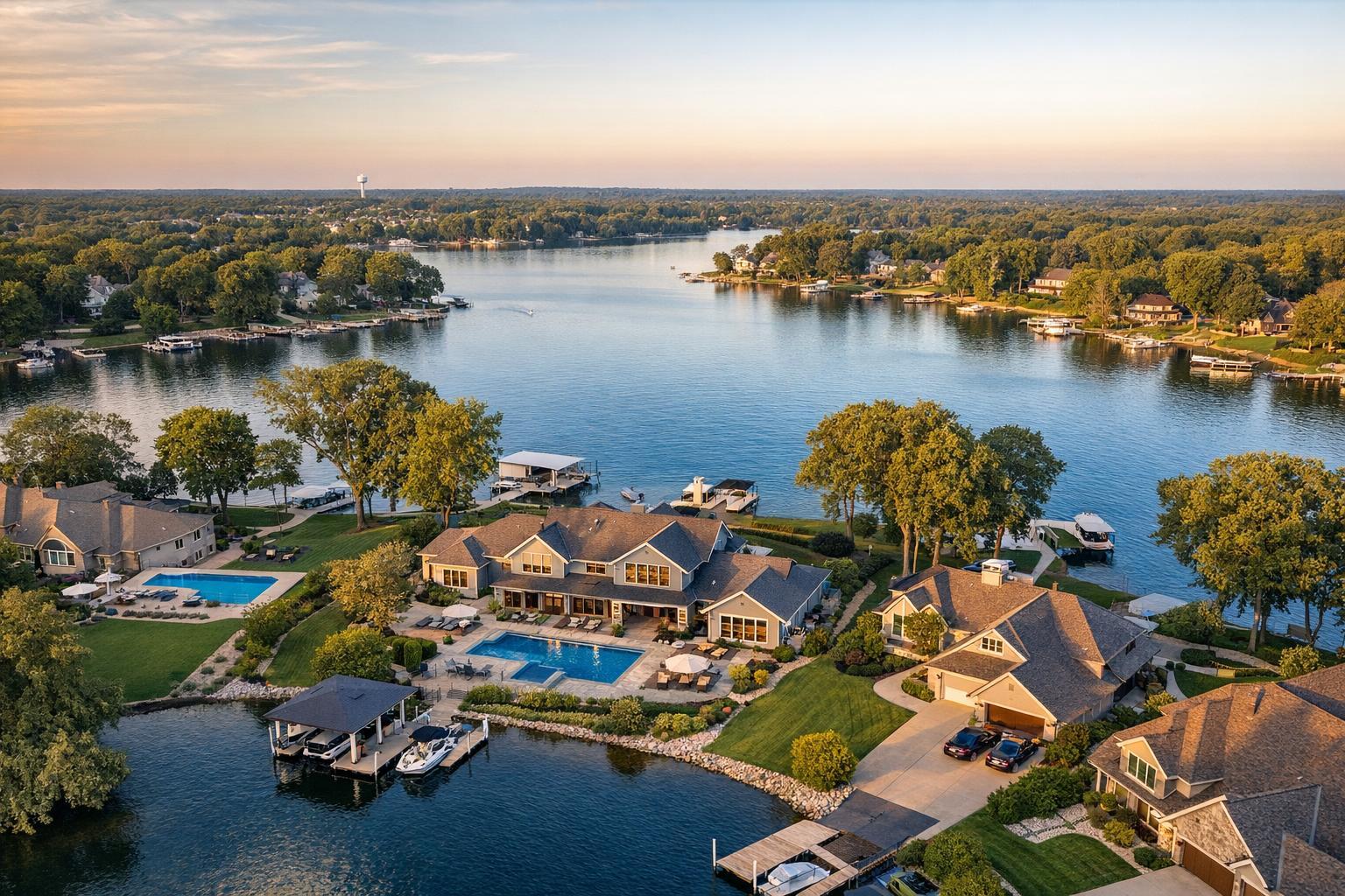
Drone photography captures a picturesque lakeside community with elegant houses, green lawns, and private docks during golden hour.
Drone Photography Near Me: How to Choose the Right Real Estate Media Partner
Searching for drone photography near me signals a real, practical question: can aerial media actually help showcase a listing in your location, and if so, who is truly equipped to deliver it well? For NYC and New Jersey agents, brokers, and property owners, this decision goes beyond simply finding the nearest drone operator. The right provider brings both aerial expertise and real estate marketing know-how—helping you capture what matters, when it's safe and legal to do so.
What Professional Aerial Media Adds That Ground Photography Can’t
Most listings are built on high-quality interior and exterior photos. But some properties present unique challenges or potential: large lots, private roof decks, sweeping water views, or a position in the landscape that’s hard to illustrate from the ground. This is where real estate drone photography services can add real value:
- Showing property size and full extent of outdoor features—driveways, pools, patios, landscaping
- Documenting a home’s proximity to water, marinas, parks, or shorelines
- Showcasing rooftop terraces, private gardens, or upper-level outdoor living spaces
- Revealing panoramic views, distinctive architecture, or unique building layout
- Establishing the relationship between the property, its land, and the neighborhood
Aerial real estate photography is most powerful when it helps answer specific buyer questions—how private is that roof deck? What does the backyard actually look like from above? How close is the home to the shoreline or park? Images captured from the air can often communicate these answers with a single shot.
When incorporated into listing video, coordinated drone sequences can establish the setting or build anticipation before walking viewers through ground-level and interior spaces. But aerial media works best as part of a well-organized visual plan, not as a generic add-on.
When Does Drone Media Make Sense for a Listing?
Not every property requires or benefits from drone work. Compact city apartments in high-density zones usually see a stronger return from well-lit interiors, accurate floor plans, and perhaps a virtual tour. Drone imagery tends to make the biggest difference in cases like:
- Homes with substantial outdoor features: Large New Jersey properties, acreage, landscaped yards, and homes with pools, tennis courts, or multiple structures are often difficult to understand without an aerial view.
- Waterfront, shoreline, or view properties: House-hunters looking for river, city, or ocean views care about setting and context. Drone photos can highlight dock access, beach proximity, or the sense of space between a home and its surroundings.
- Properties with roof decks or terraces: Manhattan, Brooklyn, and Jersey City listings with private outdoor spaces above street level often need aerial angles to clarify scale, privacy, and access.
- Distinctive architecture or larger commercial sites: Sometimes the only way to communicate a building’s form, site plan, or visual “wow” factor is from the sky.
For these listings, aerial photos and video offer clarity that traditional photography simply can’t provide.
Local Reality: Why NYC and NJ Demand a Case-by-Case Approach
Not every address lends itself to a drone shoot. In NYC—especially in Manhattan and many parts of Brooklyn—urban density brings its own set of challenges: tight streets, active sidewalks, tall buildings, complex airspace, limited launch zones, and frequent FAA restrictions. Sometimes even a listing with fantastic rooftop amenities cannot be flown due to safety or legal grounds.
By contrast, New Jersey’s mix of suburban neighborhoods, larger parcels, and coastal properties might seem like drone-friendly territory. But open space doesn’t automatically guarantee flight access—local weather, nearby airports, power lines, densely wooded lots, and local site conditions all influence feasibility.
A few real-world factors a responsible drone provider will assess:
- Airspace restrictions and FAA/regulatory requirements
- Weather conditions, including unpredictable wind, precipitation, and visibility
- Availability of safe takeoff and landing zones on or near the property
- People, traffic, and neighboring activities near the site
- Site-specific hazards (trees, wires, construction)
- The need for authorization, if applicable
- The professional judgment of the drone pilot at the time of the shoot
Reputable providers, including RealtaSnap, treat every address individually. If a drone flight can’t be done safely and legally, they build the rest of the visual plan around strong ground-level coverage. No provider should guarantee aerial imagery for every address without a proper review.
What to Ask When Choosing a Real Estate Drone Provider
The best decision starts with questions that reveal practical expertise:
- Do they have direct real estate marketing experience? High-end drone footage means little if it doesn’t serve the listing. Review sample work and look for documentation of homes or property types similar to yours—clean compositions, useful perspectives, and images that communicate layout, features, and land.
- Do they manage FAA and local airspace requirements? Especially in NYC, airspace can be highly restricted. The provider should be able to explain what’s required for your address, not treat every job as routine.
- Are they fully insured for real estate drone operations? Proper insurance matters, particularly when flying near buildings, amenities, or common areas with people present. If your property is in a managed building, ask if building management has any additional rules, insurance, or approval requirements.
- What exactly is included? Clarify whether you’re booking still aerial images, drone video, clips integrated into a listing film, or a mix. Ask how these will work with your larger marketing plan.
- Can aerial capture be scheduled along with ground photography or video? Well-organized providers (including RealtaSnap) can often group services to deliver consistent, cohesive visuals—saving you time and giving potential buyers a more complete view.
Before you book, clear answers to these questions will give you confidence and help you set informed expectations.
Preparing a Property for Aerial Photography
Most preparation overlaps with standard listing readiness, but some details are unique to aerial work:
- Move vehicles and bins from driveways and visible areas
- Put away hoses, tools, and loose items
- Arrange patio furniture and open umbrellas if weather allows
- Clean pools, decks, and outdoor kitchens
- Declutter roof decks and upper terraces
- Unlock any exterior gates or access points needed for flight
- Notify the provider of pets, active construction, or anything that might impact access
It’s also worthwhile to flag which features are most important to capture from above, whether it’s the pool, proximity to the water, the privacy of a garden, or a rooftop amenity. When expectations are clear, the shoot can be planned to highlight your priorities.
Choosing the Right Local Real Estate Media Team
Searching for real estate drone photography services will lead you to a wide array of vendors, from freelance drone pilots to larger production shops and companies specializing in property media. The best fit will be the provider who:
- Reviews your address for real aerial feasibility and compliance
- Understands how to create marketing-focused images and videos
- Can coordinate aerial and ground coverage in one seamless appointment
RealtaSnap provides on-site real estate photography, video, and drone media throughout NYC and New Jersey. Drone services are offered on a case-by-case basis—factoring in airspace, weather, safety, access, and pilot judgment. This helps avoid unpleasant surprises on the day of the shoot; if aerial capture is not feasible, you’ll know upfront rather than at the last minute.
For listings where drone work fits, RealtaSnap can help bring context, scale, and visual interest to your property presentation. Services and appointments can be reviewed and booked online after entering your property address.
See more about drone real estate media in NYC or real estate photography throughout New Jersey.
Making Aerial Media Work for Your Listing
Aerial imagery delivers value when it brings fresh context—a sense of space, setting, and unique features—to a listing presentation. It’s most effective when it complements strong ground-level photography and contributes to a clear, honest depiction of the property.
Before you book, prioritize providers who focus on marketing outcomes, set realistic expectations, explain feasibility, and coordinate drone work with the rest of the media package. For New York City and New Jersey, RealtaSnap can help assess whether your address is a match for on-site drone coverage.
If you want to explore options or book a shoot, visit www.RealtaSnap.com.
FAQ
Question: Can drone coverage be done at any address in NYC or New Jersey?
Answer: No. Every location requires a separate review for airspace, weather, safety, flight area, and local access. In dense city neighborhoods especially, FAA rules, physical limitations, and safety often affect feasibility.
Question: Is drone media best for stills, video, or both?
Answer: Still images are great for showing property layout, land, and context at a glance. Aerial video can establish the setting within a listing film. The right approach depends on your property and how you intend to use the imagery.
Question: How is scheduling handled for aerial and ground photography?
Answer: With RealtaSnap, you can book services online for most standard shoots. If drone work is appropriate, it’s coordinated with the rest of your appointment for a seamless process. Availability is based on your address and real-world flight feasibility.