Aerial Advantage: How Drone Photography Elevates NYC Real Estate Listings
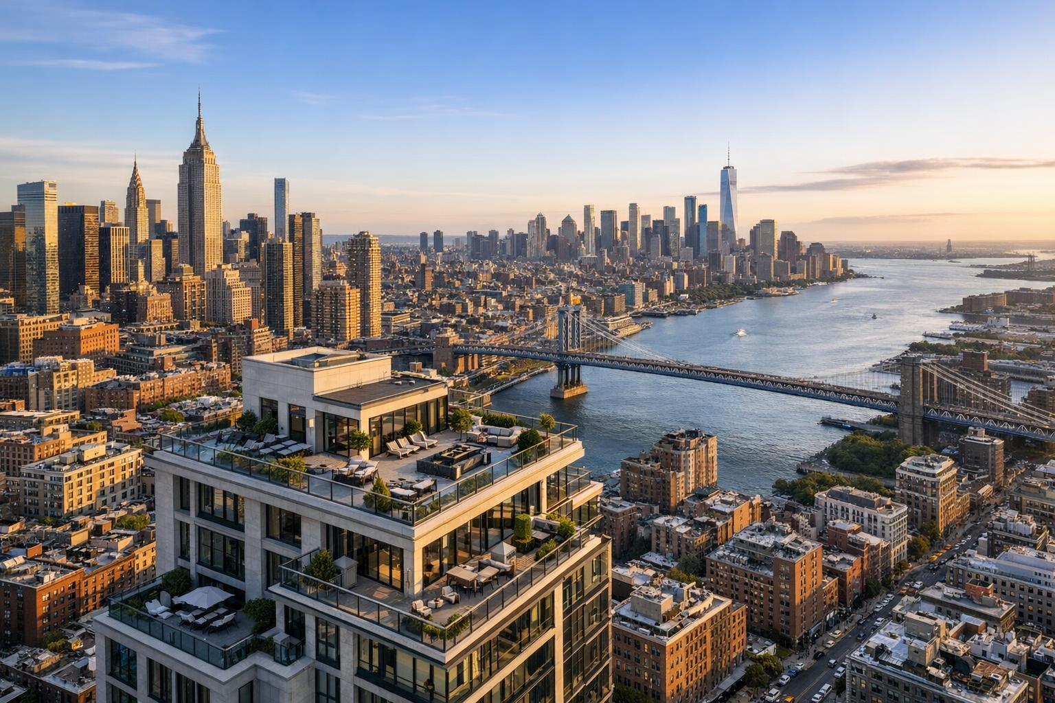
Drone photography captures a stunning aerial view of NYC, showcasing skyscrapers, bridges, and the river at sunset.
Aerial Advantage: How Drone Photography Elevates NYC Real Estate Listings
Drone photography in NYC has transformed the way real estate professionals market properties, offering a dimension that ground-level images alone can’t provide. In dense urban neighborhoods and sprawling New Jersey suburbs alike, aerial imagery supplies valuable context: the setting, the scale, the surrounding amenities, and the property’s relationship to its environment. For anyone invested in presenting real estate effectively—brokers, owners, managers, and agents—aerial media is quickly becoming a core visual strategy.
Why Aerial Real Estate Photography Brings Value
Traditional real estate photography does a great job indoors, making rooms look welcoming, capturing design details, and using professional lighting to balance exposure. But no matter how carefully you capture interiors or curb appeal, certain questions just aren’t answered at eye level. Aerial real estate photography lets viewers see how a rooftop deck interacts with skyline views, how a property sits on a corner lot, or how far the backyard stretches in relation to neighboring houses. In competitive NYC and NJ markets, this context can be the difference between a listing that’s difficult to picture and one that feels immediately clear.
The Layer of Context Only Drones Can Offer
Aerial media supports a story that begins where most other property visuals end. Take these real-world examples of what drone imagery can highlight:
- Roof decks, gardens, and outdoor entertaining spaces that aren’t visible from the street.
- How a building relates to nearby parks, transit lines, water, or retail areas.
- The scale of a townhouse, single-family home, or multi-unit property, revealing otherwise hidden yard space or driveways.
- Architectural features of the building’s facade and setting within the block.
- The context of larger developments or how a home “sits” in relation to neighboring structures.
The most effective drone images are thoughtfully composed, prioritizing perspectives that answer what buyers, renters, and investors want to know. An interior image might make a room inviting. A drone photo can make its location and possibilities unmistakably clear.
Where Drone Coverage Makes the Most Impact
Not every property needs aerial media. For apartments in compact buildings without outdoor context, well-executed photography, a detailed floor plan, or a property video may be more practical. But when there’s a unique asset—a rooftop space, a large lot, proximity to water, a dramatic architectural style—drone coverage becomes a strong investment.
Single-Family Homes and Townhouses
Properties with outdoor amenities or hidden backyard features gain the most from aerial imagery. The yard size, patio layout, garden, garage placement, and neighborhood context become immediately apparent. It’s important for aerial shots to be intentional: capturing garden space and facade in a single view, or showing both levels of a multi-story townhouse when the perspective makes sense.
Multifamily, New Development, and Larger Properties
When a listing involves a building with multiple units, new construction, or substantial shared amenities, drone media excels at showing massing, rooftop elements, and what’s available outside the front door. The goal is always accuracy—showing a nearby park or waterfront without misrepresenting distance or views, and ensuring that the imagery is a trustworthy reflection of the experience a resident or visitor will have.
Design-Focused and Luxury Residences
Contemporary architecture, custom landscaping, and high-end builds are at their best when photographed from above. The symmetry, geometry, and flow of a modern home, or the interplay between built and natural environments, often become clearer from a drone’s vantage point. For luxury listings, brief aerial videos can add polish to the beginning or end of a property film, supporting an overall sense of elegance and place.
Commercial and Mixed-Use Buildings
For offices, storefronts, investment properties, and mixed-use spaces, aerial coverage can help clarify the building’s corner presence, parking layout, adjacency to transit, and local business bustle—information buyers and tenants often struggle to piece together from ground photographs alone. RealtaSnap’s drone services focus on marketing perspective, not architectural or engineering analysis.
Choosing Between Aerial Photos, Video, or Both
Deciding on the right deliverable depends on the marketing plan and the specifics of the listing.
- Drone Photos: Still images work in gallery listings, marketing brochures, sales decks, social posts, and email campaigns. At RealtaSnap, a standard package includes 10 HDR aerial photos with blue-sky replacement, priced at $209. These are particularly useful for documentation and presentations where clarity and flexibility matter.
- Aerial Video: Motion coverage is ideal for introducing a listing film, capturing the approach to a home, or demonstrating spatial relationships in sweeping sequences. One minute of finalized 4K aerial video is $229.
- Combined Packages: Need both? For listings where both stills and motion tell the story best, RealtaSnap’s package includes 10 HDR photos and a one-minute 4K video for $299.
For a detailed look at available drone media options, visit the RealtaSnap drone photography and videography page.
Integrating Aerial With Ground-Level Media
The best real estate marketing plans coordinate multiple visual tools. Interior photography and video build the emotional connection; floor plans clarify the flow; drone imagery locks in the orientation and physical context. For townhouse listings in Brooklyn, you might see a floor plan paired with room-by-room images and aerial shots that highlight both the roof deck and the rear yard. Larger NJ properties often depend on drone views to explain acreage and outdoor features not easily captured at ground level.
From the production side, teams make choices about coverage based on the property, the neighborhood, and the story being told. Consistency in edits (across sky colors, brightness, and style), camera placement, and honest perspective are key to making the listing feel complete and coherent.
What to Know About Drone Operations in NYC and Nearby Markets
Operating drones in NYC is never a “set it and forget it” proposition. With dense airspace, regulatory restrictions, weather variables, and tight layouts, each site must be evaluated on its own terms.
- Airspace and Authorization: All flights must follow FAA Part 107, and specific neighborhoods have heightened restrictions. Just because a property looks suitable for drone photography doesn’t mean approvals or conditions make it feasible on any given day. Careful, site-specific assessment is a standard part of the process.
- Roof Access and Logistics: In urban environments, access to the roof often makes an aerial session possible—it provides a safer launch and landing space, minimizes exposure to sidewalk traffic, and enables stronger perspectives of roof amenities and nearby views. If you can offer roof access, communicate that clearly while booking.
- Permitting: RealtaSnap does not obtain municipal, NYPD, or special-event flight permits. If a property requires permits beyond standard FAA authorization, clients are responsible for securing them. If they’re not available, the drone portion may be declined or rescheduled.
- Weather and Safety: Unpredictable weather in NYC and New Jersey—wind, precipitation, and rapidly changing conditions—can affect both safety and image quality. Professional discretion always takes precedence over the photography wish list. A safe, practical outcome comes first.
For a deeper look at compliance, safety, and permitted use, see RealtaSnap’s service information.
Preparing for Aerial Coverage: Practical Field Tips
Most drone shoots require less intricate prep than staging a full interior, but there are a few essentials:
- Remove any visible outdoor clutter: bins, hoses, stray furniture, tools, or toys.
- Set up patios, terraces, and outdoor furniture to look intentional and ready.
- Confirm access in advance—whether it’s the roof, backyard, or gated drive.
- Let your photographer know about nearby active construction, events, or areas to avoid.
- Decide which exterior features deserve extra focus (roof deck, pool, gardens, garages).
- Plan for daylight that flatters—not washes out or shadows—your priority spaces.
Aerial images should reflect the property accurately, showing it as it exists—not staged for fantasy, but clarified for easier comprehension.
How to Schedule Drone Services With RealtaSnap
Booking with RealtaSnap is straightforward. Use the online scheduling page, select the address and add entry instructions, choose drone photos, video, or both, and complete your booking. Drone services are available throughout NYC’s five boroughs and across New Jersey.
Availability can depend on airspace, building access, and weather, so it’s best to plan as early as possible. RealtaSnap’s real-time calendar shows up-to-date availability, and only 24 hours’ notice is required under most circumstances.
Key Considerations When Comparing Real Estate Drone Services in NYC
Not all drone operators are equally experienced with the unique logistical and regulatory challenges of the New York metropolitan area. As you evaluate providers, ask these questions for peace of mind and effective results:
- Do they offer both aerial photos and video tailored to your strategy?
- How do they check airspace and feasibility for your address?
- What’s expected regarding building or roof access?
- What’s their process for evaluating safety and weather conditions?
- Are their deliverables designed for real estate marketing, not only architectural or engineering uses?
- What’s included in the quoted package—number of images, video length, edits?
- Do they manage required permits, or are those the client’s responsibility?
Clarity up front reduces headaches later and ensures your property is presented both accurately and professionally.
The Professional’s Perspective: What Makes an Effective Aerial Image?
Dramatic high-altitude photos grab attention, but the best aerial images always have a clear intent. Each one should communicate something a prospective buyer or tenant genuinely needs to know: the size and privacy of a yard, connectivity to outdoor amenities, the relationship between a living space and its setting, or the presence of a rooftop retreat. Before scheduling a session, define your listing’s most compelling story. Is it the outdoor space, the placement within a neighborhood, or the dramatic design? That answer drives planning and helps your drone provider capture exactly the views that matter most.
Ready for a New Perspective?
Aerial imagery is not just a luxury—it’s quickly becoming a must-have for properties where context, setting, and outdoor features are at the core of the marketing strategy. For those working in NYC, New Jersey, or surrounding areas, RealtaSnap offers a range of real estate drone services designed for local realities and property-specific goals.
To see available options or to schedule your next drone shoot, visit www.RealtaSnap.com.
FAQ
Question: Is drone photography available for all NYC and NJ properties?
Answer: Drone coverage is subject to airspace restrictions, weather, and access at each location. Not all properties will qualify for aerial shoots—regulatory compliance, feasibility, and pilot discretion always apply. Roof access can help, but planning ahead is essential.
Question: Should I choose drone photos, drone video, or both for my listing?
Answer: Choose drone photos for flexible usage in galleries and print, video when movement or cinematic storytelling adds value, or a combined package for listings that benefit from both. RealtaSnap offers all three options to fit varying strategies.
Question: Does RealtaSnap handle flight permits for drone shoots?
Answer: RealtaSnap completes standard FAA compliance but does not acquire municipal or special-event permits. If additional permits are required for your address, you’ll need to obtain them; otherwise, the drone session may be declined or rescheduled.