When Is Drone Photography Worth It for a Real Estate Listing?
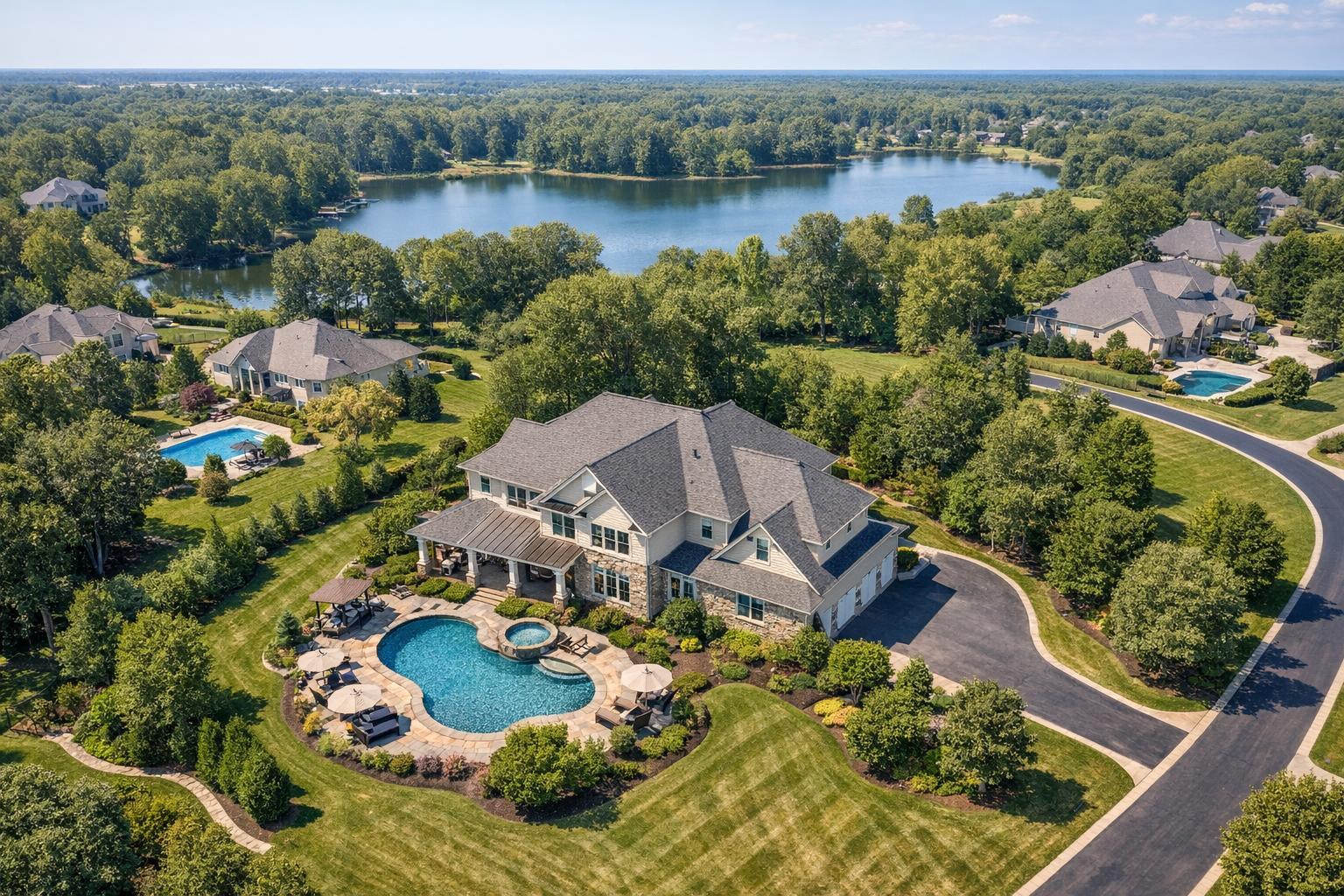
Drone photography captures an expansive real estate view featuring a luxurious house with a pool, surrounded by lush greenery and a serene lake in the background.
When Is Drone Photography Worth It for a Real Estate Listing?
Drone photography real estate has become an essential option for agents who want to add context, scale, and drama to property marketing. The question, though, isn’t whether drone images look good—it's when they tell the story better than ground-level photography.
In practice, aerial media serves a clear purpose: to provide a perspective that helps viewers understand something important about a property. For every listing, the practical question is, “What will this view reveal that the rest of my listing media cannot?”
Let’s look at where drone media makes a tangible difference—and where it may not be worth the investment for New York City, New Jersey, and surrounding markets.
What Aerial Media Really Shows: Perspective With Purpose
Traditional listing photography does a lot of heavy lifting. It covers interiors, finishes, layout, curb appeal, and entry points. But even the best ground shots have limits, especially for properties with complex sites or desirable surroundings.
Aerial property photography becomes valuable when it adds clarity—such as showing:
- How a home sits on its lot relative to neighbors or landscape
- The size and boundaries of the property, yard, or estate
- Connections to amenities like a pool, deck, or multiple outdoor spaces
- Proximity to water, parks, trails, or views that matter in the selling story
- Distinctive architectural features that are obscured at eye level
- The context of a commercial building, parking layout, or access points
Drone images should do more than “wow” a viewer—they should answer real questions or explain something hard to capture from the ground. For instance, a single high shot might neatly define a waterfront property, while a lower oblique angle could help buyers understand the relationship between a home, its pool, and landscaped grounds.
Effective drone photography isn’t about quantity. It’s about adding one or two perspectives that make the property’s story easier for buyers to grasp.
Property Types That Often Benefit From an Elevated Perspective
Not every listing needs aerial media. But certain property features often lend themselves to drone photography:
- Large lots, estates, and homes with extensive grounds: When street-level images can’t capture the full footprint, an aerial image can clarify the scope and relationships between outdoor spaces, outbuildings, and the main residence.
- Waterfront, shore, or view-oriented properties: Drone views can accurately depict how a property relates to a lake, river, shoreline, or distinguished natural surroundings, helping buyers “see” the context before a tour.
- Distinctive outdoor amenities: Homes with pools, patios, outdoor kitchens, tennis courts, or expansive yards appear more compelling—and organized—when seen as a complete outdoor living environment.
- Notable architecture or rooflines: Certain architectural details only emerge from above. Aerial photography can reveal roof symmetry, modern additions, courtyard layouts, or how a house sits on a sloped lot.
- Commercial or development sites: For commercial real estate, aerials provide insight into parking, access, loading zones, and the relation to adjacent roads or developments—supporting decisions that ground photos can’t.
When the aerial angle is used, it’s most effective as part of a complete visual plan. Interior and exterior ground photography remain essential to tell the whole story.
Where Aerial Coverage May Add Little Value
It’s tempting to add drone photography to every listing because it’s available—but quite often, an elevated perspective may not contribute meaningfully to the marketing goal.
Consider listings such as:
- Straightforward townhouses or rowhomes with small lots
- Apartments in dense buildings where the value lies inside the unit
- Condominiums where the selling points are finishes, interiors, lobby, or amenities
For these properties, exterior drone shots may duplicate what street or amenity photography already communicates, or even feel disconnected from the story buyers actually need to see.
A practical moment before booking: ask if an aerial image will meaningfully explain a feature, setting, or value that’s difficult to capture from the ground. If not, the media budget is usually better directed toward comprehensive on-site photography or a video walkthrough.
Dense Urban Listings: Additional Challenges and Considerations
In NYC and the surrounding urban areas, real estate drone photography services run into a different set of questions. Manhattan, Brooklyn, Jersey City, Hoboken, and other dense markets contain hundreds of buildings where exterior aerial imagery may not be useful, or even feasible.
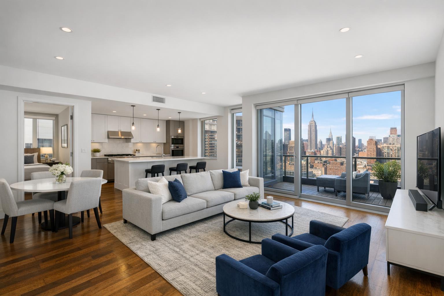
The story of a Manhattan apartment, for example, is usually found in the light, finishes, layout, and city or river views from within the unit—not the shape of the roof or a distant flyover. Many buildings simply don’t offer enough exterior ground to make a compelling aerial image. In fact, an overhead shot of a large high-rise may give little information about a particular apartment, and in some cases, may actually dilute the listing’s appeal.
Urban feasibility is another layer:
- Airspace is heavily regulated, especially near airports, heliports, or special-use zones.
- Nearby buildings may limit safe flight paths or launch areas.
- Roof access doesn’t automatically guarantee a flight can proceed; it’s just one part of the assessment.
For these reasons, planning aerial media for urban listings requires an honest evaluation of whether the resulting images will truly support the listing strategy.
Practical and Operational Realities of Drone Media
Drone operations for real estate must follow more than just a creative wish list. Each proposed flight is reviewed case by case for feasibility, safety, and regulatory compliance. RealtaSnap evaluates every drone request according to:
- FAA Part 107 rules for commercial drone operation, including airspace restrictions and required authorizations where applicable
- Weather conditions (wind, visibility, precipitation) affecting safe flight and image quality
- On-site safety for both equipment and people, including launch and landing areas
- Property access, especially important in urban or commercial locations
- Local ordinances and special permit requirements (note: RealtaSnap does not obtain municipal or NYPD permits for drone flights—this is the client’s responsibility if needed)
- Pilot discretion based on professional assessment of safety and practicality at the site
Early planning is key. Confirming aerial feasibility before building it into a marketing plan saves time, helps manage client expectations, and prevents surprises at the shoot.
Pairing Aerial and Ground Media for Maximum Value
From an operational perspective, drone photos or video work best in the context of an intentionally planned capture day. RealtaSnap often schedules aerial imaging to complement standard listing photography, making sure the end result feels cohesive.
A few workflow considerations:
- Interior photography comes first for explaining rooms, features, and layout.
- Ground-level exterior photos establish curb appeal and entrances.
- Drone media provides context—showing setting, footprint, or the relationship with outdoor amenities or nearby landmarks.
- When video is included, a well-edited sequence may combine ground and aerial footage to create a dynamic story, showing transitions and approach.
All components should be visually consistent, avoid duplicated storytelling, and focus on giving potential buyers the best possible understanding of the property.
Budgeting and Booking for Drone Media
Because drone services are an add-on investment, it’s wise to tie them to a clear deliverable and purpose. If a listing truly benefits from showcasing scale, waterfront orientation, or architectural context, a handful of aerial stills can make a strong impact. If movement is central to how a property is experienced, a drone video is worth consideration.
For NYC and New Jersey, RealtaSnap’s current drone service options are:
- 10 HDR drone photos with blue-sky replacement if needed ($209)
- One-minute 4K drone video ($229)
- Drone photo and video package: 10 photos plus a one-minute video ($299)
All pricing is straightforward and can be selected directly when booking online.
Booking is easy: visit the RealtaSnap scheduling page to check availability, select address and services, add any site notes, and secure a time. For more details about drone media in NYC or New Jersey, see the aerial services page.
RealtaSnap’s Approach: Informed, Practical, and Focused on the Story
As a real estate media provider focused on NYC, New Jersey, and select areas nearby, RealtaSnap approaches every drone request with both operational expertise and realistic expectations. The value of aerial media is always grounded in its ability to clarify the property’s physical context.
Before booking, think about:
- What is the exterior story?
- What will buyers actually need or want to know from an overhead or elevated perspective?
- Is a drone shot feasible, safe, and likely to add something unique to the presentation?
Clients who do this homework up front are in the best position to use aerial media effectively. And when drone work is a good fit, a clear capture plan brings out the best of both ground and aerial perspectives in the listing.
If you’re considering drone photography for your next NYC or New Jersey listing, it’s never too early to start the conversation. Learn more about RealtaSnap and discuss your listing’s media needs.
FAQ
Question: Is drone photography real estate worth it for every listing?
Answer: Not every property will benefit from aerial coverage. Drone media excels when it clarifies lot size, setting, outdoor features, or architectural layout that ground photos can’t convey. For compact urban apartments or simple townhouses, standard photography and video may cover the listing’s strengths more effectively.
Question: Can aerial coverage be guaranteed for an NYC property?
Answer: No—every drone flight is evaluated based on airspace restrictions, weather, building access, local regulations, and pilot judgment. Even with roof access, some addresses or days won’t permit safe or legal flight. Feasibility is always confirmed case by case.
Question: When should I consider both drone photos and drone video?
Answer: Choose both when the listing’s exterior story benefits from a mix of strong still views and motion—such as large waterfront homes, properties with extensive amenities, or sites where approach, flow, and surrounding context matter. Still images are best for clear documentation, while video adds movement and can show how a property relates to its environment.
For more about booking drone or standard listing media, visit www.RealtaSnap.com.