Evaluating Drone Photography’s Role in New Jersey Real Estate Marketing
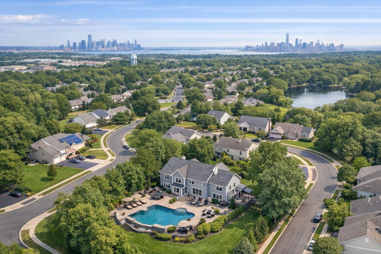
Drone photography in NJ captures a suburban neighborhood with a swimming pool in the foreground and the distant city skyline in the background.
Drone Photography NJ: How Aerial Real Estate Photography Elevates Every Listing
In today’s fiercely competitive Northeast property landscape, drone photography NJ services have become essential for agents and sellers seeking every possible edge. This post explores how aerial real estate photography, when paired with proven expertise, elevates marketing for both residential and commercial listings in New Jersey. You’ll learn why strategic drone use attracts more buyers, how it solves real-world property marketing challenges, and what working with a seasoned team like RealtaSnap means for your success.
The Real-World Problem: Why Your Listings Need an Upgrade
Even in sought-after markets like NYC and New Jersey, many listings suffer from underwhelming visuals. Agents, brokers, and owners often face:
- Low click-through rates for listings lost in the crowd
- Weak first impressions due to flat or cluttered street-level shots
- Poor lighting and empty spaces that fail to inspire
- Buyer hesitation when a property’s setting, scale, or amenities aren’t fully clear
- Limited imagination—buyers struggle to picture renovations, yards, or views
- Slow or uncertain leads due to confusing, inconsistent brand presentation
A typical listing photo might show a driveway, a living room, or a backyard—but without context, buyers won’t grasp what really sets a property apart or how it fits into the surrounding neighborhood. That’s where drone photography changes everything.
What Experienced Media Teams Know About Drone Photography NJ
After hundreds of shoots across city skylines, leafy suburbs, and New Jersey’s unique blend of properties, we’ve seen firsthand what makes—or breaks—a listing’s visual appeal.
- Lighting and Timing: The best aerial real estate photography happens when sunlight isn’t harsh: morning or late afternoon “golden hour” flights minimize harsh shadows and highlight textures.
- Prep and Clearance: Before a drone ever takes off, our workflow includes checking for temporary obstructions (cars, workers, bins) and prepping client sites for optimal roof and exterior views.
- Flight Planning: We always verify FAA compliance, airspace restrictions, and weather. In parts of NJ near airports or within city limits, we may secure special authorization or adjust takeoff points for safety.
- Framing & Scale: Aerial shots show scale, layout, and features—capturing not just the house, but driveways, pools, yards, and proximity to parks or waterfronts—all in a single shot.
- Editing for Clarity: Raw footage is only the start; post-production includes blue sky replacements on cloudy days, exterior color balancing, and careful correction of vertical distortions so listings look as natural as they do impressive.
It’s not just about the hardware: a seasoned real estate media team knows exactly how to anticipate the unique challenges of New Jersey’s dense suburbs, coastal communities, and urban mixed-use zones.
How RealtaSnap Solves It: The Drone Photography NJ Approach
At RealtaSnap, drone photography isn’t an afterthought—it’s a core part of our comprehensive visual marketing strategy. Here’s what you get when you work with us:
- 4K HDR Drone Imagery: Showcase homes, condos, or commercial spaces with sharp, high-resolution views that tell the full story of scale and setting.
- Fast, Reliable Scheduling: With flexible NJ coverage and next-day appointments available in most areas, your marketing is never delayed.
- Regulatory Expertise: All RealtaSnap drone operators follow FAA Part 107 rules and confirm airspace clearance before every shoot. We assess feasibility in urban, waterfront, and restricted zones—so your project remains fully compliant and safe.
- Customizable Packages: Get ten professionally edited drone photos, a stunning 1-minute highlight video, or a combined still/video bundle for a competitive fixed rate. (Full details on service options and pricing can be found here: Drone Photography & Videography NYC/NJ. All prices and information are subject to change. Information is deemed reliable but not guaranteed.)
- Industry-Leading Turnaround: We deliver edited photo and video sets that match your brand and listing specs—usually within 24–48 hours.
- Consistent, Market-Tested Results: We don’t just fly drones. We carefully sequence each shoot, prep every site, and optimize every angle for dramatic, inviting presentations that drive real buyer engagement.
Benefits of Choosing RealtaSnap for Drone Photography NJ
- Professional 4K drone photos and video for every listing type
- Full FAA and regulatory compliance in all serviced NJ areas
- Fast, next-day scheduling with flexible rescheduling options
- Blue sky replacement and advanced photo editing included
- Clear, consistent turnaround—photos and video in 24–48 hours
- Transparent, project-based pricing (no hidden fees)
- Advice from experienced real estate media professionals
- Seamless bundles with virtual tours, floor plans, or videos
Why This Matters in the NYC / NJ Market
If you market real estate in the NYC metro, Northern NJ, or surrounding areas, you know that buyers are as discerning as they are fast-moving. Competitive listings often come with full media packs: aerial drone shots, video walkthroughs, 3D tours, and detailed floor plans. Whether it’s a Jersey City penthouse, Hoboken brownstone, Bergen County colonial, or suburban commercial parcel, buyers expect to see the true scale of properties—and their proximity to transit, amenities, and open space—before they ever reach out to schedule a visit.
In suburban NJ, aerial real estate photography can highlight spacious yards, extended driveways, or unique site features—something impossible with ground-based shots alone. In denser towns or urban “Gold Coast” riverfronts, high-angle drone shots reveal skyline views and access to New York City, helping listings stand out above the crowd.
Comparison With Traditional and Lower-Quality Alternatives
Media quality isn’t just a matter of tech; it’s a question of expertise, process, and commitment to your marketing outcome. Here’s how RealtaSnap’s drone photography NJ services outshine common alternatives:
| RealtaSnap Drone Media | Lower-Quality Phone Photos / Rushed Media |
|---|---|
| High-resolution, stabilized shots | Grainy, distorted, inconsistent framing |
| FAA-compliant pilots and flight checks | No regulatory oversight, risking fines or failed shoots |
| Expert timing for lighting and prep | Weather and sunlight issues ignored |
| Cohesive editing and blue sky replacement | Dreary or overcast results posted as-is |
| 24–48 hour delivery | Delays or unpredictable turnaround |
| Strategic neighborhood context | Tight, cropped images—setting lost on buyers |
Because we handle all drone, ground, and multimedia production in-house, RealtaSnap ensures your listings receive consistent, polished, and on-brand visual assets—critical for making an impact on the platforms buyers and renters use most.
Effective Use Cases for Drone Photography in NJ: Residential & Commercial
Residential Listings:
- Single Family Homes: Capture rooflines, outdoor space, and landscaping for properties from Westfield to Princeton.
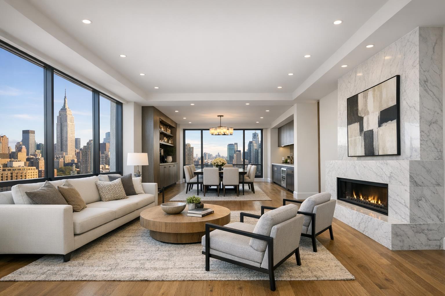
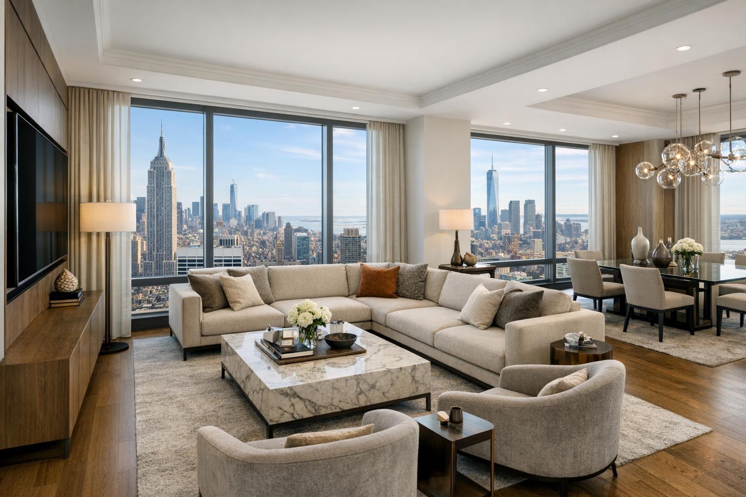
- Luxury Condos: Showcase skyline views, rooftop decks, and amenities in Hoboken, Jersey City, or the Gold Coast.
- Suburban Estates: Reveal private drives, tennis courts, pools, or proximity to parks invisible from ground level.
Commercial Properties:
- Retail/Office Developments: Demonstrate parking, traffic patterns, site access, and surrounding businesses.
- Multifamily and Mixed-Use: Map out building footprints, amenity decks, and region connectivity to highways or public transit.
- Development Parcels: Offer investors transparency on boundaries, potential buildouts, or environmental features.
From first-time sellers to seasoned developers, aerial imagery consistently boosts interest and credibility.
Regulatory and Practical Considerations in NJ
Flying drones for commercial real estate in New Jersey isn’t just a matter of better angles—regulations, safety, and site access make a difference:
- FAA Part 107 Certification: Every RealtaSnap pilot is properly licensed and flies in full compliance.
- Local Restrictions: We conduct pre-flight research to identify airspace waivers, no-fly zones, or cities with unique permitting requirements. In some densely populated towns or near airports, drone operations may be limited or require advance notice.
- Roof and Site Access: For city and downtown locations, roof access may be vital for clear shots and legal takeoff. Our process includes coordination with building management when necessary.
- Client Permits: If formal city or police permits are required, RealtaSnap guides clients on what’s needed, but we do not pull municipal or event-specific permits ourselves. If a specialized permit can’t be obtained, we’ll recommend alternatives based on the property and your marketing goals.
Conclusion & Call to Action
In the world of New York and New Jersey real estate, average visuals simply aren’t enough. Drone photography NJ services from RealtaSnap let you reveal your listing’s true personality—its scale, location, amenities, and wow factor. Whether you’re facing stiff competition in Hoboken, Jersey City, Montclair, or along the Shore, aerial real estate photography can be the creative edge that drives buyer action and strengthens your brand.
Ready to see your listings soar? Discover how RealtaSnap’s full suite of drone and real estate marketing services can work for you by visiting our Drone Photography & Videography page. For a broader look at everything we offer—from photography and video to 3D tours and floor plans—explore www.realtasnap.com. Let’s raise the bar, together.
Frequently Asked Questions
1. What happens if drone flights can’t be performed due to airspace or weather in NJ?
Our pilots always check FAA rules and hyperlocal weather before every shoot. If a flight isn’t feasible, we communicate immediately and recommend the safest, best-possible alternative—so your listing still shines.
2. Are there extra steps for drone photography at city high-rises or near airports?
Yes, dense areas or proximity to controlled airspace may require pre-planning, special authorizations, or roof access. RealtaSnap handles all regulatory research and advises clients if extra permitting is needed, so you’re never left guessing.
3. Can drone and ground photography be bundled for faster turnaround and savings?
Absolutely. RealtaSnap’s packages allow you to mix aerial, video, and stills at transparent, project-based rates. Edits and delivery are streamlined—photos and video usually arrive within 24–48 hours, ready for your listing launch.
For a seamless, elevated approach to property marketing—ground to sky—trust RealtaSnap, the local experts serving NYC and New Jersey real estate professionals with proven results.