The Impact of Drone Photography Real Estate Services on NYC Property Marketing
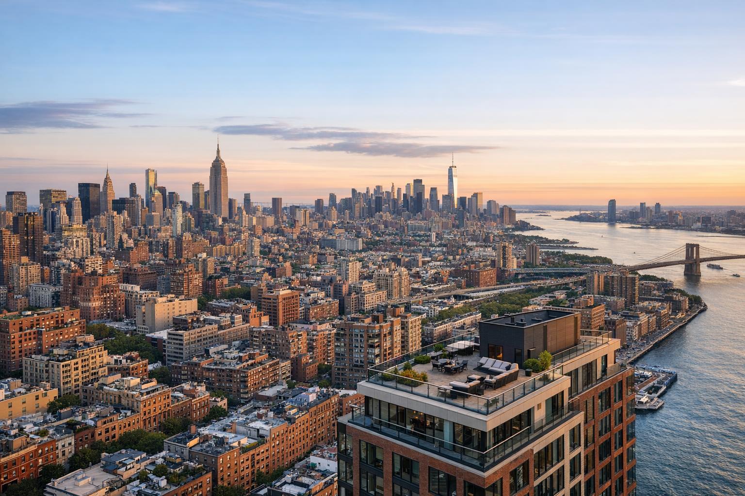
Drone photography captures an expansive real estate view of a city skyline with a river and prominent skyscrapers.
Drone Photography Real Estate: Elevating NYC & NJ Property Marketing with RealtaSnap
Introduction
Drone photography real estate is transforming how properties are marketed, especially in competitive cities like New York and New Jersey. In this article, you’ll discover how aerial visuals elevate listings, solve real-world marketing hurdles, and drive faster engagement for agents and sellers—based on hands-on experience in the field. You’ll learn why professional, expertly edited drone media can make the critical difference in residential, commercial, and rental outcomes, and how RealtaSnap’s specialized services bring this edge to your listings with speed, consistency, and true market expertise.
The Real-World Problem
Every agent, host, and property manager knows the anxiety of a stale listing. Maybe you’ve struggled with beautiful properties that just don’t shine online, or high-end spaces hampered by lackluster, static photos. Here’s the hard truth: generic or poorly executed visuals don’t just “fail to impress”—they actively cost you opportunities in a market that moves at warp speed.
If you’re listing in NYC or New Jersey, you’re probably familiar with these challenges:
- Online platforms like
Zillow,StreetEasy, andrealtor.complace your property side-by-side with thousands of others. Weak main images tank your click-through rate in seconds. - First impressions frequently hinge on a single photo. Especially with high-rise condos or mixed-use buildings, ground-level snaps rarely capture curb appeal or lifestyle context.
- Static, eye-level images can flatten unique features—like rooftop decks, garden spaces, or city views—that deserve to be center stage.
- Urban listings suffer from window glare or shadowy corners, making interiors look smaller or less inviting than reality.
- Empty or under-furnished rooms force buyers to use their imagination—and in the NYC/NJ market, they rarely have the time or patience.
- Poorly sequenced, misaligned, or inconsistent photos create a jarring, forgettable online experience.
When aerial real estate photography isn’t part of the package, you’re often left explaining to your client why their “prime location” or “unobstructed view” doesn’t come through onscreen. And when listings linger, your timelines get tighter, clients get nervous, and pipeline momentum stalls.
What Experienced Media Teams Know
Media professionals—those of us who shoot, edit, and deliver hundreds of listings every month across all five boroughs and New Jersey—see trends and pitfalls up close. Here’s what consistently moves the needle:
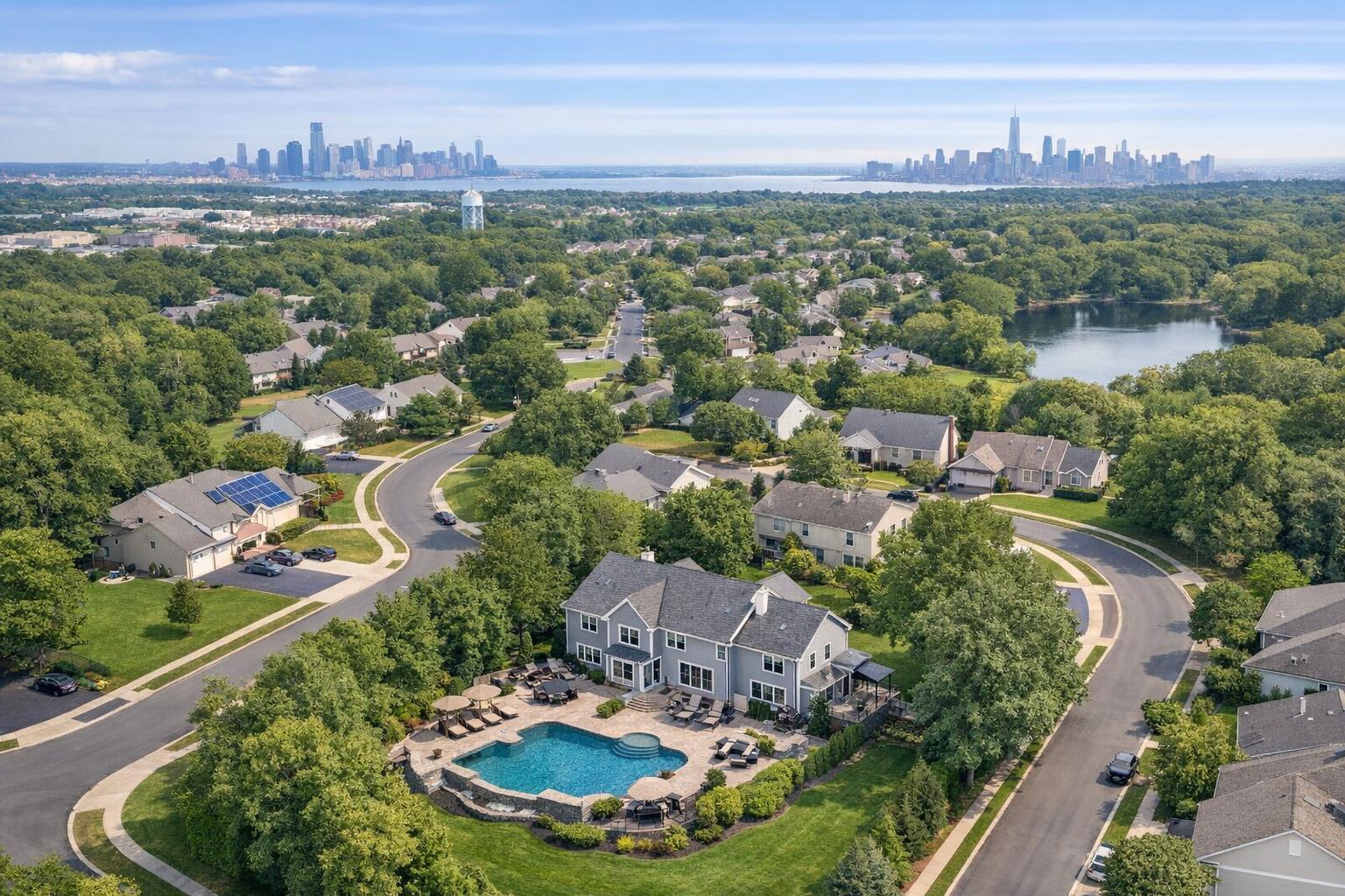
- Aerial Context Sells: Whether it’s a historic brownstone in Brooklyn, a luxury tower in Jersey City, or a sprawling office complex in Paramus, aerial photography uniquely frames the property’s relationship to its surroundings. It lets buyers appreciate proximity to parks, transit, retail, or the skyline at a single glance.
- Timing Is Everything: The best aerials are shot when sunlight is slightly angled—early morning or late afternoon—so façades glow and shadows add depth, not distraction. Drone teams factor in weather, air traffic patterns, and even street activity to avoid car clutter or construction.
- Preparation Avoids Pitfalls: Before flying, professionals confirm flight zones, check for FAA waivers in dense city areas, and scout the property footprint for obstructions (think rooftop HVAC, overhead wiring, or tight backyard access).
- Precision Editing Matters: Post-production isn’t one-size-fits-all. For city scenes, balancing window exposure (so skyline views are clear, not blown out) is crucial. Experienced editors correct vertical lines—no “leaning” buildings or warped perspectives.
- Workflow Drives Consistency: The most valuable service is fast but never rushed. Media teams with proven workflows shoot, ingest, edit, QC, and deliver in less than a day—sometimes within hours for urgent rental launches.
The bottom line? Aerial real estate photography is as much about process and know-how as it is about equipment—and no two markets, neighborhoods, or buildings are exactly alike.
How RealtaSnap Solves It
At RealtaSnap, we built our NYC- and NJ-focused workflow around the realities agents face every day. Our commitment is clear: top-tier drone photography and aerial videography—delivered quickly, reliably, and always with meticulous quality control.
Here’s what our process looks like:
- Expert FAA-Certified Pilots: Every aerial shoot is handled by seasoned pilots who know exactly how to maximize each property’s location, sight lines, and environmental context. We’re fully compliant with flight regulations in even the most restrictive NYC airspace.
- On-Site Coordination and Preparation: Agents rave about our ability to work around tight show schedules, tenant move-ins, or inclement weather. We’ll pre-scout roof decks, courtyards, and surroundings to find the angles that tell your property’s story best.
- Professional, In-House Editing: All drone imagery and footage go through a two-step editing process, balancing color, exposure, and perspective with an eye for how each shot will display on major listing platforms.
- Turnaround That Keeps You Ahead: With our streamlined system, your fully edited aerials are ready within a guaranteed 24 hours—often delivered via your RealtaSnap dashboard before your next open house.
- Transparent, Straightforward Pricing: We offer a range of drone services to fit any listing:Every shoot includes a free custom listing website and direct download access from any device. There are no hidden upgrade fees or confusing tiers.
- 10 Aerial Photos: $209
- 1-Minute 4K Aerial Video: $229
- Combo (10 Photos + 1-Min Video): $299
- Seamless Booking and Communication: Schedule in under three minutes. You’ll get real-time notifications at every step—from pilot en route, to shoot completed, to files uploaded.
Ready to see examples? Find out how our services could change your workflow here: Drone Photography and Videography Services – RealtaSnap.
All prices and information are subject to change. Information is deemed reliable but not guaranteed.
Benefits of Choosing RealtaSnap
- FAA-certified pilots, legal and insured for NYC/NJ airspace
- 24-hour guaranteed turnaround—no delays
- HDR aerials and 4K video for stunning clarity
- Consistent, professionally edited images every time
- Direct download and sharing from your dashboard
- Flexible scheduling adapted to tenant or building needs
- Free custom website for every listing
- Transparent, simple pricing—no hidden fees
Why This Matters in the NYC / NJ Market
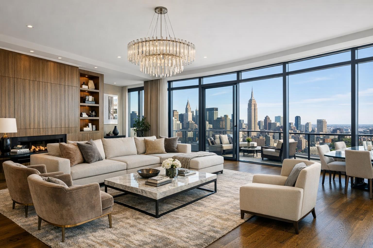
NYC and New Jersey are unlike any other real estate markets. Here, views matter almost as much as square footage. A Jersey City penthouse with a skyline view, a Williamsburg rental with a rooftop, or a Newark multi-family project surrounded by parks—these selling points can’t be captured fully from the ground.
Buyers (and renters) browsing Zillow, StreetEasy, or local brokerage sites are conditioned to swipe—fast. Aerial real estate photography grabs attention not just because it’s beautiful, but because it instantly frames location, accessibility, and lifestyle in seconds. In markets with aggressive pricing and tight timelines, those first few seconds are everything.
Urban listings need to showcase walkability, amenities, and context. Suburban listings need to prove the space, lot lines, and privacy advantages. And in a market where branded, photo-rich listings drive more inquiries, agents can’t afford to look generic or incomplete.
Comparison with Traditional or Lower-Quality Alternatives
Let’s be honest—phone photos and rushed shoots have no place in NYC or NJ property marketing. Mediocre, ground-level shots can flatten even the most impressive new development. Dimly lit, color-imbalanced photos cast doubt on your professionalism.
Here’s what we’ve learned from re-shooting listings that first came to us with “DIY” visuals or hurried, low-budget media:
- Photos snapped at the wrong time of day leave shadows across the façade, hiding architectural details.
- Uncorrected aerials tilt the skyline, making luxury towers or historic streets look awkward.
- Delayed delivery means agents miss premium listing windows or weekend rental surges.
- Inconsistent editing results in MLS pages where every image looks like it’s from a different source.
- Poorly staged exteriors (think garbage cans, parked trucks) distract from core selling points.
RealtaSnap’s expertise turns these headaches into seamless, repeatable success. Our workflow, trained eyes, and local market fluency mean your listings look exceptional—every single time.
Conclusion & Call to Action
Drone photography real estate isn’t just a trend—it’s become an essential tool for agents committed to delivering true value to clients. In the fast-paced, visually driven NYC and New Jersey markets, there’s no room for missed opportunities or second-rate presentation.
At RealtaSnap, we combine deep local experience, proven production workflows, and a tech-driven delivery system to ensure your listings stand out, online and in person. Whether you’re marketing a boutique condo, a commercial high-rise, or a sprawling suburban home, our drone photography services help capture the story only your property can tell.
Ready to elevate your listings? Schedule your next shoot with us today: RealtaSnap Drone Photography & Videography NYC.
Or explore all our property media solutions and secure your spot at www.realtasnap.com.
All prices and information are subject to change. Information is deemed reliable but not guaranteed.
Frequently Asked Questions
1. How do I know drone photography will make my listing stand out?
Many agents are concerned that aerial media might just be a “nice-to-have” add-on. In our experience, listings with professionally captured aerial views consistently receive higher engagement because they highlight features and location that ground-level photos simply can’t. RealtaSnap’s seasoned team ensures every drone photo and video is designed to drive interest—and your dashboard makes sharing a breeze.
2. Is drone photography safe and legal in NYC and New Jersey?
It’s a valid concern, especially given strict regulations in urban spaces. RealtaSnap exclusively uses FAA-certified pilots who know the specific flight rules in each area. We manage all the legalities for you, so you can focus on your listing—confident that everything is handled safely and above board.
3. I need fast turnaround; can drone visuals be delivered as quickly as standard photos?
Absolutely—a common worry is that drone work will slow down your listing launch. At RealtaSnap, our entire workflow is engineered for speed: in most cases, your aerial photos and videos are edited, quality controlled, and delivered within 24 hours via your own agent dashboard. You’ll always be notified the moment files are ready, so you’re never left waiting.