The Impact of Drone Photography on Real Estate Listings in NYC and NJ
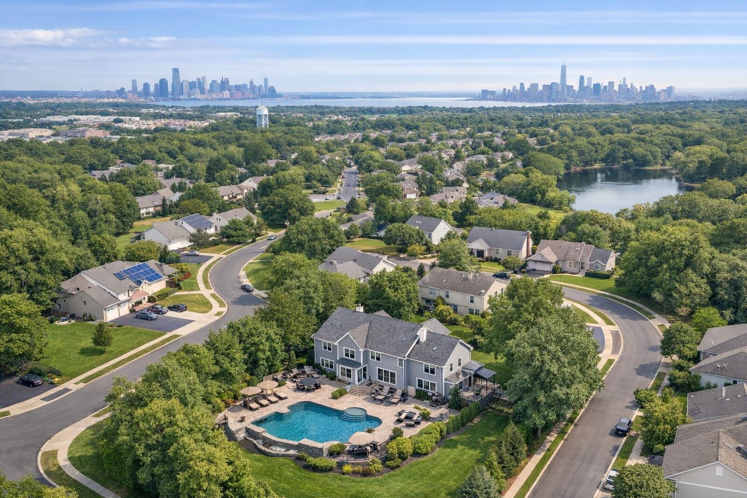
Drone photography captures a stunning view of real estate along a waterfront with a bustling city skyline in the background.

Drone Photography Real Estate: Elevating NYC and NJ Listings with Aerial Expertise
Introduction
Drone photography real estate solutions are changing the game for agents, property managers, and hosts who need to capture attention fast—especially in NYC and New Jersey’s hyper-competitive markets. If you've ever wondered why certain listings leap off the screen while others stall, this article delivers practical answers grounded in real-world experience. You’ll learn how aerial real estate imagery draws buyers and renters in, why it matters for your listing’s performance, and what sets RealtaSnap’s drone photography NYC services apart from generic “point-and-shoot” alternatives.
The Real-World Problem
Getting people to notice, click, and remember your listing isn’t just about having “photos”—it’s about making an instant, emotional connection. Here’s what we see in the field: agents upload flat, ground-level shots that don’t communicate property scale, miss the surrounding amenities, or fail to showcase what makes the location special. The result? Listings blend in and get lost in crowded feeds on platforms like Zillow, StreetEasy, or Realtor.com.
Low-angle driveway shots, rushed phone photos, or even well-produced interiors can still leave potential buyers or tenants wondering: Where exactly is this property? How close is it to the park, train, or waterfront? Does it have usable outdoor space? Even luxury listings in Manhattan or new developments in Jersey City can underperform when visuals are static, inconsistent, or don’t reflect the property’s true lifestyle potential.
We’ve watched listings with limited context or weak first impressions suffer from:
- Low click-through rates despite strong fundamentals
- Incomplete storytelling (especially for lots, rooftops, or garden units)
- Missed highlights—like proximity to schools, skyline views, outdoor decks, or private drives
- Buyer skepticism due to visual gaps (“Is that fenced? Where’s the playground?”)
- Inconsistent or “muddy” brand image, especially across multiple units or portfolio listings
In short, agents and managers are left with great properties that feel “invisible” online—and buyers who never get to experience the full picture.
What Experienced Media Teams Know
After hundreds of shoots in NYC, Brooklyn, the Bronx, and across New Jersey, our team knows the nuances of real estate drone work can make or break visual impact. You can’t just send a drone up; the magic is in the timing, planning, and editing. We always check lighting at different times of day—morning drone shots can show off sparkling river views, while late afternoon captures golden light on city brownstones or suburban patios.
Operationally, here’s what actually happens behind the scenes:
- Our FAA-certified pilots scout the flight path in advance, checking for trees, overhead wires, crowded sidewalks, and tight urban airspace.
- On-site, we coordinate closely with the agent (many times via text or app) to confirm shot priorities: highlight backyard, show walkability to the subway, frame the full width of a townhouse, or angle for that unobstructed skyline glimpse.
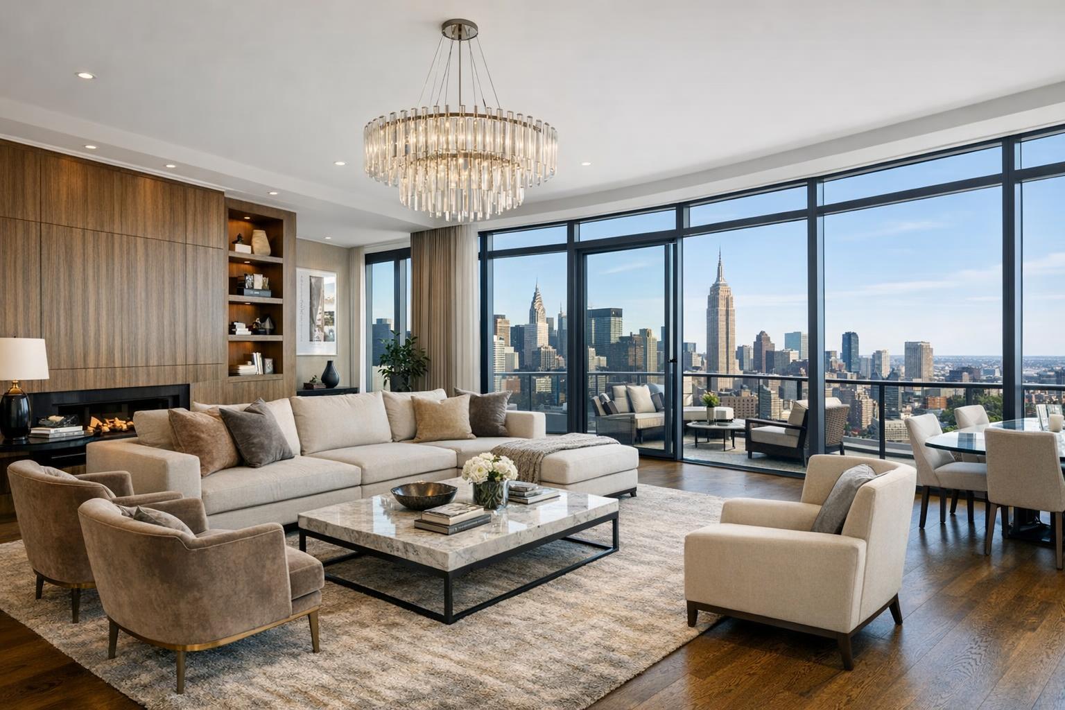
- We always balance window exposure—city condos with dramatic floor-to-ceiling glass need careful bracketing, so exteriors and interiors don’t “blow out” or look flat.
- Drone altitudes and camera angles are chosen to maximize usable photos for MLS and rental platforms. We correct vertical lines in post, ensuring buildings look upright and natural, not like a GoPro selfie.
- Our in-house editors deliver consistent color—even when NYC’s weather swings from sunny to overcast in the hour it takes to cross from the Upper East Side to Hoboken.
We know that agents want reliable results, not surprises. That’s why every aerial real estate imagery project is planned, shot, and edited with the end use in mind, whether that’s a hero image for a $5 million listing or social-ready aerials for a SoHo walk-up.
How RealtaSnap Solves It
At RealtaSnap, we built our drone photography NYC process to remove every obstacle from your listing workflow—because we’ve seen firsthand how delays and technical hiccups can derail a sale or rental.
Here’s how we make it seamless:
- FAA-certified pilots, always: Safety and legality first. Every flight is pre-cleared, and our pilots are trained to work in varied NYC, Brooklyn, and suburban NJ settings.
- Flexible Scheduling via App/Web: Book a drone shoot in under 3 minutes on our online platform or app—no back-and-forth needed.
- Shotlist Collaboration: Specify target features (decks, driveways, pools, backyard, rooftop, surrounding amenities) right at booking. Our team gets on-site and captures all the must-have angles in a single visit, minimizing disruption.
- In-House Editing & QC: Your drone photos or aerial videos are edited by our dedicated team, not farmed out. We check for clarity, exposure, and color balance—every single time.
- Lightning-Fast Turnaround: You get fully edited aerial media within 24 hours, always—no waiting, no follow-ups required, just an automatic notification the moment it’s ready.
- MLS & Rental Platform Compliance: Deliverables are optimized for both legacy MLS systems and modern rental sites. Need a vertical crop for Instagram? Add a social media-friendly alt cut to your order.
- Clear, Honest Pricing: 10 professionally edited drone photos for $209, a 1-minute 4K aerial video for $229, or both for $299—all with a free custom listing site included.
After delivery, everything is accessible in your RealtaSnap dashboard—just download, share, and go live. And if you need last-minute tweaks (say, swap out a twilight sky or virtually stage a rooftop lounge), you can add those edits right from the platform.
Benefits of Choosing RealtaSnap for Drone Photography
- FAA-certified pilots ensure safety and legal compliance every time
- 24-hour turnaround—even for complex aerial media
- All visual media edited in-house for consistent branding
- App/web booking streamlines the process in under 3 minutes
- Custom listing websites at no extra charge
- Flexible options: photos, 4K drone video, or both
- MLS and social-media-ready deliverables
- Upfront, transparent pricing—no hidden fees
- Professional color correction and vertical line adjustment
Why This Matters in the NYC / NJ Market
Let’s face it—NYC and NJ are a puzzle of micro-neighborhoods, landmark views, and diverse property types. An aerial perspective is often the key to standing out:
- Manhattan and Brooklyn: Dense blocks mean ground-level shots rarely show proximity to the park, skyline, or waterfront.
- Suburban NJ and Staten Island: Acreage, fenced yards, and driveways matter. Drone shots tell a story of privacy and space.
- Hudson River corridor and Jersey City: Buyers care about commute options, river access, and building amenities—all visually “mapped” with aerial real estate imagery.
Buyers and renters here are tech-savvy. They expect immersive, magazine-quality visuals and want to see lifestyle amenities up-front. Listing platforms emphasize visual assets more than ever—drone imagery draws eyes to your listing thumbnail amidst a sea of sameness. Fast-moving markets require agents and managers to move even faster; old ways of waiting days for good photography just don’t cut it.
Comparison with Traditional or Lower-Quality Alternatives
Traditional or DIY approaches might seem tempting, but here’s where they fall short in NYC and NJ’s high-stakes environment:
- Smartphone or basic camera photos rarely capture full property scale; rooftops, gardens, multi-unit layouts, and parking spaces disappear from view.
- Rushed, unplanned shoots lead to crooked lines, overexposed windows, washed-out skies, and jarring visual “jumps” between gallery images.
- Third-party providers without local experience often miss hidden neighborhood assets—a gated path, secret rooftop deck, or signature city view.
- Delayed delivery means stale listings, lost leads, and unnecessary stress, especially when turnaround runs to 48+ hours (it happens more than you’d think).
- Inconsistent editing means brand dilution—your web presence looks “pieced together,” weakening the trust and recall that bring buyers to the table.
With RealtaSnap, you’re partnering with professionals who obsess over details, from flight planning to color grading. Agents who book aerial services get media that sells the whole story and supports their reputation for high-quality presentation.
Conclusion & Call to Action
In today’s crowded NYC and NJ real estate markets, drone photography isn’t just a luxury—it’s a necessity for agents, property managers, and owners who want their listings to get noticed, clicked, and remembered. When you leverage professional aerial real estate imagery, you’re giving buyers the story they need to imagine life at your property—and the confidence to reach out.
Ready to elevate your next listing with consistent, expertly-edited drone visuals? Book a shoot in minutes with RealtaSnap’s easy online scheduler or explore all our NYC drone photography services. Every photo is backed by in-house expertise, a 24-hour turnaround promise, and real support from a media team that actually knows your market.
All prices and information are subject to change. Information is deemed reliable but not guaranteed.
Frequently Asked Questions
1. Is drone photography actually legal in NYC and New Jersey?
Great question—many agents worry about compliance. Every RealtaSnap drone operator is FAA-certified, follows local regulations, and obtains necessary clearances. We handle all logistics up front, so your shoot is 100% legal and by-the-book.
2. What if I only need 2-3 aerial shots, or want something specific?
We routinely handle custom requests! Specify your priorities during booking—like focusing on rooftop lounges, building entrances, or surrounding amenities. Your shoot can be tailored, and you’ll only pay for the deliverables you need.
3. How soon will I receive my edited drone photos and video?
You’ll always get fully edited, platform-ready aerial media within 24 hours, thanks to our in-house editing process. No waiting, no chasing—just reliable delivery so you can go live quickly and confidently with RealtaSnap.
For more information or to schedule your next drone shoot, visit www.realtasnap.com.