The Impact of Drone Photography on Real Estate Listings in NYC and NJ
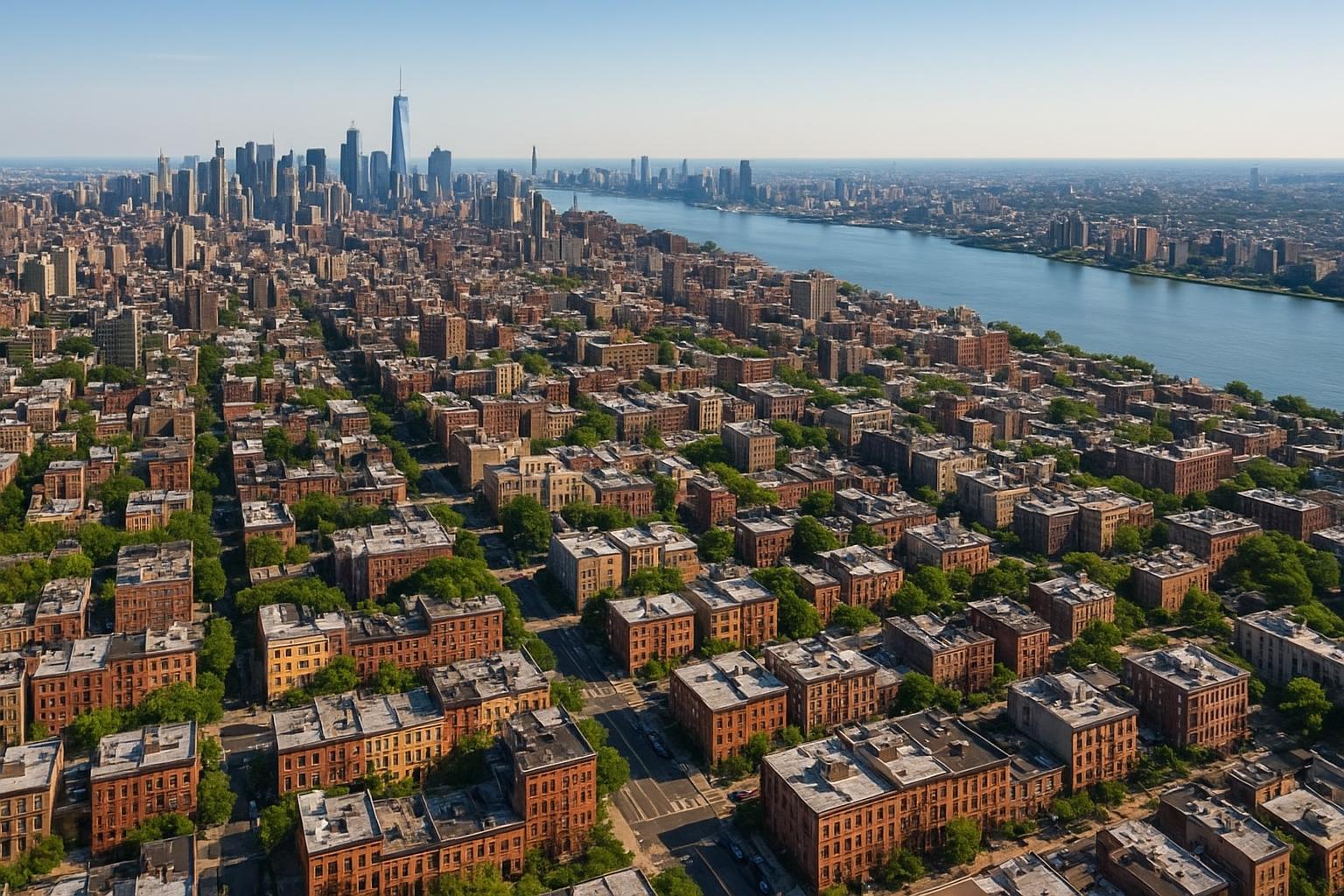
Drone photography captures a sprawling urban landscape featuring densely packed residential buildings leading towards a distant skyline by the river.
Drone Photography Real Estate: Revolutionizing NYC and New Jersey Property Marketing
Drone photography real estate has become a pivotal force in showcasing properties across the New York City and New Jersey markets. As listing platforms evolve and buyer expectations rise, drone photography in NYC and surrounding areas is transforming conventional real estate marketing—offering agents, property managers, and sellers new ways to capture attention, highlight unique features, and drive engagement that static or ground-level imagery can’t match. In this guide, our experienced team shares what truly sets aerial real estate photography apart and how RealtaSnap delivers professional, FAA-compliant results that make listings stand out.
The Real-World Problem
In congested urban settings and diverse suburban neighborhoods alike, real estate professionals face a consistent visual marketing challenge: standard listing photos often fail to capture the full story of a property. Low click-through rates, lackluster first impressions, and buyer disinterest can all stem from the same set of issues:
- Exteriors and settings get cropped by street-level angles or blocked by adjacent buildings.
- Poor lighting and harsh shadows hide critical details.
- Empty spaces or dimly lit corners make it hard for buyers to imagine how the property really feels.
- Commercial listings struggle to convey their true scale, access points, or proximity to transit, retail, and amenities.
- Media assembled on the fly or by amateurs risks inconsistent branding, off-color whites, and distorted window views—undercutting a property’s value and the agent’s reputation.
Simply put: Sellers miss out, agents lose leads, and properties languish when listings can’t instantly communicate their best features and context to digital-first buyers.
What Experienced Media Teams Know
Having executed hundreds of shoots across NYC and New Jersey, our team has learned that thoughtfully produced drone, photo, and video content is never a one-size-fits-all service. Real-world production has taught us:
- Lighting and timing are everything. The ideal capture windows for drone visuals differ from interiors. We recommend mid-morning or late afternoon, when sun angles reveal landscaping and architecture without harsh glare.
- Urban flights require deep regulatory knowledge. Each borough and neighborhood presents airspace quirks. FAA Part 107 compliance is non-negotiable—flights are never scheduled near restricted zones like airports or stadiums without vetted authorization.
- Roof access can make or break a city drone shoot. Securing rooftop permissions in advance allows safe, dynamic angles that work within NYC’s legal and physical constraints.
- Consistency matters for multi-family, rental, and office listings. We maintain matching color profiles, elevate shooting height for context, and design shot lists that guide the buyer’s eye from neighborhood to doorstep to front door.
- Deliverables must be edit-ready and fast. Most clients expect a 24–48 hour turnaround—delays kill listing momentum. Our workflows ensure every image is carefully corrected for vertical lines, window exposures are balanced, and skies are replaced as needed for maximum curb appeal.
Grounded experience informs every drone mission and edit, turning challenges into practical solutions that maximize listing performance.
How RealtaSnap Solves It
RealtaSnap blends best-in-class aerial real estate photography with deep market knowledge of NYC and New Jersey. Here’s how our process works:
- Consultation & Feasibility: Every drone project starts with a review of local airspace rules, building access, and property type. We only schedule legal, safe flights in available airspace and advise clients upfront about feasibility.
- FAA-Compliant Pilots: Our drone operations adhere strictly to FAA Part 107—including airspace authorization, real-time safety assessments, and operational discretion. If formal municipal permits are needed, we communicate that clients will need to handle those directly. RealtaSnap's commitment: regulatory compliance without surprises【20:9†RealtaSnap_Service_Execution_Policy_MASTER.docx】.
- On-Site Precision: Our crews arrive prepared—knowing the lighting, staging, and framing needs for both residential and commercial properties. We pre-check access, prime the site for vertical perspective correction, and monitor for the best angles that reveal both property and context.
- High-Quality Deliverables: All drone packages include HDR blue sky replacement (as needed) and 4K video—typically delivered within one business day.
- Integrated Storytelling: Drone photos and videos are edited to match ground-level work, keeping branding and buyer experience seamless across all listing platforms.
- Flexible Booking and Fast Turnaround: Clients can schedule directly at www.realtasnap.com and expect transparent pricing and ahead-of-schedule delivery.
Pricing for professional drone real estate services starts at $209 for 10 HDR aerial photos, $229 for 1-minute drone video, or $299 for a combined photo/video package. *All prices and information are subject to change. Information is deemed reliable but not guaranteed.*【20:1†RealtaSnap_Rate_Sheet_MASTER.docx】
Benefits of Choosing RealtaSnap
- FAA-licensed, insured drone pilots for every mission
- Same-day or next-business-day photo delivery
- HDR blue sky and exposure correction included
- High-rise and urban feasibility checks upfront
- Consistent editing, color, and style across entire listing packages
- Service coverage throughout NYC, New Jersey, and select approved regions【20:13†RealtaSnap_Service_Areas_MASTER.docx】
- Online scheduling with real-time availability
Why This Matters in the NYC / NJ Market
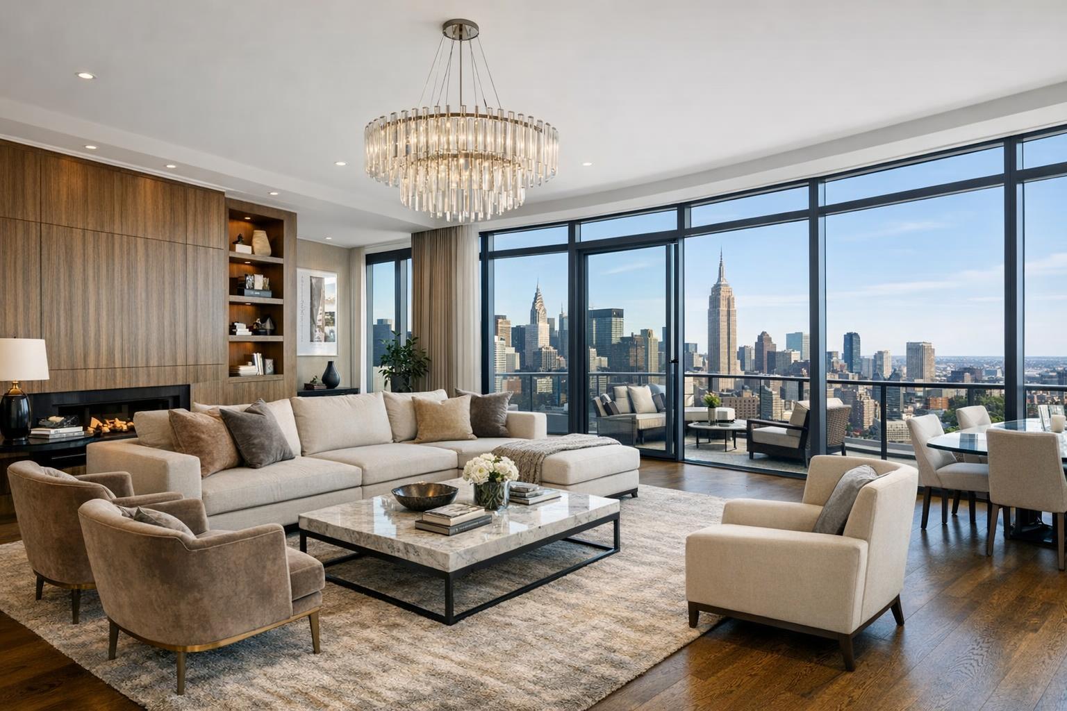
New York City and New Jersey present unique marketing challenges: vertical density, tight lot lines, hidden courtyards, rooftop amenities, and intense competition for buyer attention. In luxury property listings, commercial buildouts, or residential developments, the window to make a strong digital impression is shorter than ever.
Urban buyers—and renters—are increasingly visual-first and expect to see not just interiors but also context: street views, proximity to parks and transit, skyline vistas, and a property’s relationship to its neighborhood. Drone photography nyc isn’t just about pretty aerials—it’s about providing authentic, story-driven imagery that helps urban listings cut through noise and communicates lifestyle possibilities to a fast-paced, screen-oriented audience.
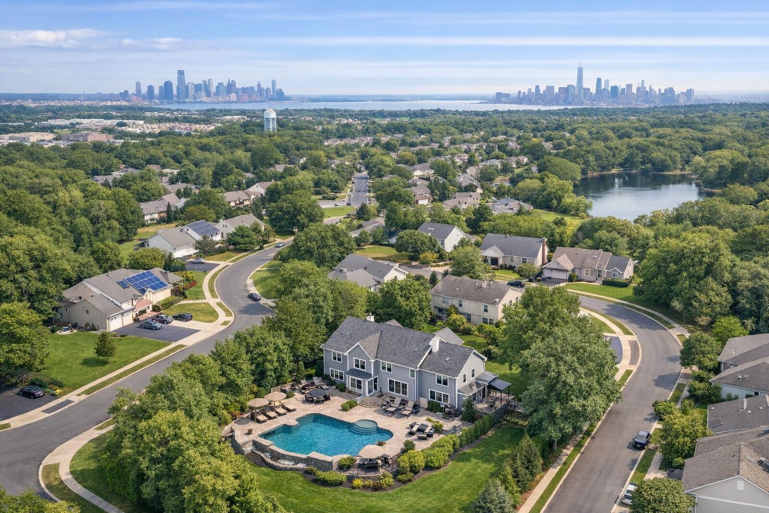
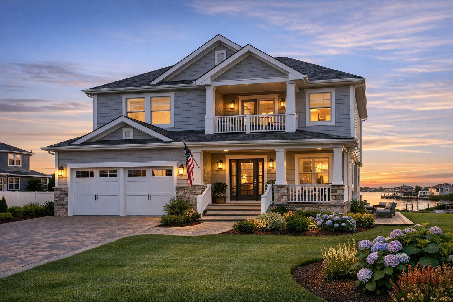
NJ’s suburban and waterfront communities gain equally: aerial real estate photography highlights yards, pools, lot boundaries, and elevation in ways flat photography never can. For sellers and agents looking to differentiate in a crowded platform environment, these perspectives are a competitive advantage.
Comparison with Traditional or Lower-Quality Alternatives
Traditional listing photos—with a phone or entry-level camera—often suffer from skewed perspectives, blown-out skies, and a missing sense of space. Phone-shot aerials can be grainy, improperly exposed, or shot from restricted altitudes without regard for FAA rules—risking both listing quality and legal exposure.
Other challenges our team often sees:
- Rushed, amateur media leads to inconsistent branding across listings.
- Delayed or uncoordinated editing due to non-specialist vendors.
- Weak staging—rooms look empty, cluttered, or poorly lit—forcing buyers to imagine a property’s true potential.
- In NYC and NJ, logistics matter: Without market-specific expertise, providers fail to secure building access, misjudge flight restrictions, or produce unusable footage.
By contrast, RealtaSnap delivers organized, staged, and fully compliant drone photo and video that fit seamlessly into full-service media packages—helping listings stand out on competitive platforms and driving real buyer engagement.
Conclusion & Call to Action
Drone photography real estate has shifted from niche add-on to core marketing necessity in NYC and New Jersey. In today’s visual marketplace, listing success depends on maximizing both property features and context—giving buyers the information and emotional connection they need to take action. With RealtaSnap, agents, managers, and sellers gain a trusted partner who understands the market, the regulations, and the real-world realities of listing photography.
Ready to elevate your next listing? Explore our drone and integrated media packages at RealtaSnap Drone Photography Services or start booking directly at RealtaSnap.com. Let’s showcase your property the way it deserves.
Frequently Asked Questions
1. Isn’t drone real estate photography in NYC tough with all the airspace rules and tall buildings?
It can be—but that’s why choosing an FAA-compliant provider matters. RealtaSnap’s team carefully checks every property for flight feasibility and always operates within legal, safe airspace. We’re upfront about what’s possible for your building or lot, so you’ll never risk fines or unusable footage. Your listing gets only what’s truly deliverable【20:9†RealtaSnap_Service_Execution_Policy_MASTER.docx】.
2. How quickly will I receive my drone photos or video after the shoot?
We know timing can make or break a listing. RealtaSnap’s standard turnaround is typically one business day for drone deliverables. Every file is professionally edited, exposure-corrected, and branded to match your primary images—so your listings go live looking consistently polished, fast.
3. What if my neighborhood or building needs special permits or has super-restricted drone rules?
Some NYC and NJ areas do require special permits, and certain buildings limit rooftop or aerial access. While RealtaSnap can advise if you’ll need extra permissions, formal municipal/NYPD/event permits are up to you. If a site is not flyable, we’ll suggest alternative approaches so your listing still shines, but we’ll never risk your compliance or reputation【20:7†RealtaSnap_Service_Execution_Policy_MASTER.docx】.
This blog post demonstrates RealtaSnap’s commitment to responsible, results-driven aerial real estate photography—grounded in local expertise, practical experience, and real-world best practices for NYC and New Jersey property pros.