The Evolving Impact of Drone Photography on Real Estate Listings in NYC and NJ
Drone photography captures a scenic view of waterfront real estate against a stunning city skyline at sunset.
Drone Photography Real Estate: How Aerial Media is Changing NYC and North Jersey Listings
Introduction
In today’s crowded property market, drone photography real estate services are rapidly becoming a game-changer for agents across NYC and New Jersey. If you’ve ever wondered why some listings spark immediate clicks and strong buyer interest—while others barely get a glance—this guide will show you how premium visuals like drone photography NYC are transforming how real estate is seen, marketed, and ultimately sold. We’ll share hard-earned insights from the field, covering what actually works on platforms like StreetEasy and Zillow, and why agents who embrace aerial real estate photography are achieving faster, more consistent results.
The Real-World Problem
Let’s face it—the listing environment in New York City and North Jersey is more competitive than ever. The sheer volume of properties available at any given moment can overwhelm buyers. In these fast-moving markets, seconds matter. A weak cover photo, flat angles, or overlooked outdoor potential can undermine a listing’s first impression from the very start. Sellers and landlords are left wondering why their properties aren’t getting qualified inquiries, even though the location, floor plan, or amenities are great on paper.
Here’s what we see every week:
- Listings with dim or uneven lighting that fail to reveal the true character of a property.
- Generic, tight living room shots that miss the bigger picture—literally.
- Empty rooftops or lackluster curb appeal that prevent a building’s exterior or amenity space from telling a story.
- Missed opportunities to capture the vibrant urban energy, green spaces, skyline views, or block charm that matter most to potential buyers and renters.
- Properties stuck with average click-through rates or stagnant price negotiations due to visuals that just don’t ignite buyer imagination.
The result? Slower sales cycles, shorter showing waitlists, and more time spent answering the same “what’s the view like?” questions. In a market where time really is money, that’s frustrating for both agents and their clients.
What Experienced Media Teams Know
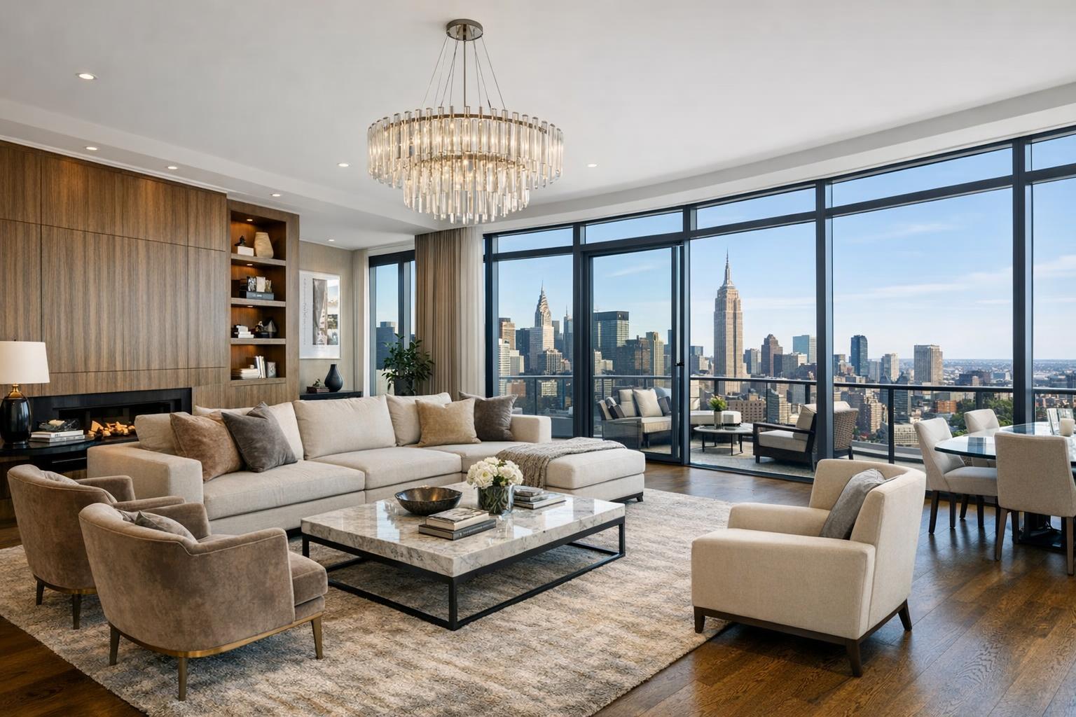
After hundreds of photo shoots throughout Manhattan, Brooklyn, Jersey City, and beyond, our team at RealtaSnap can tell you—there’s an art and a science to crafting exceptional listing visuals. It’s not just about showing a room from every angle. It’s about carefully balancing window exposures, choosing the right time of day for maximum natural light, and correcting for vertical perspective so that lines look crisp and true (not warped).
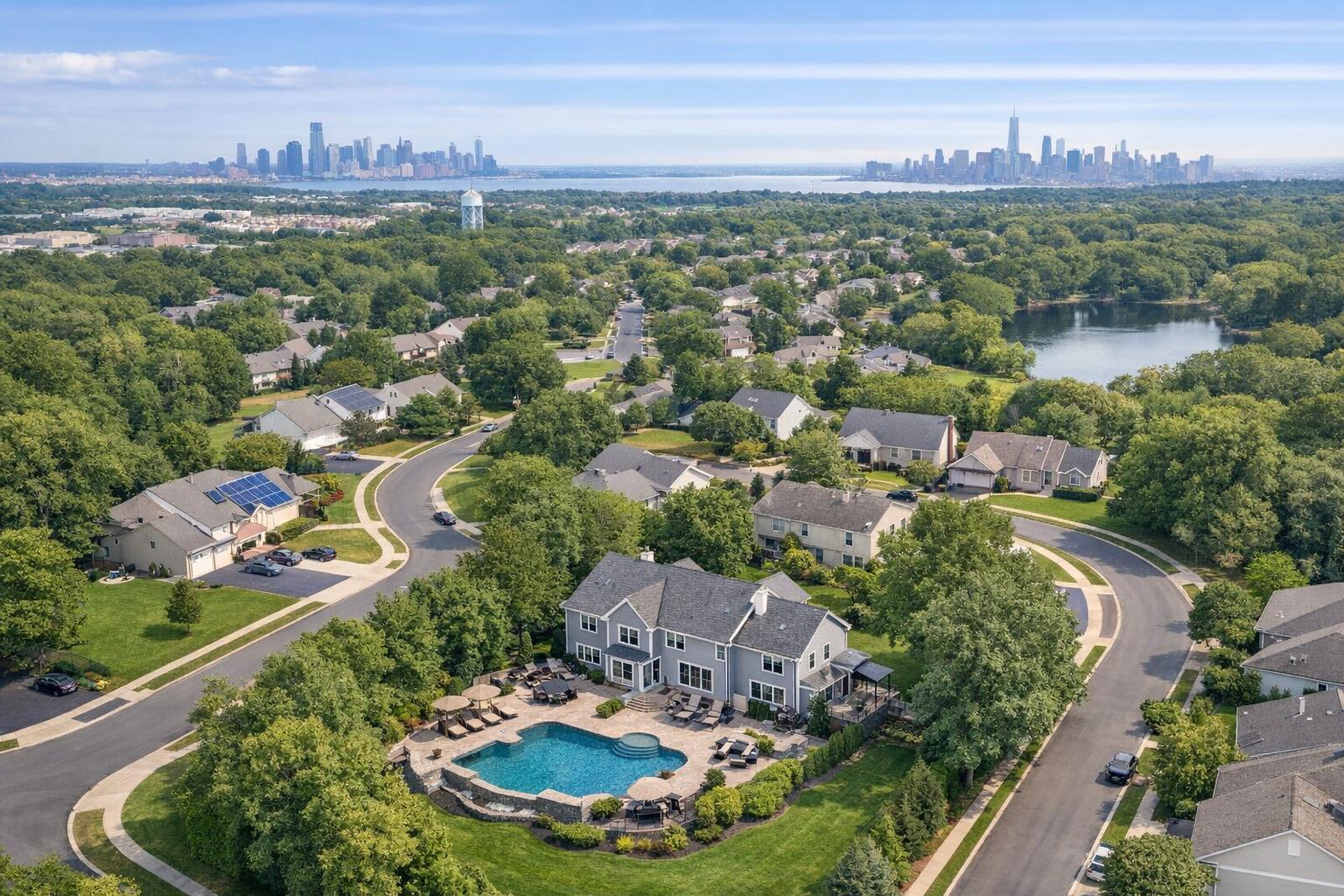
Professionals also know that exterior shots are tricky. Rushed curb photos, taken from a car or the sidewalk, often flatten a building’s best features. To really capture a rooftop garden, river view, or prime location, you need modern aerial equipment and a keen eye for composition. FAA-certified pilots ensure every flight is safe, legal, and optimized for the property—whether it’s a boutique condo or a sprawling commercial site.
And then there’s the workflow. Experienced teams streamline every stage—advance communication, property preparation tips, backup batteries, and post-processing steps like color balancing and cloud-based delivery. Real differences come from well-crafted plans: re-shooting if the weather doesn’t cooperate, using bracketing to keep sky and shadows perfectly exposed, and always allowing time for both hero shots and “storytelling” angles. We’ve learned you can’t fake these things. You get premium results only by working methodically from start to finish.
How RealtaSnap Solves It
At RealtaSnap, we built our entire process around these real-world lessons—starting with the tools and people we trust. Every drone shoot comes with an in-house, FAA-certified pilot and high-resolution, stabilized camera gear. Before a rollout, we coordinate closely with property contacts to secure launch and landing zones, choose optimal times for sunlight and weather, and plan the most impactful shots based on the building’s unique attributes.
Our deliverables are tailored for maximum marketing impact:
- 10 professionally edited aerial photos for $209
- 1-minute 4K aerial video (perfect for social, listing sites, or presentations) for $229
- Or combine both with our drone photo + video combo at $299
Every aerial real estate photography package includes industry-standard enhancements—vertical line correction, exposure balancing, and cloudless sky replacement where needed. All files are delivered through our streamlined digital dashboard within 24 hours, letting you post, print, or syndicate without the usual wait.
And here’s where our experience pays off: We make it easy to pair drone photography with additional services (HDR interiors, 3D Matterport tours, custom floor plans) for a truly cohesive media package—no need to juggle multiple vendors or lose precious days to clunky file transfers.
The bottom line? Fast booking, consistent output, stunning media, and zero guesswork—so your listings can hit the market looking their absolute best. For more details on service bundles, visit our NYC real estate drone photography page.
Benefits of RealtaSnap’s Drone Photography Services
- FAA-certified pilots for safe, legal, reliable flights
- Crystal-clear aerial photos and 4K video for every listing
- 24-hour guaranteed delivery and instant sharing dashboard
- Built-in enhancements: vertical line correction, exposure balancing
- Effortless pairing with HDR photos, 3D tours, and more
- Seamless online booking in under 3 minutes
- Transparent pricing with no hidden fees
Why This Matters in the NYC / NJ Market
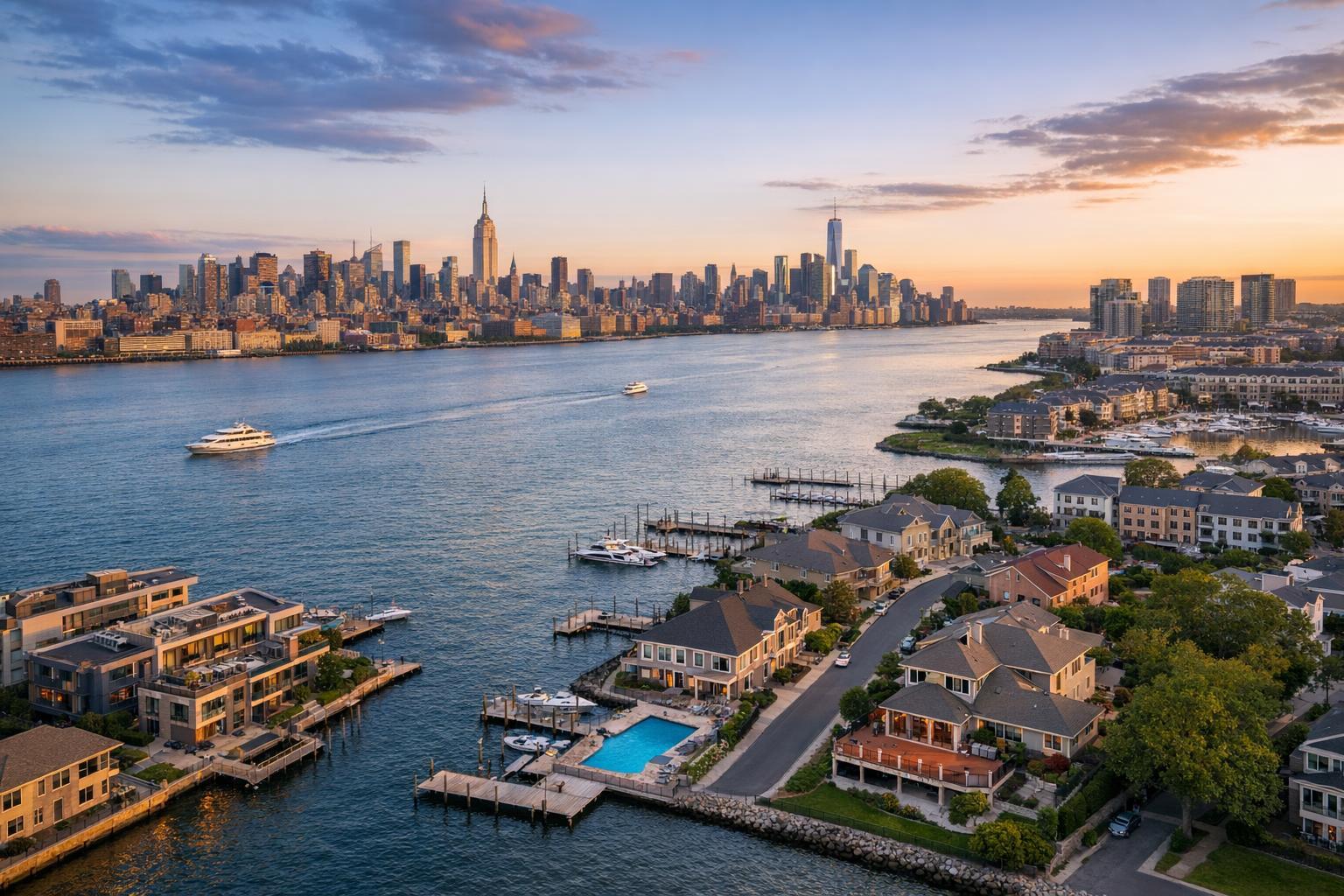
Urban and regional property marketing live by their own rules. In NYC, a high-rise’s proximity to Central Park, the view down a Brooklyn block, a rooftop terrace in Hoboken—these are all headline-grabbing features only aerial media can showcase properly. Rental studios, brownstones, and luxury condos all fight for attention against slick, scrolling feeds on StreetEasy and Zillow. It’s not just about looking good; it’s about telling the story only your property can tell.
Buyers in these regions expect more. They want context. Where does the building sit in the block? How close is public transit or nightlife? Suburban and riverside homes deserve broadcast-worthy drone sweeps over water, gardens, or full lot lines. Aerial real estate photography turns these details into conversion-driving selling points in a way no ground image or text ever could.
Comparison with Traditional or Lower-Quality Alternatives
We see it too often:
- Phone snapshots taken from street level with poor light, crooked lines, and background clutter.
- Quick, low-end drone flights with automatic camera settings that blow out highlights or muddy the sky.
- Slow return times for “edited” images—sometimes days after listing deadlines.
- Media that’s inconsistent with interior visuals, creating a jarring or unreliable feel throughout the listing.
- Unlicensed drone pilots risking fines and compliance headaches for agents and owners.
These shortcuts don’t just lead to weaker ads—they can actively turn off buyers. Inconsistent branding, obvious post-processing mistakes, or lack of exterior context cost agents real momentum. With RealtaSnap’s professionally produced, next-day-turnaround packages, you’re investing in visuals that set the standard for your own reputation and client results.
Conclusion & Call to Action
In a crowded, high-stakes market like NYC or North Jersey, every visual counts. Drone photography real estate services have moved from novelty to necessity, empowering agents, hosts, and property managers to differentiate their listings, accelerate engagement, and deliver the context that drives buyer action. With RealtaSnap’s blend of local expertise, streamlined workflow, FAA-certified pilots, and rapid turnaround, you don’t just keep up—you stand out.
Ready to see for yourself? Get instant pricing or schedule your next drone shoot at www.realtasnap.com or head directly to our real estate drone services page for more information and easy booking.
All prices and information are subject to change. Information is deemed reliable but not guaranteed.
Frequently Asked Questions
1. How quickly can I get my drone photos and videos after the shoot?
We understand the urgency of listing deadlines—waiting days can mean missing crucial buyer attention. That’s why RealtaSnap delivers all aerial media (photos and video) within 24 hours via your online dashboard, so you can launch your marketing with no time lost.
2. Is drone photography compliant and safe in NYC or NJ?
It’s a legitimate concern—regulations can be strict. RealtaSnap uses only FAA-certified pilots who plan every shoot for legal compliance and safety, whether near airports or in busy city neighborhoods. You’re protected from fines or liability, and your clients can be confident in the process.
3. What if I want to combine drone shots with other real estate media?
Many agents want one cohesive package. RealtaSnap lets you bundle aerial photography with interior HDR photos, 3D virtual tours, and floor plans—all booked through a single dashboard. You get visual consistency and faster turnaround, making your listing look cohesive and polished every single time.