Drone Photography in Real Estate The Evolving Role in NYC and NJ Markets
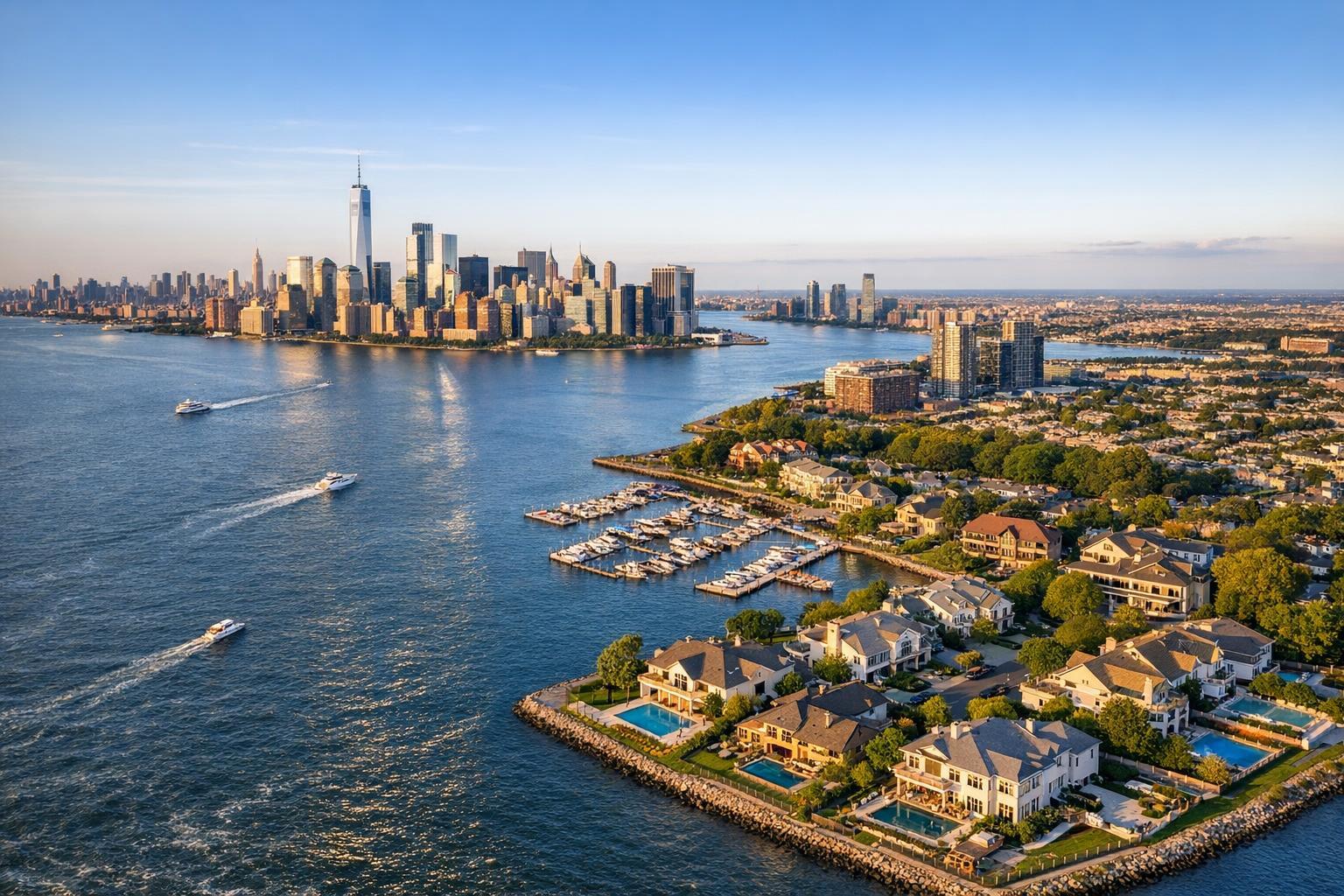
Drone photography captures a striking view of real estate with luxurious waterfront homes, a bustling marina, and the iconic skyline in the background.
Drone Photography Real Estate: How Aerial Visuals Transform NYC and North Jersey Listings
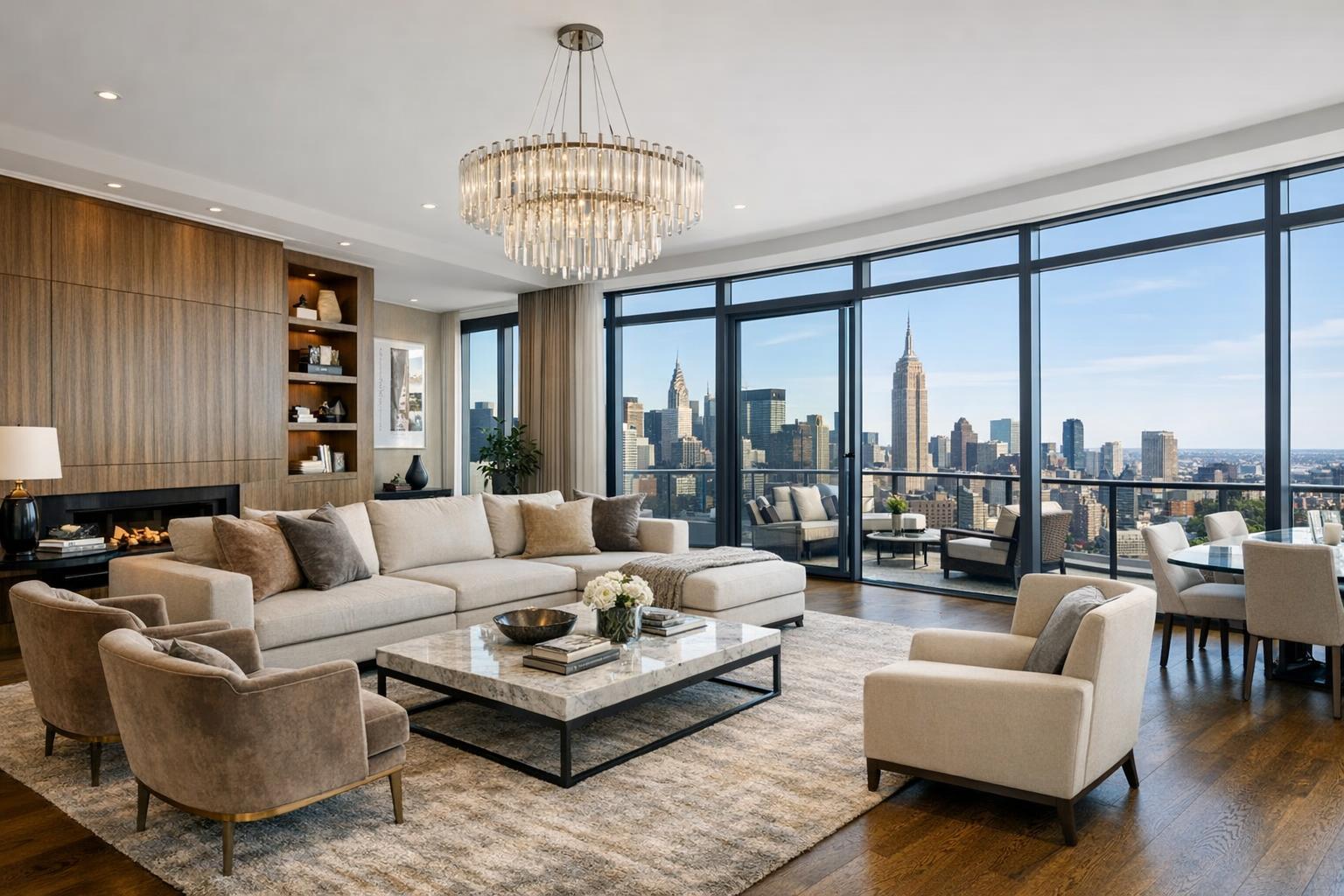
In today’s fiercely competitive market for New York City and North Jersey properties, drone photography real estate has become a game-changer for agents aiming to attract buyers with unforgettable first impressions. From residential brownstones to sprawling commercial listings, the right aerial real estate photos not only draw more clicks but tell a compelling story—grabbing attention, highlighting amenities, and setting the stage for higher engagement. In this article, we draw from years of hands-on experience at RealtaSnap to show agents how aerial imaging truly elevates property marketing, answer practical pain points, and share the approachable package pricing options that make premium media accessible to every listing.
The Real-World Problem
Ask any seasoned broker: standing out online is tougher than ever. A typical NYC or North Jersey listing might get seconds—if that—before a buyer scrolls on. Too often, we hear from agents struggling with:
- Low click-through rates as listings blend in instead of pop out
- Weak first impressions due to cramped visuals, poor lighting, or generic angles
- Empty or under-furnished spaces that leave buyers guessing about scale
- Listings that over-promise or under-deliver because photography didn’t capture the true feel
- Slow initial engagement from buyers who can’t picture location, amenities, or how the property “fits in”
- Inconsistent branding that makes portfolios look scattered instead of intentional
Traditional ground-level photography—while valuable—often can’t show the bigger picture. Tight Manhattan corridors or overgrown North Jersey yards might obscure curb appeal or block iconic skyline backdrops. Listings with only basic photos routinely struggle for attention on major platforms, especially as more agents adopt video, drone, and interactive content.
What Experienced Media Teams Know
Having photographed thousands of listings across NYC and North Jersey, we’ve seen how small details and pro workflows change outcomes. For example, aerial drone images captured at the right hour—often just after sunrise or before sunset—infuse exteriors with softer, directional light that naturally flattens harsh shadows and emphasizes architectural details. Before a shoot, our team frequently advises owners to refresh landscaping and stage patios, knowing that even an empty rooftop terrace can become the hero shot from above.
Professionals also monitor for FAA flight restrictions unique to local neighborhoods (especially near busy downtown airspaces), ensuring safe, legally-compliant operation. We balance window exposure so indoor and outdoor views are visible—no blown-out skies or dark interiors—and always vertical-correct facades for a sense of realism and prestige. In post-production, maintaining consistent color balance across all images is essential so that every listing—regardless of weather or time of day—reinforces a cohesive agent brand.
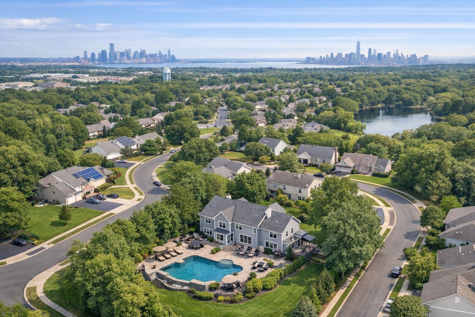
True value comes from anticipating how buyers behave: aerial shots capture not just the house, but parks, schools, transit, or the Manhattan skyline. The best teams think beyond the frame, helping agents connect listings to lifestyles and location.
How RealtaSnap Solves It
At RealtaSnap, we built our workflow around what agents tell us they need most: reliability, speed, and visuals that sell a story. Here’s how we deliver:
- FAA-certified drone pilots: Every aerial shoot is handled by experienced, insured professionals who understand local airspace, weather, and safety protocol.
- Trained editorial team: Photographers prep sites and collaborate with agents on shot lists, ensuring everything from landscaping to window shades is ready.
- Flexible packages: Need just drone hero photos? Or full MLS sets with interiors, exteriors, and aerials? Our packages make it easy to get exactly what you need—with our Residential Drone Photo Add-On starting at just $75 added to a primary photo package, or as a stand-alone option.
- Fast and consistent turnaround: Next-business-day delivery keeps your listings moving quickly, with digital proofs delivered online for easy review and download.
- Quality you can trust: Every photo goes through meticulous editing—vertical correction, balanced window exposures, and careful color matching—so buyers see the property at its best.
- Easy, agent-friendly booking: Our digital process is streamlined for busy schedules—just a few clicks to select your services, schedule, and upload details, all at www.realtasnap.com.
We’ve helped everyone from first-time property managers to top-producing agents refresh portfolios and hit the market with content that gets noticed.
Key Benefits of Choosing RealtaSnap
- FAA-certified drone pilots ensure legal and safe flights
- Next-business-day photo delivery keeps listings moving
- Tailored photo packages for any listing size or style
- Consistent color and exposure for cohesive branding
- Aerial images highlight proximity to landmarks and amenities
- Flexible upgrades: drone add-ons start at just $75*
- Transparent process and photographer communication
- Local NYC and NJ team with market-specific insight
- Simple, digital booking at www.realtasnap.com
- Commercial and residential listing expertise
*All prices and information are subject to change. Information is deemed reliable but not guaranteed .
Why This Matters in the NYC / NJ Market
Real estate moves fast in the city and its suburbs. Unique floor plans, high expectations, and urban density present special marketing challenges: tall walk-ups hemmed in by neighboring buildings, brownstones vying for attention on crowded blocks, or new construction that needs to highlight community amenities. NYC buyers and renters rely on visuals to gauge value and lifestyle before ever setting foot on-site.
Out in North Jersey, sprawling lots and parks mean location matters—overhead drone photography spotlights everything from big backyards and pools to proximity to New York City or NJ Transit lines. In such competitive, visually-driven markets, listings with aerial views see increased engagement and stronger qualified leads.
Comparison with Traditional or Lower-Quality Alternatives
What sets RealtaSnap’s drone photography apart isn’t just the gear—it’s our knowledge and commitment. Agents relying on cell phone snapshots or rushed media frequently see:
- Dim, uneven lighting that flattens features
- Skewed or warped perspectives from improper lens use
- Delayed delivery and missed market windows
- Overexposed windows or dark rooms
- Editing that fails to correct for city smog tint or north-facing light
- Missed marketing potential: ground shots alone hide major selling points (think a penthouse terrace, private backyard, or nearby skyline)
Generic providers may not understand NYC's tricky airspace requirements, leading to rescheduling headaches or subpar angles. Inexperienced teams sometimes miss out on neighborhood context shots—showing, for example, how close a Hoboken residence is to Manhattan ferry terminals. Our workflow is built to avoid these mistakes so every agent’s brand stays polished and professional.
Conclusion & Call to Action
Aerial real estate photos aren’t just a trend—they’re now an expectation in NYC and North Jersey’s most competitive markets. With drone photography, agents can lift listings above the noise, attract the right buyers, and showcase what makes every property truly unique. At RealtaSnap, our experience in both the city and suburbs gives you the technical skill, creative eye, and local knowledge needed to make every shot count.
Ready to see your property from a new point of view? Learn more about drone photography, view recent success stories, or schedule your shoot directly through our online portal. For a full overview of packages, pricing, and real-world results, visit www.realtasnap.com.
Frequently Asked Questions
1. Can drone photography be done at any property or location in NYC and North Jersey?
Many properties are excellent candidates for drone photography, but some NYC areas do fall under FAA flight restrictions due to proximity to airports or sensitive infrastructure. At RealtaSnap, our FAA-certified pilots always review airspace maps in advance, and we advise on what’s possible before every shoot, so there are no surprises.
2. Is drone photography really worth the investment versus just traditional interior and exterior shots?
Aerial imaging isn’t just about “pretty pictures.” Drones reveal context—showing buyers the whole property, neighborhood, and local amenities (like parks or transit) that ground-level shots may miss. Listings with aerial views consistently see more clicks and faster engagement. RealtaSnap packages start at just $75 as an add-on, making it a modest investment for measurable impact.
3. How fast can I get my drone photos after the shoot?
We know time is money, especially in fast-paced NYC and North Jersey markets. RealtaSnap delivers all aerial and still images by the next business day, so you can publish, promote, and move your listings forward almost immediately.
*All prices and information are subject to change. Information is deemed reliable but not guaranteed.