The Impact of Drone Photography on Real Estate Media Practices in NYC
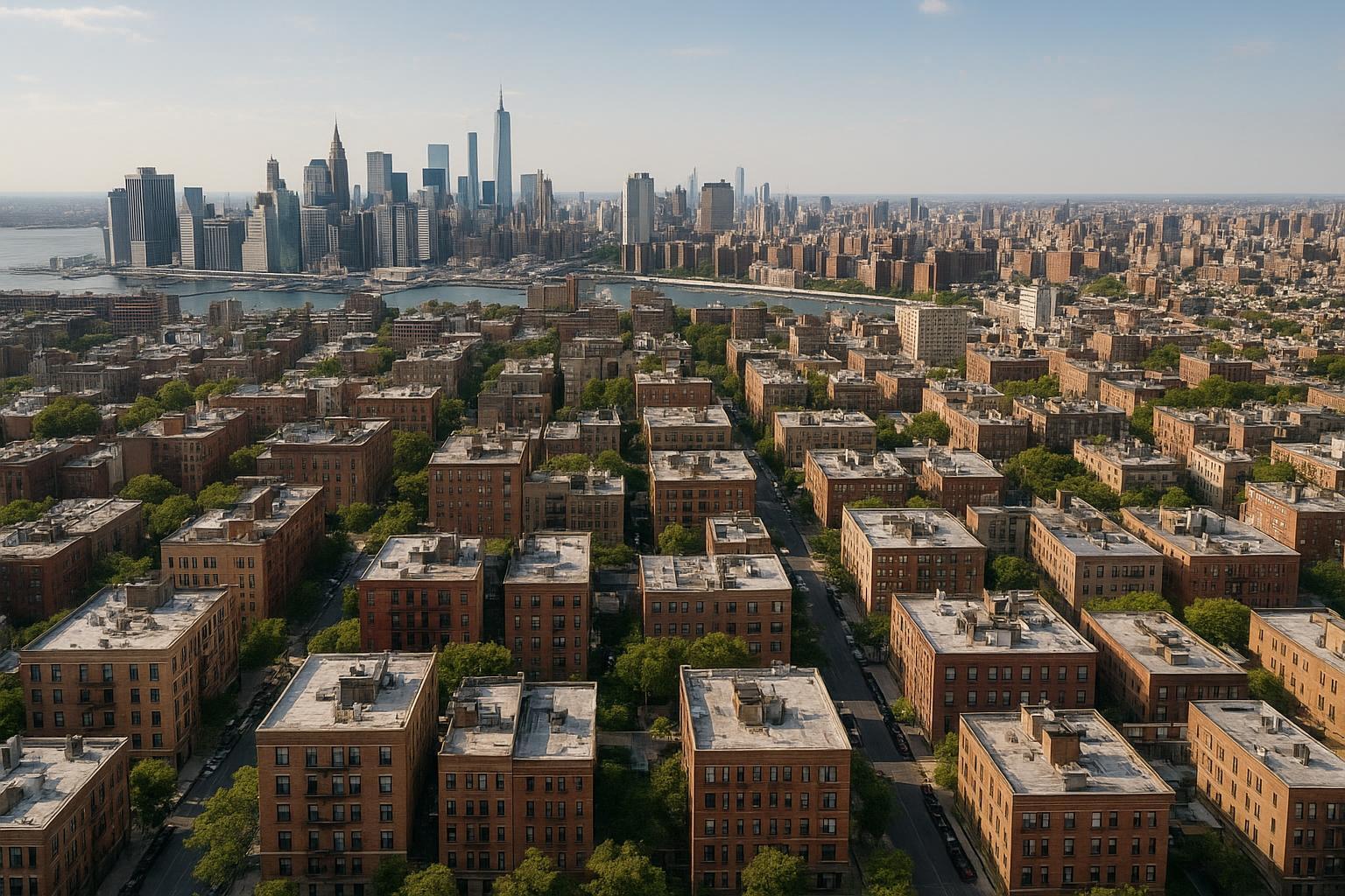
Drone photography captures a vast urban landscape of residential buildings with the city skyline in the background.
How Drone Photography Is Revolutionizing Real Estate Media in NYC
Drone photography real estate is transforming how agents and property owners market homes in NYC, New Jersey, and nearby markets, offering a dynamic blend of aerial property photography, immersive video, and advanced real estate aerial imaging. In this article, you’ll learn how real estate professionals leverage drone perspectives to boost listings, why aerial media is in high demand across New York City, and how RealtaSnap’s hands-on expertise delivers results where traditional media falls short. We’ll cover the real-world problems agents face, what only experienced production teams know, the specifics of RealtaSnap’s approach, and what truly sets great aerial media apart in today’s ultra-competitive market.
The Real-World Problem: Stale Listings, Weak Impressions, and Missed Opportunities
Every experienced broker, host, or owner in NYC and NJ knows the pain of a listing that stalls. Poor-quality photos—or worse, mediocre images taken from a phone—can sink a property’s chances right out of the gate. We’ve seen firsthand how typical challenges play out:
- Low click-through rates from buyers skimming thousands of images daily.
- First impressions that miss the mark, making spaces feel smaller, darker, or simply forgettable.
- Empty rooms leaving buyers unable to picture themselves living there.
- Outdoor shots that fail to capture the building’s setting or block context.
- Media with uncorrected distortion or blown-out windows, eroding buyer trust and wasting precious seconds of attention.
In dense urban environments like Manhattan or Jersey City, buyers expect more. Properties are stacked vertically, street views are tight, and competition is relentless. If aerial property photography isn’t part of your media toolkit, you’re asking buyers to imagine what you could show them in seconds—and you’re relying on their imagination instead of your marketing.
What Experienced Media Teams Know: Field-Tested Insights from Every Listing
At RealtaSnap, our team brings a practical, hands-on approach to every shoot. Having photographed and videoed thousands of listings across New York and New Jersey, certain nuances continually rise to the surface:
- The golden hour isn’t just a cliché—it’s the best time for balanced lighting and dynamic skies in aerials. Good drone photographers plan shots for perfect shadow lines and crisp green roofs.
- In dense urban neighborhoods, clarity about airspace is crucial. There's no guarantee you can capture ‘the shot’ from street level alone. Sometimes, roof access means the difference between a breathtaking aerial showcase and a missed opportunity.
- Aerial shots require careful vertical correction—maintaining straight lines so buildings don’t look like they’re leaning or warping, especially on wide lenses and HDR edits.
- Editing consistency matters. Buyers notice when colors shift between exterior and interior shots, undermining brand trust or giving listings a ‘cobbled together’ feel.
Professionals know that every detail—from when the windows get cleaned to where trash bins are staged—impacts the results. When you’ve been on-site for scores of shoots, you learn which angles sell a walk-up condo and which drone elevations make a pre-war co-op stand out online.
How RealtaSnap Solves It: Reliable Aerial Imagery, Every Time
RealtaSnap addresses these field realities with a process built for New York’s pace and expectations—and for agents, hosts, and sellers who need results, not just pretty pictures:
- Process & Setup: Every project starts with a review of the property type, client goals, and local airspace. Feasibility assessments ensure compliance with FAA regulations and the realities of NYC flying, so all drone flights are legal and safe.
- Execution: Our licensed pilots use pro-grade drones to capture high-resolution, true-to-life 4K/HDR images and video footage. If the weather turns or airspace is unexpectedly restricted, we reschedule to ensure only the highest-impact visuals make the cut.
- Visual Quality: Images are color-corrected, skies replaced as needed, and every photo is edited with an eye toward natural light, contrast, and making structures pop.
- Turnaround & Consistency: Most drone photo shoots are completed and delivered within 24 to 48 hours, including all edits—helping you hit critical listing deadlines.
- Ease of Use: Booking is straightforward: schedule online, specify your needs, and get alerted when your media is ready for download.
For pricing, our drone packages include 10 HDR photos (with blue sky replacement if needed) for $209, or a bundled photo + video package (10 aerials and a 1-minute video) for $299—always with prompt, predictable turnaround. All prices and information are subject to change. Information is deemed reliable but not guaranteed【20:0†RealtaSnap_Rate_Sheet_MASTER.docx】.
Learn more and see our NYC/NJ aerial real estate samples here: RealtaSnap Drone Photography & Videography NYC【20:2†RealtaSnap_URL_List_MASTER.docx】.
Benefits of Choosing RealtaSnap for Drone Photography
- Licensed, experienced drone pilots familiar with NYC and NJ markets
- FAA-compliant flights, with realistic airspace and safety assessment
- Rapid 24–48 hour delivery on most aerial photo/video projects
- High-res, HDR-edited photos and 4K video for maximum impact
- “Blue sky” replacement and color correction to ensure visual appeal
- Consistent editing style tailored to your brand and listing needs
- Easy online booking and transparent, flat-rate pricing
- Built-in support for virtual tours, video, and full media bundles
Why This Matters in the NYC / NJ Market
Aerial photography carries outsized importance in metro markets. In New York City, buyers expect listings to demonstrate both a property’s private features and its context—skyline peeks, rooftop spaces, shared green areas, building placement, and neighborhood landmarks. In New Jersey, buyers want to see proximity to transit, parks, and unique suburban amenities. Rental competition and platforms like StreetEasy, Zillow, and Realtor.com put visual storytelling front and center. High-impact drone shots deliver immediate differentiation, supporting faster buyer engagement and greater listing traffic.
Listings that use real estate aerial imaging can showcase views, roof decks, or neighborhood orientation—details impossible to replicate with only handheld interior photography. In a vertical city, or a market with sprawling yards, these perspectives are game-changers.
Comparison with Traditional or Lower-Quality Alternatives
Rushed phone snapshots, inconsistent editing, or generic, outsourced drone work simply can’t keep up. Listings with crooked horizons, washed-out skies, or poorly staged outdoor areas come across as amateur. Inconsistent color—caused by mixing iPhone photos and ad-hoc drone services—makes listings look cobbled together, losing buyer trust within seconds.
Traditional photos are critical, but they can’t show the full scope, scale, or drama of a property the way aerial property photography can. With real estate aerial imaging:
- Buyers see the roof and yard layout, neighboring buildings, and outdoor amenities all at once.
- Agents can visually prove proximity to transit, parks, or city icons—powerful motivators in competitive markets.
- Video flyarounds reveal traffic patterns, garden size, and curb appeal, instantly answering “What’s it like to live here?” before a single showing is booked.
Relying on fast, high-volume media mills or DIY phone footage means you risk missed angles, off-kilter perspectives, and—worst—lost listing momentum as buyers skip your post for something more compelling.
Conclusion & Call to Action
Great drone photography isn’t a luxury—it’s a necessity in today’s NYC, New Jersey, and surrounding markets. The difference between a listing that gets seen and one that gets scrolled past comes down to visual impact, accuracy, and storytelling, especially in hyper-competitive, fast-moving neighborhoods.
With RealtaSnap, you can count on a seamless process, expert market knowledge, and crisp aerial imagery that helps your properties resonate with more buyers—fast. If you’re ready to elevate your listings and show every home’s full story, learn more at RealtaSnap or visit our main site: www.realtasnap.com【20:2†RealtaSnap_URL_List_MASTER.docx】.
Frequently Asked Questions
1. Is drone photography even possible for my NYC or New Jersey property?
In dense metro areas or near airports, airspace restrictions and building regulations are real challenges. RealtaSnap always checks airspace and on-site access; not every location is possible, but our team helps maximize what’s feasible. Roof access can make all the difference. Our process ensures all drone work is safe, legal, and effective, so your listing gets premium images where it counts.
2. How long will it take to get my drone photos and video assets?
Most RealtaSnap aerial packages are delivered within 24 to 48 hours of the shoot, even with custom edits like sky replacement or consistent color grading. If weather or flight feasibility changes, we reschedule quickly, so your timeline stays on track. You get efficiency along with top-tier visual quality.
3. Aren’t phone photos or out-of-the-box drone shots “good enough” for listings?
While it’s tempting to save time or cost with quick phone pics or generic drone vendors, buyers notice the difference—often instantly. Drab skies, poorly framed elevations, or mismatched editing can weaken your listing’s first impression. RealtaSnap specializes in expert, branded, and market-savvy edits that help listings stand out, ensuring you get the best possible marketing outcome.
If you have more questions about drone photography for your next NYC or NJ real estate listing, reach out to the RealtaSnap team. We’re here to help your property shine.


