The Impact of Drone Photography on Real Estate Marketing in New Jersey
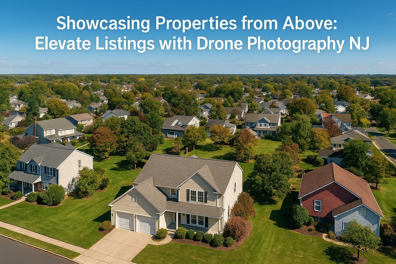
A scenic aerial view showcases suburban homes surrounded by lush greenery, highlighting the caption "Showcasing Properties from Above: Elevate Listings with Drone Photography NJ."
Drone Photography NJ: Elevating Real Estate Marketing With Stunning Aerial Imagery
When it comes to drone photography NJ, the difference between eye-level listings and those that take flight is dramatic. In today’s visually-driven real estate market, expert drone photography real estate services unlock breathtaking perspectives and essential context—capturing more attention, more imagination, and ultimately, more engagement. In this article, the RealtaSnap team explains how aerial real estate photos transform property marketing throughout New Jersey and the NYC metro area, and why partnering with real professionals is the sharpest move ambitious agents and sellers can make.
The Real-World Problem: Getting Noticed and Chosen
Let’s be honest: the challenge isn’t just photographing a property—it’s making sure it stops the scroll. Local agents, hosts, brokers, and sellers in New Jersey face some of the most saturated online real estate platforms in the country. Listings often blend together, plagued by:
- Flat, poorly lit spaces that minimize curb appeal
- Drone-free exteriors that don’t reveal proximity to amenities or green space
- Street-level photos hiding property scale, lot lines, or unique features
- Inconsistent media—mixed smartphone snapshots with rushed editing
- Repetitive visuals that fail to spark a lasting emotional impression
These issues lead directly to lower click-through rates, fewer showings, and even price reductions. In the digital era, getting buyers’ attention isn’t about luck—it’s about creating visual content that instantly initiates curiosity and trust.
What Experienced Media Teams Know
As real estate media professionals serving both urban and suburban NJ/NYC, we see firsthand how listings climb or stall based on image quality. Here's what sets experienced teams apart:
- Timing is (almost) everything: For exteriors, shooting at golden hour often gives warm, vibrant shadows and rich sky color. For aerials, midday is best when you want crisp, shadow-free lot definition.
- Preparation and communication: We coordinate with sellers to prep yards—move cars, secure pets, and declutter patios—since every drone image is wide and comprehensive. Anything missed on the ground becomes a distraction in the air.
- Regulatory and safety knowledge: Pilots must evaluate local airspace—especially in NJ’s busy suburban corridors and near the NY metro. FAA Part 107 certification is essential, and controlled airspace is case-by-case, requiring advance checks.
- Post-production magic: True HDR processing and blue sky replacement (when needed) create a polished, magazine-ready look—never overdone, always realistic.
- Consistency in branding: We match color profiles and aspect ratios so every visual asset reflects a unified, professional brand, whether for a single listing or a multi-property portfolio.
We’ve seen listings where an aerial shot of a backyard oasis doubled showing requests, and urban condos that only “clicked” with buyers after drone images revealed rooftop amenities and skyline views. These aren’t theoretical—they’re weekly realities.
How RealtaSnap Solves It
RealtaSnap’s drone photography NJ services are designed for reliability, creativity, and fast turnaround—because first impressions often happen overnight. Here’s how we address the real-world pain points:
- FAA & local regulations: Every RealtaSnap drone shoot is performed by certified pilots who know the airspace, assess risks, and follow safety rules. In tricky locations, we’ll advise on feasibility and secure all standard authorizations. Clients never worry about compliance or safety.
- Visual quality: We use 4K/HDR drones to capture sharp, detailed aerial real estate photos that show off scale, location, and unique property aspects. Our editors expertly balance exposures for window clarity, natural tones, and striking sky color.
- Transparent process, no surprises: We guide clients through prep (what to move, what to showcase), coordinate scheduling, and deliver ready-to-use images with fast turnaround—often next-day for standard shoots.
- Consistent results: Whether it’s a Bergen County single-family home, Hoboken townhome, or Jersey City high-rise, our standards never slip. We ensure straight vertical lines, clean lot demarcation, and beautifully-cropped images suited for every platform.
- All-in-one service: Drone photography, drone video, and combo packages are seamlessly booked together—whether you need listing photos, a social media sizzle, or both. No separate vendors, no workflow gaps.
Pricing for RealtaSnap’s drone packages in NJ starts at $209 for 10 HDR aerial photos, $229 for a 1-minute 4K video, and $299 for a combined photo and video shoot. All prices and information are subject to change. Information is deemed reliable but not guaranteed【20:1†RealtaSnap_Rate_Sheet_MASTER.docx】.
Benefits of Choosing RealtaSnap
- FAA Part 107 certified pilots for every drone shoot
- True HDR drone imagery and polished editing
- Blue sky replacement included when needed
- Clear communication and property prep checklist
- Consistent delivery—often in 24 hours
- Drone videos fully edited and branded for real estate use
- No complicated contracts or hidden fees
- Easy online booking, fast rescheduling if needed
- Local insight—urban, suburban, and special property types
- All content formatted for MLS, major portals, and social media
Why This Matters in the NYC / NJ Market
The tri-state real estate market is one of the most dynamic and competitive in the country. In New Jersey, you’ll find a mix of suburban homes with sprawling lawns, luxury high-rises, tight city rowhouses, and waterfront properties. Every property type presents distinct photographic challenges:
- In urban areas, drone photography and videography capture rooftop decks, skyline views, and walkability—key features that set listings apart on platforms flooded with eye-level sameness.
- For suburban or rural homes, aerial shots establish scale, highlight property lines, and showcase outdoor amenities in ways ground photos simply can’t. This context is often what turns a “maybe” into a showing request.
- Rental competition is fierce in both NYC and North Jersey, making every listing’s first impression not just a bonus but a necessity.
- Buyers and renters expect professional storytelling. Media that feels amateur or generic simply gets bypassed—especially on high-volume platforms like Zillow, StreetEasy, and Realtor.com.
With so much riding on visual media, why risk blending in?
Comparison With Traditional or Lower-Quality Alternatives
Aerial real estate photos and video stand in stark contrast to listings relying on:
- Smartphone or DIY drone shots that struggle with overexposure, crooked angles, or poor resolution
- Rushed, non-HDR images that lose detail in shadows and highlights
- Generic providers unfamiliar with northern NJ’s airspace and property nuances
- Patchwork deliverables arriving days (or weeks) late
- Inconsistent branding or aspect ratios that confuse the viewer and dilute your professional reputation
At RealtaSnap, our process, equipment, editing standards, and hands-on local expertise mean agents and owners never gamble on quality or compliance.
Conclusion & Call to Action
Aerial media isn’t a luxury in the NJ/NYC market—it’s mission-critical visual storytelling. Elevate every listing, educate and engage more buyers, and build a reputation for professional marketing with RealtaSnap’s drone photography NJ services. See how we’ve helped countless listings stand out at our NJ drone photography and video page, or learn more about all our local offerings at www.realtasnap.com.
Frequently Asked Questions
1. Is drone photography really necessary for my listing in NJ?
It’s increasingly expected, not just “nice to have.” Aerial images show a property’s setting, scale, and neighborhood context in ways no ground shot can. With so much competition and buyer browsing happening online, aerial media helps listings stand out—and fast. RealtaSnap makes the process easy and safe, ensuring your property is seen at its very best.
2. How does RealtaSnap handle drone regulations and safety in crowded New Jersey areas?
Our pilots are FAA certified and experienced with NJ’s varied airspace. We conduct location-specific risk and regulatory checks ahead of every flight, and we advise clients honestly about what’s possible and safe. You never have to worry about compliance—our job is to keep every shoot legal and smooth.
3. What if weather or location restrictions prevent drone flying on my preferred date?
We closely monitor weather and airspace regulations, and always have backup shoot days available. If the property is temporarily unflyable, we’ll reschedule promptly or recommend the best possible alternative, keeping your marketing timeline on track. With RealtaSnap, you’re in experienced, communicative hands.
For consistently beautiful listings that soar above the rest, partner with RealtaSnap for your next drone, photo, or video shoot. Explore all options and see real examples at www.realtasnap.com.


