How Drone Photography Is Shaping the Visual Standards of NYC Real Estate Listings
Drone photography captures a stunning aerial view of NYC's skyline and residential neighborhoods, highlighting its impact on real estate listings.
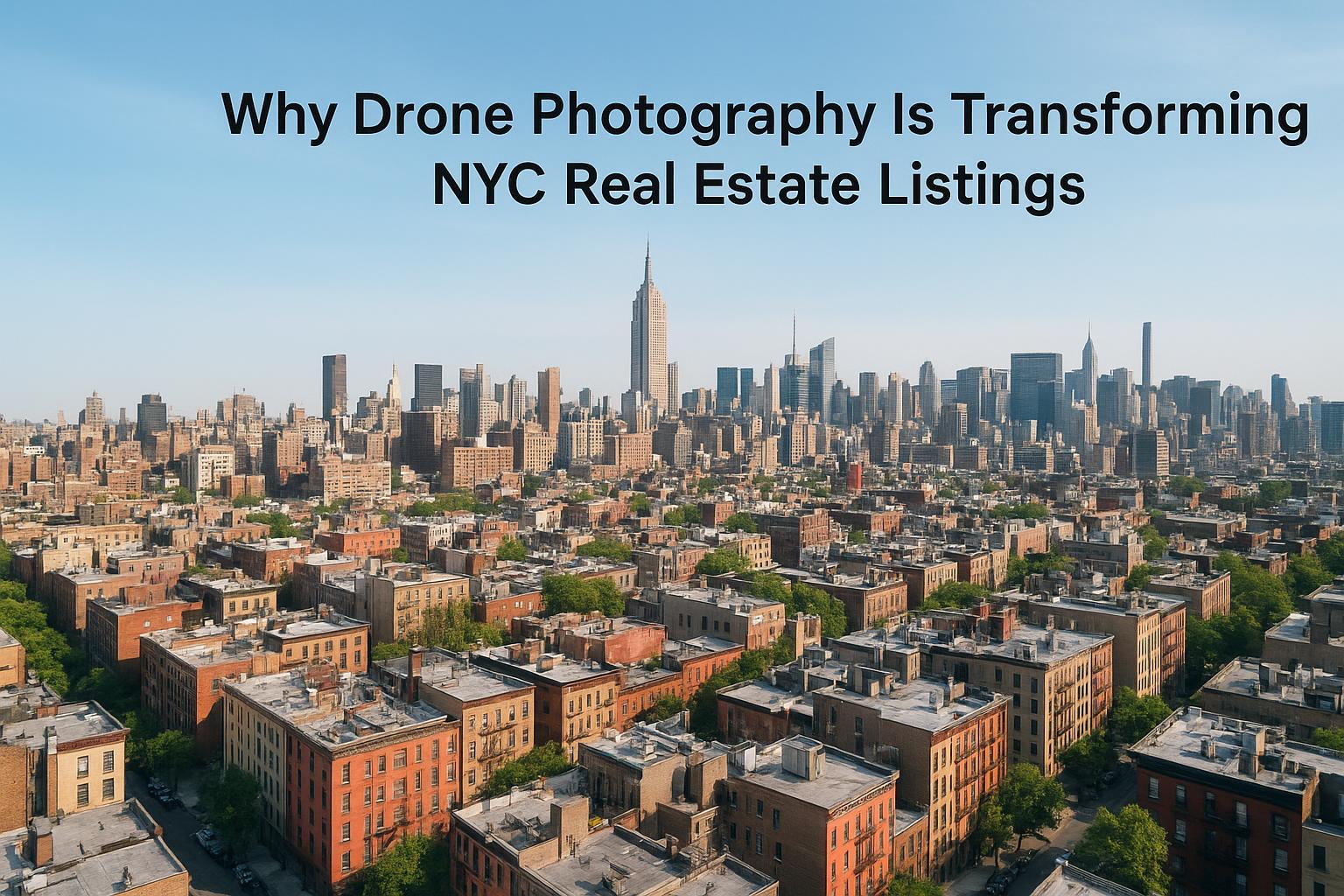
Drone Photography Real Estate: How Aerial Perspectives Are Transforming NYC Listings
Drone photography real estate has rapidly become an essential tool in competitive Northeast markets, giving NYC and North Jersey agents a real edge over traditional media. This article explores how aerial real estate photography—also known as drone photography NYC—dramatically elevates listing performance, helps buyers truly appreciate a property’s setting, and distinguishes both homes and agents in Manhattan, Brooklyn, and North Jersey. We’ll unpack the real challenges today’s agents face, what experienced media teams have learned from years in the field, and the practical ways RealtaSnap ensures your listing stands out with every listing platform’s audience in mind.
The Real-World Problem
For residential brokers, property managers, and sellers across NYC and North Jersey, there’s a familiar frustration: a beautiful condo, townhouse, or brownstone sits online for weeks—yet views and inquiries trickle in slowly. Even with decent photography, listings often suffer from:
- Low click-through rates on crowded platforms
- Flat first impressions caused by poor lighting or uninspiring angles
- Empty or poorly staged spaces complicating buyer imagination
- Limited ability to convey a home’s surroundings, outdoor amenities, or city views
- Inconsistent branding across media that can undermine agent reputation
- Suburban listings missing context, scale, or curb appeal
Let’s say you’re selling a Brooklyn townhouse. You snap some phone photos and get them up on the MLS. The rooms look “fine,” but buyers browsing Zillow scroll right past—none see the beautiful storybook backyard or the historic block lined with trees. Or, an Upper West Side penthouse might feel cramped and washed out in standard shots, hiding skyline views that would stun in person. Agents in North Jersey’s competitive market may struggle to distinguish new construction from the street, unable to showcase proximity to parks or the allure of the skyline at sunset.
As a result, even strong listings get ignored or undervalued—simply because limited visuals fail to connect with the right buyers.
What Experienced Media Teams Know
Those of us who’ve spent years producing for the NYC and Jersey listing markets know that great real estate photography is about more than just gear or filters. It’s about:
- Reading each property’s unique selling story: Is it the open floor plan? Outdoor space? Proximity to Central Park?
- Timing shoots to maximize window daylight and avoid harsh noon sun—essential for Manhattan glass towers or brownstone stoops.
- Using vertical correction and careful framing to keep lines tight (especially in high-rise shoots), so spaces feel true-to-life and room proportions aren’t distorted.
- Coordinating with property managers and agents for room prep, so staging looks natural and lived-in rather than sparse or too “virtual.”
- Carefully managing exposure balance, especially in units with iconic views—so the cityscape shines through without turning the room into a dark silhouette.
- Making logistical calls in the field: Is a drone launch feasible given city airspace? Can we access the roof for better sightlines? How do we work around pedestrian traffic or tight courtyards?
Experienced visual storytellers also know how buyers behave: the first three seconds on any listing platform are make-or-break. Drone images that reveal a property’s full context—block, skyline, outdoor features, even amenities—are the quickest way to spark immediate interest.
How RealtaSnap Solves It
At RealtaSnap, our approach is grounded in hands-on production and local expertise. Here’s what clients can expect:
- Process & Reliability: Every drone shoot is planned to capture both dramatic and practical views, balancing compliance with logistical realities (especially key in Manhattan and Jersey City’s complex airspace). We handle everything from airspace assessment to pilot assignment, always with an eye for what truly sells the listing.
- Visual Quality: Our drone imagery is shot in HDR and 4K, with post-production to ensure bright blue skies—even on overcast days. We correct verticals, edit for vibrancy, and never over-process so your listing feels authentic.
- Turnaround Time: Agents and hosts can typically expect delivery within 24–48 hours, minimizing listing lag and keeping marketing windows sharp.
- Consistency: Every shoot—whether it’s a riverside North Jersey high-rise, a Cobble Hill brownstone, or a Midtown luxury condo—gets the same pro edit touch, branding overlays by request, and standardized photo quality so your listings are always on-brand.
- Ease of Use: Booking is as simple as starting your order online, adding your property and services, then scheduling your shoot with just 24 hours’ notice—no frustrating back-and-forth or unclear next steps【20:4†RealtaSnap_Booking_Process_MASTER.docx】.
Current pricing for RealtaSnap drone services: 10 HDR photos (1 hour, blue sky replacement if needed) at $209, video (1 hour, 1 minute final 4K video) at $229, or combined photo & video at $299. All prices and information are subject to change. Information is deemed reliable but not guaranteed【20:0†RealtaSnap_Rate_Sheet_MASTER.docx】.
Benefits of Choosing RealtaSnap
- Easy, fast online scheduling
- Reliable local pilots and strict FAA compliance
- HDR aerial photos with true-to-life color
- Blue sky replacement for maximum curb appeal
- Consistent editing and photo branding
- Ultra-fast 24–48 hour turnaround
- Flexible service packages for NYC, Brooklyn, and NJ
- Full suite of ground, video, virtual tour, and floorplan add-ons
Why This Matters in the NYC / NJ Market
In dense urban environments like New York and Jersey City, most buyers can’t easily “drive by” a listing. They judge curb appeal, block quality, and amenity value from real estate platforms before ever deciding to visit. Aerial real estate photography offers context that even the sharpest ground shots can’t—capturing not just the building, but the view, block, and entire neighborhood atmosphere.
For Manhattan penthouses, access to outdoor space or skyline views can add six figures to perceived value—but only if showcased the right way. In Brooklyn and North Jersey, differentiating a home from similar listings on the same street—or highlighting proximity to a new park—makes all the difference. Aerials even help agents position listings for out-of-town or relocating buyers, who rely on virtual tools to visualize spaces before scheduling tours.
Comparison with Traditional or Lower-Quality Alternatives
- Phone Photos: Limited angles, soft focus, poor weather, and lack of context can make listings feel generic or amateur, costing clicks—especially compared to listings with dynamic aerials.
- Rushed Media: Hasty shoots often miss critical exterior or rooftop moments, overlook skyline orientation, or fail to capture amenity decks and outdoor pools—a common oversight for high-rises.
- Inconsistent Editing: Non-standard color and lighting corrections lead to mismatched, disjointed photo galleries. RealtaSnap ensures uniformity across galleries for stronger branding.
- Delayed Delivery: Agents who wait days for edits or lose time wrangling multiple vendors may miss the crucial initial listing window, especially in fast-moving markets.
- Poor Staging Decisions: Homes left empty or sparsely staged can look cold and uninspiring; RealtaSnap’s workflow integrates with staging teams and offers virtual staging as needed to fill the gaps and inspire buyers.
- Generic Providers: National vendors typically lack local situational awareness about traffic, sun angle, window views, or neighborhood highlights—RealtaSnap’s team is NYC/NJ-based and brings deep market familiarity.
Conclusion & Call to Action
Done well, drone photography isn’t just a flashy add-on—it’s a foundational tool for making your NYC or New Jersey listing stand out, connect emotionally, and convert more prospects to showings. By pairing pro aerials with consistent editing, fast delivery, and true local expertise, RealtaSnap transforms the way your listings are seen and remembered by target buyers.
If you’re ready to elevate your property marketing with dramatic, high-impact visuals, discover more or get started today by exploring our drone photography and videography services in NYC. For a full suite of real estate media options, visit www.realtasnap.com.
Frequently Asked Questions
1. Is drone photography worth the investment for my NYC or North Jersey listing?
Many agents worry that drone imagery is just for luxury or high-end properties, but in practice, aerial perspectives routinely boost engagement even for mid-market or rental units—especially in dense or competitive neighborhoods. RealtaSnap’s packages are designed to add value for every level of listing, making the upgrade a smart strategic move.
2. Are there restrictions or permits needed for drone flights in Manhattan, Brooklyn, or Jersey City?
Drone flights in urban areas must comply with FAA rules, and not every location can be legally flown due to airspace restrictions. Our pilots are trained to handle the logistics, evaluate feasibility, and secure authorizations when possible, so you can focus on selling your listing. If additional permits are required, clients are informed up front and supported through the process【20:6†RealtaSnap_Service_Execution_Policy_MASTER.docx】.
3. How quickly can I get drone photos and video for my listing?
Some providers take several days or longer, but RealtaSnap typically delivers fully edited aerial media within 24–48 hours of the shoot—so your property hits the market at maximum impact, without lag time. This speed ensures you never miss the critical launch window for your listing.
For more information and to book your next listing’s aerial shoot, visit RealtaSnap’s Drone Photography & Videography page today.


