How Drone Photography Is Shaping the Presentation of NYC Real Estate Listings
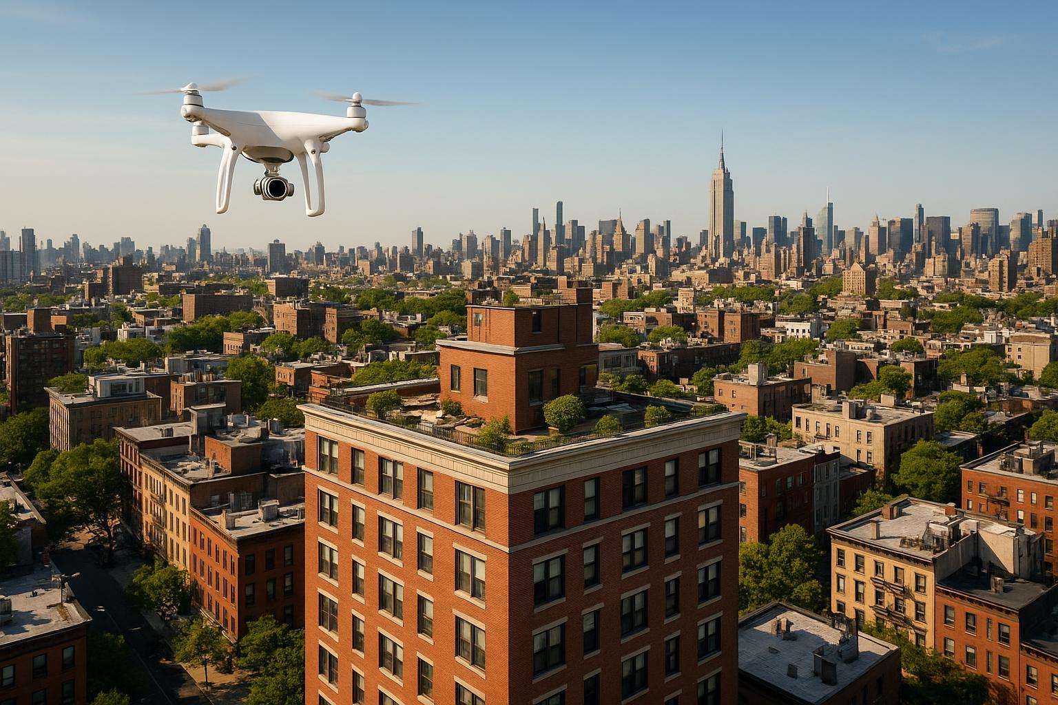
A drone flies above the New York City skyline, capturing the urban landscape with the iconic skyscrapers in the distance.
How Drone Photography Is Transforming NYC Real Estate Marketing
Today’s real estate market in New York City and New Jersey is fiercely competitive, and drone photography NYC is rapidly becoming the cornerstone of captivating modern listings. As search behaviors shift and buyer expectations rise, aerial real estate photography—also known as drone photography real estate—offers a dramatic new perspective that sets properties apart from the very first click. In this article, we’ll walk through how drone imagery is reshaping property marketing, what actual hands-on experience teaches us about capturing real estate from the air, and why a professional approach matters if you want your listings to stand out in today’s fast-moving Northeast markets.
The Real-World Problem: Flat, Forgettable Listings Miss Out
Sellers, agents, and property managers across NYC and NJ know that standing out is harder than ever. Properties with uninspiring visuals risk being overlooked—no matter their true value. Here’s what can go wrong without high-quality aerial and professional media:
- Low click-through rates: Listings with standard phone photos, poor composition, or bland angles simply don’t entice potential buyers or renters to click for more.
- Weak first impressions: The main listing photo drives online engagement. Without a dynamic shot—even better, an aerial view—it’s easy for a home or commercial space to blend into the endless scroll.
- Poor lighting and exposure: Limited windows, tricky floorplans, or city shadows can make even spacious residences look dark and unwelcoming.
- Empty or uncontextualized exteriors: For buildings with unique footprints, shared rooftops, or green space, traditional street-level photos fail to communicate value.
- Limited imagination and engagement: Buyers often can’t visualize layout, proximity to parks, or scale of amenities from basic stills alone.
- Inconsistent brand presence: Rushing to stitch together mismatched media leads to listings that feel amateur and inconsistent—hurting both agent reputation and listing performance.
These are not theoretical problems. Our team has witnessed firsthand how buyers will scroll right past a listing that lacks visual interest or clarity—especially on dense platforms like StreetEasy, Zillow, and MLS systems where dozens of properties are competing side by side.
What Experienced Media Teams Know
With years of experience shooting apartments, townhouses, brownstones, co-ops, condos, and larger commercial assets throughout NYC and NJ, we’ve learned several truths about aerial real estate photography:
- Timing matters: The sharpest, most dimensionally accurate drone images are typically captured mid-morning or late afternoon, when the sun’s angle shows texture but avoids harsh shadows on facades or backyards.
- Preparation is essential: Before launching a drone for exteriors, the team confirms all windows are spotless, common areas are staged (flowers on terraces, pool covers off), and rooftop amenities are pristine. Trash bags or clutter on a shared roof can ruin an otherwise perfect aerial shot.
- Framing counts: Hovering at the right altitude matters—too high and exteriors lose their detail; too low and you lose the sense of neighborhood or privacy cues that luxury buyers crave. We’re also always attentive to vertical correction, ensuring that tall buildings don’t look distorted or artificially flattened.
- Legalities can’t be ignored: In New York City, flying drones requires FAA certification, strict airspace compliance, and often explicit property manager approval for multi-family and commercial sites. No serious provider cuts corners here; workflow must include flight planning, permitting, and careful communication with building staff.
- Workflow influences turnaround: Efficient editing pipelines, with accurate color grading and precise exposure blending, allow us to consistently deliver next-day or two-day media even for complex jobs. Agents rely on speed without sacrificing quality, especially in fast-paced urban markets.
We know from both successful and failed marketing efforts that the right aerial imagery—shot by pros who understand post-production and city regulations—translates directly to higher engagement and better leads.
How RealtaSnap Solves It
At RealtaSnap, our approach to drone photography is grounded in real-world listing experience and rigorous workflow discipline. From luxury condos in Midtown to historic brownstones in Brooklyn and commercial portfolios in Jersey City, our team handles every phase seamlessly:
- Consultation & compliance: Every job starts with property review and, when needed, securing all necessary drone flight permits under FAA Part 107. For co-ops and high-rise buildings, we coordinate with property management to ensure legal and physical access.
- Professional on-site execution: Our drone pilots and photographers work as a unified team, staging scenes, check-lighting conditions, and adjusting for seasonal nuances (leaf coverage, snow, or shadow mapping).
- Specialized post-production: Raw drone shots are never simply uploaded. We hand-edit every image to correct vertical tilt, accurate color, and sky replacements if cloud cover is unhelpful, ensuring exteriors pop without looking artificial.
- Consistent, next-day delivery: Agents tell us that speed without sacrificing quality is a game-changer. Our workflow guarantees next-business-day turnarounds on most residential photo and aerial video sets, allowing brokers to launch listings with confidence.
- User-friendly booking & transparent pricing: Our simple online booking lets you select drone photography and videography add-ons alongside other media services at checkout. You can review all service options and book online here: RealtaSnap Drone Services.
Our entire model is built around making advanced visual media as accessible, reliable, and visually transformative as possible for busy property professionals in NYC and NJ.
Benefits of Choosing RealtaSnap
- Next-business-day delivery for drone photo and video sets
- FAA-certified pilots and insured operations at every site
- Full post-production, including exposure, sky, and color correction
- Turnkey booking with bundled service options
- Compliance with NYC/NJ airspace and property management rules
- Consistent image style and branding across multiple listings
- On-site scene and lighting optimization for aerial shots
- Experienced editors ensure no distorted or overexposed images
- Transparent pricing, no hidden fees
- All-in-one service for urban, suburban, and mixed-use listings
Why This Matters in the NYC / NJ Market
The sheer density of properties—and buyers—means that first impressions are everything in New York City and surrounding New Jersey neighborhoods. With so many listings tightly packed on digital feeds, drone imagery brings vital advantages:
- Urban complexity: Manhattan townhouses, Brooklyn walkups, and Jersey City towers each demand unique presentation strategies. Drone photography provides context and shows amenities—rooftop decks, private courtyards, skyline perspectives—that standard ground-level shots miss.
- Market expectations: High-end buyers now expect immersive, cinematic introductions to properties, not just static stills. Aerial views set the right tone before any in-person showing.
- Rental and development competition: Large buildings and new construction thrive on showcasing scale and progress from above, crucial for investors and lessees evaluating opportunities remotely.
- Listing platforms drive the standard: On platforms like StreetEasy or LoopNet, listings with aerial views see meaningfully higher engagement and longer on-page dwell times.
In short, for NYC and NJ property professionals, integrating drone photography is no longer “nice to have”—it’s increasingly a must-have to attract and retain serious buyer attention.
Comparison with Traditional or Lower-Quality Alternatives
Let’s be candid: we’ve seen plenty of listings try to cut corners, and the results don’t hold up.
- Phone snapshots or amateur drone attempts: These often come out crooked, improperly lit, or miss the essence of the property—leading to mistaken impressions about lot size or amenities.
- Rushed, inconsistent editing: Hasty post-production may leave windows blown out or skies unbalanced, hurting the sense of transparency and inviting skepticism about what’s being “hidden.”
- Delayed media delivery: Waiting days for media can mean lost momentum and delayed go-to-market during a hot season or key opening window.
- Sloppy staging choices: Without careful pre-shoot prep, exteriors can look neglected, or common areas unsellable, magnified by the wide field of aerial vision.
- Generic providers: Non-specialists rarely understand local regulations, skyline context, or the branding details that elevate luxury listings versus generic units.
The difference shows up not just in the polish of the final image, but in measurable engagement rates and listing confidence.
Conclusion & Call to Action
Drone photography is no longer an “extra”—it’s a transformative tool for NYC and NJ real estate pros committed to delivering unforgettable first impressions. At RealtaSnap, we leverage real production know-how, FAA-certified pilots, and streamlined workflow to make it easy, fast, and reliable to upgrade any listing with stunning drone photos and videos.
Ready to see how aerial real estate photography can spotlight your next property? Discover your options and book your shoot today at realtasnap.com. See the difference that professional NYC drone photography makes, powered by true market expertise and seamless service.
Frequently Asked Questions
1. Can I legally use drone photography for my NYC real estate listing?
Understandably, many agents worry about legal hurdles when it comes to flying drones in New York City. Permits, insurance, and airspace restrictions do apply—especially in dense urban neighborhoods or near airports. At RealtaSnap, every project is handled by FAA-certified pilots who follow all federal and local regulations, so you can be confident your aerial images are both legal and secure.
2. How fast can I get listing-ready drone photos and videos?
A common concern is turnaround speed—especially in a market where timing can make or break a deal. We deliver fully edited drone photos and videos by the next business day in most cases, allowing you to launch new listings or update existing ones on schedule. Our streamlined process means you don’t wait around or lose momentum.
3. Will drone images really make my listing stand out online?
Skeptics sometimes wonder if the investment pays off. In our experience, aerial views consistently increase viewer engagement and help differentiate listings in crowded marketplaces. By showing the full context—building amenities, neighborhood features, unique outdoor spaces—professional drone media gives buyers and renters compelling reasons to take the next step. RealtaSnap’s proven approach means you get that edge without extra hassle.
All prices and information are subject to change. Information is deemed reliable but not guaranteed.
Ready to begin? Learn more or get started at www.realtasnap.com.


