Exploring the Impact of Drone Photography on New Jersey Real Estate Marketing
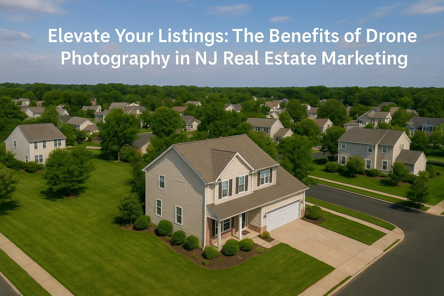
Drone photography in NJ showcases a suburban neighborhood with well-maintained lawns and houses, highlighting its benefits in real estate marketing.
How Drone Photography in NJ Transforms Real Estate Marketing: Insights from RealtaSnap’s Professional Media Team
Drone photography in NJ, combined with expert real estate visual services, is rapidly changing the way properties are presented—and perceived—across one of the country’s most dynamic markets. In this post, we’ll break down how aerial real estate photography elevates listing appeal, shortens sale cycles, and brings an unmistakable competitive edge to agents, brokers, hosts, and property managers in New Jersey, NYC, and the surrounding areas. Drawing on our extensive hands-on knowledge from hundreds of shoots, we’ll explore the hard realities agents face, show how real production teams overcome marketing challenges, and explain how a professional partner like RealtaSnap delivers consistently superior results with drone imagery.
The Real-World Problem: Selling Properties Without Aerial Perspective
Anyone who’s listed, sold, or managed property in the NYC and NJ area knows the pressure: properties fight for attention against thousands of competing listings. The difference between a fast-moving deal and a property that lingers can often trace back to first impressions, listing engagement, and visual storytelling. Most listings still rely on basic phone photos or rushed images that flatten space, misjudge lighting, and fail to capture the property’s context. For both residential and commercial spaces, this means common issues like:
- Low click-through rates on MLS or rental platforms
- Dull curb appeal due to weak exterior shots
- Empty rooms that feel lifeless and uninviting
- Poor perspective—buyers can’t “see themselves” in the space
- Unclear property boundaries, amenities, or outdoor features
- A lack of story or emotion to inspire action
These problems aren’t just cosmetic. Agents report that listings without high-quality visuals attract less qualified traffic, generate lower seller confidence, and take longer to close. In the competitive, high-stakes environments of Jersey City, Hoboken, Newark, the NYC boroughs, or North Jersey’s suburbs, these media shortcomings cost time, money, and reputation.
What Experienced Media Teams Know
After years photographing everything from brownstones to high-rise luxury condos, free-standing homes to commercial developments, we know that the right visuals can redefine a listing. There are concrete steps an expert team takes—grounded in real-world shooting experience:
- Pre-Shoot Prep: Collaborating with agents on property readiness. Removing distractions, opening blinds for balanced natural light, advising on minor staging tweaks.
- Timing: Scheduling exteriors based on optimal sunlight (late morning for eastern facades, late afternoon for western ones), or even capturing “golden hour” shots for warm, marketable ambiance.
- Framing and Editing: Using drone aerials to show context: not just the home, but how it relates to downtown skylines, nearby parks, waterfronts, or transit. Correcting vertical lines in post-production so buildings don’t appear to lean. Editing window views so interiors feel bright without losing outdoor details.
- Workflow: Fast, organized digital file delivery—including high-res images, social media-ready versions, and MLS-friendly formats within 24–48 hours.
- Listing Platform Nuances: Crafting covers and lead images that pass native platform guidelines, ensuring your property always looks its best where buyers actually browse.
Professionals understand that drone photography for real estate isn’t about showing off “cool” shots—it’s about solving the real pain points of engagement, storytelling, and accurate representation. Aerial photos give potential buyers or tenants an immediate sense of scale, layout, and surroundings that static ground images just cannot match. Commercial property managers, in particular, use overheads to demonstrate parking, access, and proximity to business districts, while luxury sellers highlight privacy, outdoor amenities, or unique architectural angles.
How RealtaSnap Solves It
At RealtaSnap, we blend artistic vision with dependable execution. Our experienced drone pilots and photographers know the best way to capture both drama and clarity for every property type. Here’s how our process tackles real marketing challenges:
- Reliable Scheduling: Bookings can be made online with clear calendar availability and instant confirmation. We coordinate around weather, property access, and agent/client schedules—essential for the unpredictable Northeast seasons.
- Compliance and Safety: FAA-certified pilots (required for legal drone work), with full coverage for high-density urban, suburban, and sensitive locations.
- Image Quality: We use pro-grade drones with top-tier stabilization and sensors, ensuring crisp, noise-free aerials in all lighting conditions. Each shoot includes wide-lens contextual shots, detail spotlights, and neighborhood overviews.
- Editing Consistency: Our in-house post-production team color-corrects, removes artifacts, and balances interior/exterior exposures, presenting every property at its true best—without overediting or misrepresentation.
- Turnaround and Support: Standard drone packages are delivered within 36 hours of shoot. We’re ready to adjust image selections for MLS, rentals, print, or social media as needed.
- All-in-One Media: Drone stills, video flyovers, virtual tours, and interactive maps can be bundled, saving agents time and ensuring a coherent, distinctive property brand.
To see how these professional workflows make a difference, explore our portfolio and service options.
Benefits of Choosing RealtaSnap Drone Photography (Markdown Bullet List)
- FAA-certified and insured pilots for every shoot
- Fast 24–36 hour turnaround for standard photo sets
- Accurate property boundaries and amenity highlights
- Consistent, high-impact editing across your listings
- Specialized aerials for residential, commercial, and mixed-use spaces
- Flexible scheduling to fit agent and seller timelines
- Complimentary consultation on staging and shot selection
- MLS, rental, and social-ready photo packages available
- Sharp detail, balanced lighting, and clear window views
- Legal compliance and local expertise for NJ, NYC, and metro area
Why This Matters in the NYC/NJ Market
Marketing real estate here isn’t like anywhere else. In NYC and North Jersey alone, buyers and renters expect visually rich, context-aware listings—even for “starter homes” or modest units. Urban towers, brownstones, waterfront developments, garden apartments, and sprawling commercial properties all demand visuals that cut through the noise. Drone photography not only addresses the literal scale of diverse property types (think Jersey City high-rises vs. historic Montclair estates) but also communicates crucial details: how close is the train? Where’s the nearest park? Public vs. private amenities? In a rental-heavy, fast-moving city, listings are judged in a matter of seconds; impactful aerials help your property make the shortlist.
Comparison with Traditional or Lower-Quality Alternatives
- Phone Photos: Struggle with glare, skewed lines, and limited range—can’t capture full exteriors or property context.
- Rushed Media: Inconsistent timing or lack of prep leads to dark interiors, unflattering angles, or missed features.
- Inconsistent Editing: Haphazard color, exposure, or window edits diminish listing credibility, especially when gallery images don’t “match.”
- Delayed Delivery: Slow turnarounds cause missed campaign windows—especially critical when competing with dozens of new releases every week.
- Generic Providers: Lack local knowledge, compliance credentials, and seasoned workflows, risking legal exposure and weaker results.
We consistently hear from agents who’ve upgraded to professional aerial real estate photography: “Buyers finally got the scale from the aerial shots” or “Sellers trusted us more after seeing the full presentation.” Details like choosing the right time of day to capture both the city view and lush backyards, or knowing which features to highlight for investors vs. families, make a quantifiable difference in buyer perceptions and closing activity.
Conclusion & Call to Action
Great drone photography in NJ isn’t about trends—it’s about proven tactics that drive engagement and results in a crowded market. By prioritizing perspective, lighting, workflow, and visual storytelling, RealtaSnap unlocks new possibilities for agents, owners, and property managers who need every listing to stand out. With all-inclusive media options, compliance assurance, and a team deeply experienced in both NYC and NJ markets, you can trust that your property is being shown at its absolute best.
Learn how RealtaSnap’s drone photography and real estate media solutions can elevate your next listing—see our service offerings and book easily at www.realtasnap.com. If you’re ready for media that truly moves the market, discover our latest portfolio and get in touch.
Frequently Asked Questions
1. Does drone photography really make a difference in property sales or rentals?
Many clients are skeptical at first, thinking drone photography is only for high-end listings. In our experience, aerial photography has increased both inquiries and showings across all types of homes and commercial spaces. It gives buyers a clear sense of layout, neighborhood, and amenities—helping your listing stand out where it matters most. Even in competitive markets, smart drone visuals deliver better engagement and credibility.
2. Isn’t drone media expensive or slow to deliver?
Agents often worry about extra costs or slow workflows. At RealtaSnap, our pricing for drone photos is transparent and competitive, with packages designed for different listing needs. Most projects are delivered within 36 hours, so your marketing always stays on schedule. All prices and information are subject to change. Information is deemed reliable but not guaranteed.
3. Are there legal or safety issues with drone flights near my property?
This is a common concern, especially in dense areas or near airports. RealtaSnap only uses FAA-certified pilots and strictly follows local and federal regulations to ensure safe, legal, and professional aerial imaging. Our team handles all compliance steps, so you don’t have to worry—your listing will always be captured correctly.
Ready to transform your next listing with a trusted, experienced team? See what RealtaSnap can do today.


