Evaluating the Impact of Drone Photography on Real Estate Listings in NJ
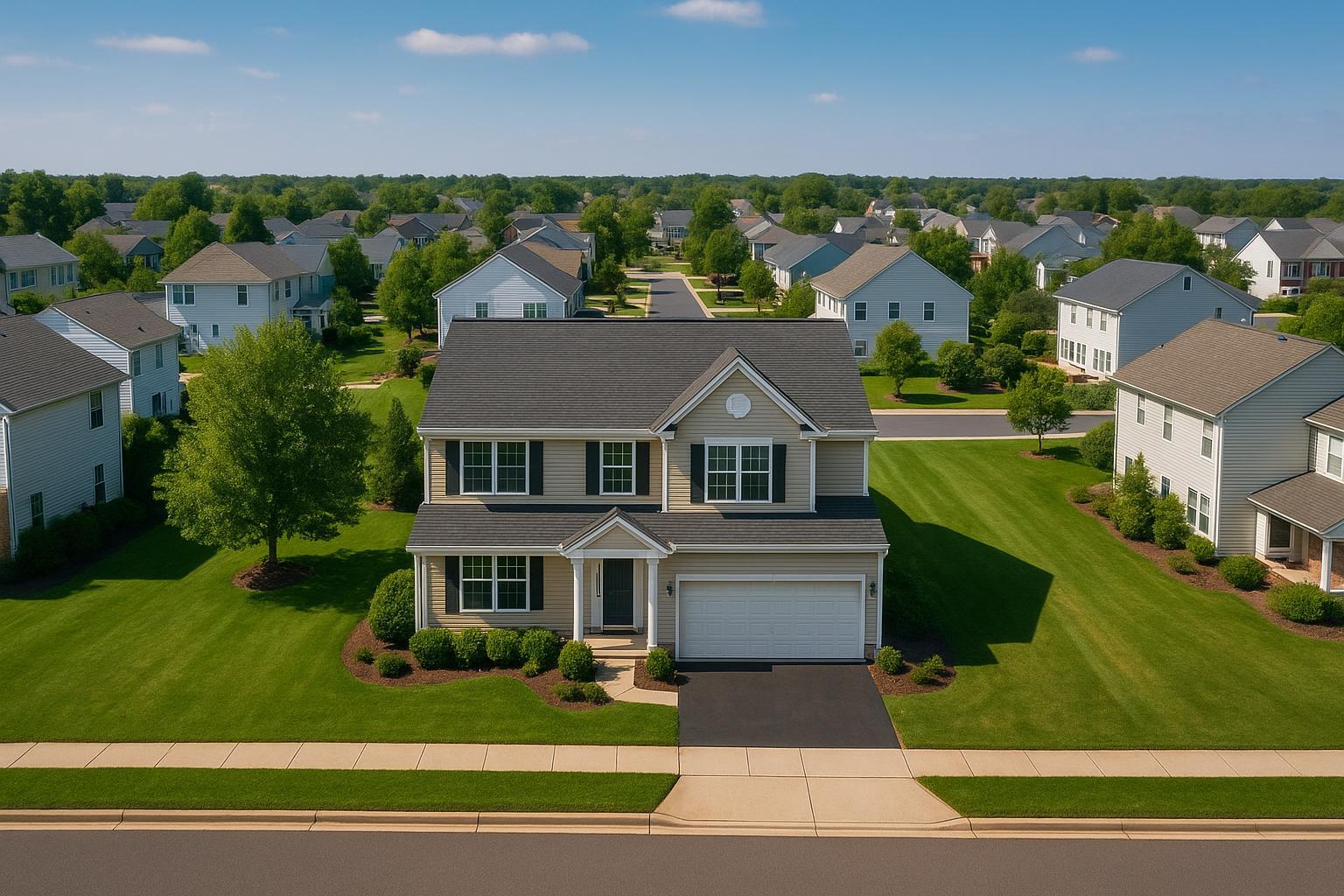
Aerial drone photography in NJ captures a suburban neighborhood with neatly manicured lawns and rows of similar-looking houses.
How Drone Photography in NJ Is Transforming Real Estate Media: An Expert Perspective
When it comes to making listings stand out in the digital age, drone photography NJ and advanced real estate media have become indispensable tools for agents and property managers in the New York City and New Jersey markets. Aerial real estate photography isn’t just a trend—it’s a proven strategy to provide extraordinary visuals, showcase property scale, and offer a unique perspective that static, ground-level photos simply can’t match. In this post, we’ll dig into why drone photography is changing the landscape for real estate listings, what professionals know from hands-on experience, and how you can leverage these insights for stronger results, especially with services from a dedicated media partner like RealtaSnap.
The Real-World Problem: When Listings Don’t Stand Out
Every real estate professional in NJ, NYC, and neighboring regions faces the same challenge: fierce competition and sky-high buyer expectations. When a property is marketed without compelling visuals, here’s what we regularly see in the field:
- Low click-through rates on listing sites, especially when the hero image is visually uninspiring.
- Bland photos that fail to capture the true expanse or amenities of the property—think limited exterior views, flat lighting, or a backyard that looks smaller than it is.
- Properties near water, parks, or urban centers losing their sense of context, making special features invisible to remote buyers.
- Struggles with poor window exposure, mismatched color tones, and awkward, empty spaces that undermine a listing's value.
- Slow buyer engagement—too many users bounce after only a few seconds.
- Difficulty building a consistent, premium brand for agents and brokerages across a portfolio of listings.
- Unflattering images hurt trust, create unnecessary objections during showings, and can result in price drops or extended time on market.
We’ve photographed hundreds of properties from Jersey City high-rises to waterfront homes in Monmouth County, and time after time, the differences between generic shots and expert drone-enabled visuals are immediate—both in buyer response and agent satisfaction.
What Experienced Media Teams Know: Field-Tested Insights
Teams that specialize in real estate photography and aerial real estate photography see an entirely different playbook than do-it-yourselfers or single-photo contractors. Here’s what truly matters:
- Timing and Lighting: For drone work, clear weather and the right time of day make or break a shot. We block out optimal windows for golden hour (often 60–90 minutes before sunset) to create sunlight that flatters both the building and its surroundings.
- Pre-Flight Planning: Not every property or airspace is equal—urban shoots may require roof access, careful FAA clearance, and strict pilot discretion, especially in controlled areas such as near Newark or downtown Jersey City. We always verify feasibility in advance and communicate openly with clients about what’s possible on their timelines【20:12†RealtaSnap_Service_Execution_Policy_MASTER.docx】.
- Framing and Sequencing: There’s an art to mixing wide, sweeping drone exteriors with tighter, context-rich shots—showing not just the roofline, but proximity to schools, transit, parks, and skyline views. We map out flight paths on site based on the listing feature priorities.
- Editing Consistency: HDR photo techniques, blue sky replacement, and careful correction of vertical lines give every image a professional polish. We don’t deliver anything less than crisply exposed, color-corrected visuals ready for listing distribution.
- Workflow Reliability: Our processes are built to deliver rapid turnaround—typically 24–48 hours after the shoot—so your listing never loses time in a fast-moving market. Agents shouldn’t have to chase their media team or worry about last-minute delays.
Real-world production is always more complex than it appears online. Weather, airspace, and property quirks require flexible, veteran teams who anticipate issues before they impact your schedule.
How RealtaSnap Solves It
At RealtaSnap, our approach to drone photography in NJ is driven by practical market experience and transparent communication. Here’s how our workflow is tailored to meet—and exceed—the demands of local real estate professionals:
- Local Market Knowledge: Our pilots understand the geography, permitting quirks, and airspace rules that govern flying over NJ and NYC. We only deploy certified pilots who assess feasibility for every address and obtain proper authorization quickly when needed【20:12†RealtaSnap_Service_Execution_Policy_MASTER.docx】.
- Professional Gear and Editing: All drone photos and video are shot in 4K/HDR, with expert in-house editing for sharpness, natural colors, and vibrant blue skies. Our process ensures media is consistent across all your listings—no mismatched skies, dull exteriors, or poorly exposed windows.
- Fast, Predictable Turnaround: Typically, we deliver finished drone media in 24–48 hours, so your listing can hit the market fast. We keep you updated every step of the way so you’re never left wondering about your project’s status【20:6†RealtaSnap_Booking_Process_MASTER.docx】.
- Easy Booking, Smooth Process: Our online platform allows you to schedule a shoot in minutes—add your address, choose drone photo/video (or a bundle), add any specific requests, and lock in your preferred date. One upfront payment, immediate confirmation, and clear expectations for shoot day and delivery.
- Compliance and Transparency: We always operate within FAA Part 107, address permitting clearly, and never take unnecessary risks. Busy agents don’t want red tape surprises—we advise what’s possible and respect your time.
- Flexible Packages: Whether you need aerials only, or a full suite with photos, video, and virtual tours, we tailor the production plan. Pricing for drone-only services starts at $209 for 10 HDR photos, $229 for 1-minute video, or $299 for both (all prices and information are subject to change. Information is deemed reliable but not guaranteed)【20:0†RealtaSnap_Rate_Sheet_MASTER.docx】.
You can learn more about RealtaSnap’s drone photography services and see examples of our work on our drone photography and videography page.
Key Benefits of Choosing RealtaSnap
- Consistent branding across all your listings
- Fast, reliable turnaround (most projects delivered in 24–48 hours)
- Certified pilots skilled in challenging NJ airspace
- 4K HDR imagery with advanced editing
- Blue sky replacement for flawless exteriors
- Clear communication—never left waiting
- Seamless online booking and payment
- Compliance with all FAA and local rules
- Packages for photo, video, or both
- Real-time scheduling and transparent service process
Why This Matters in the NYC / NJ Market
In New Jersey and New York City, competition isn’t just between listings—it’s between the quality of media agents use to bring properties to market. The region has a mix of dense urban high-rises, suburban sprawl, waterfront properties, and historic homes. Buyers expect listings to showcase what makes each location unique, including proximity to transit, city skyline, or natural amenities. Platforms like Zillow and Realtor.com are saturated, so high-quality drone visuals are no longer just a nice-to-have: they’re a necessity for getting noticed and driving showings.
Urban listings in Jersey City or Hoboken benefit from aerial shots that clarify roof decks, amenity floors, and skyline orientation; suburban listings in Bergen or Monmouth gain an edge by showing acreage, water access, or cul-de-sac privacy. Cookie-cutter “MLS” shots simply can’t compete with a compelling, well-produced aerial visual narrative.
Comparison with Traditional or Lower-Quality Alternatives
Rushed or DIY photo shoots—often using phones or basic cameras—fall short in several crucial ways:
- Limited angles and perspective: Ground shots can’t convey scale, surroundings, or feature context.
- Lighting issues: Windows often blow out, skies are flat or overcast, and interiors are misrepresented.
- Inconsistent editing: Color shifts, vertical lines, and exposure errors make listings feel less premium.
- Unpredictable delivery: Agents wait days (or longer) for media, risking missed buyer windows.
- Non-compliance: Amateurs may fly drones without proper permits, risking fines or canceled shoots.
- Missed storytelling: Buyers are left guessing about the “big picture” or unique selling points.
By contrast, RealtaSnap marries technical excellence with practical, agent-focused service: every shot is planned, executed, and delivered with the listing’s selling points (and your brand) in mind. This attention to detail helps your property stand out for all the right reasons—whether an out-of-state buyer is browsing at midnight, or a local family is narrowing down their tour list.
Conclusion & Call to Action
In today’s hyper-competitive market, great photography is table stakes—but exceptional drone photography NJ services set listings apart, spotlight location advantages, and build agent reputations. RealtaSnap delivers reliable, expertly-edited aerial real estate photography and video, tailored for real-world challenges in New Jersey and NYC. Let us help you elevate your listings and maximize your results—visit www.realtasnap.com to get started or to learn more about our real estate media solutions.
Frequently Asked Questions
1. What if my property is near restricted or controlled airspace?
It’s a common concern, especially in urban or airport-adjacent areas. RealtaSnap’s pilots assess each location for airspace classification and local restrictions prior to the shoot. We’ll advise you if special authorization or permits are needed and only schedule flights that comply with FAA regulations. If certain locations aren’t flyable, we’ll offer creative alternatives to ensure your listing still shines. You’ll never be left guessing about what’s possible【20:12†RealtaSnap_Service_Execution_Policy_MASTER.docx】.
2. How fast can I receive my drone photos and videos?
We know listing windows move fast in NJ and NYC. Most RealtaSnap drone media is delivered within 24–48 hours after the shoot. Our streamlined workflow and communication keep you in the loop, so your marketing never falls behind. Quick, dependable turnaround is a core part of our service promise.
3. What about pricing and payment for aerial photos or video?
Our drone packages are clear and up-front—starting at $209 for 10-photo drone sets, $229 for 1-minute drone video, or $299 for both. All pricing is listed on our site for transparency, and online booking is simple. All prices and information are subject to change. Information is deemed reliable but not guaranteed. To see details and book your shoot, head to our official drone photography page.


