Elevating Real Estate Marketing with Drone Photography in NYC
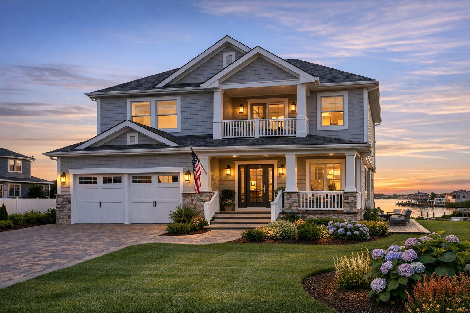
Drone photography captures a breathtaking view of NYC, showcasing the skyline, the river, and the bustling urban landscape at sunset.

Unlocking the Power of Drone Photography NYC for Real Estate Marketing
Introduction
Drone photography NYC has emerged as a cornerstone for competitive real estate marketing, transforming the way properties are presented—and perceived—across bustling New York City and New Jersey markets. In today’s landscape, listings need to stand out instantly, and creative aerial real estate photography is giving agents, brokers, and property managers the tools to capture attention, showcase location context, and drive buyer engagement. In this guide, you’ll learn exactly how experienced media teams leverage drone imagery, why agents are turning to specialists like RealtaSnap, and the major benefits that elevate property marketing above the city’s crowded noise. We’ll share hands-on insights from years spent perfecting visual storytelling for real NYC properties, explain barriers to effective listing photography, and show how purposeful, professional media bridges the gap—all while keeping you competitive in high-stakes urban and suburban markets.
The Real-World Problem
Ask any NYC agent, host, or broker: property marketing is a war for attention. With thousands of listings launching daily, your photos and videos aren’t just a visual asset—they’re a make-or-break first impression. Inconsistent branding, dimly lit interiors, distorted phone images, and media that hides a property’s real strengths can all mean the difference between a quick inquiry and a listing languishing on the market.
We’ve seen it firsthand: Listings with weak exteriors or limited context struggle with click-through rates, especially on platforms like StreetEasy and Zillow where buyers scroll quickly and demand more than just interior shots. Empty outdoor spaces, uninspired angles, or images that fail to highlight location advantages (proximity to parks, skyline views, rooftops, outdoor amenities) quickly fade into the background. At the same time, NYC and NJ buyers expect a level of sophistication—especially with higher price points or in hyper-competitive rental segments. They want to imagine lifestyle, context, and the physical “feel” of both the building and its neighborhood before ever scheduling a visit.
Even the most beautiful properties are challenged by harsh light, tight room layouts, blocked views, or inconsistent weather. Sloppy post-processing—crooked verticals, overexposed windows, or unnaturally ‘flat’ editing—further undermines trust and makes even a premium listing feel generic. In the city, where every square foot matters, these issues aren’t abstract. They’re everyday hurdles that cost real time and real money.
What Experienced Media Teams Know
There’s an art and a science to crafting media that truly sells a property—not just documents it. Having produced hundreds of listing photo and video packages across the NYC/NJ market, our team at RealtaSnap has learned what works, what fails, and why details matter from “boots on the ground” experience.
First, the most memorable listings use aerial photography to contextualize—not just decorate—a property. A drone shot isn’t arbitrary; it’s purposeful. From a single flight, we can show a Park Slope brownstone’s proximity to Prospect Park, a luxury Jersey City rental’s skyline exposure, or a multi-unit building’s private roof deck—context that’s invisible from street level. Knowing how and when to capture those assets requires on-site expertise. For example, aerials scheduled an hour after sunrise highlight east-facing views without harsh shadow, while late-afternoon flights capture warm golden lighting ideal for west-facing terraces.
Second, every shoot requires technical precision: maintaining true verticals so buildings look upright and inviting, framing so that important features (amenities, green space, entrances) are always clear, and flying within FAA guidelines to avoid legal problems or safety risks. Our workflow always starts with property preparation—clearing balconies, prepping rooftop spaces, ensuring no obstructions—because last-minute clutter is the enemy of clean, marketable visuals.
Experienced real estate photographers also know that timing and post-production are crucial. With New York’s unpredictable weather, rescheduling is sometimes inevitable, but real-time communication and rapid reshoots ensure agents aren’t left waiting. In post-production, attention to things like balancing window exposures—so interiors and skyline views are both visible without looking unrealistic—sets great drone media apart from quick, one-size-fits-all edits.
Above all, professional teams understand the pressure agents are under. Delays in turnaround mean lost momentum and frustrated sellers. This is why we’ve refined a fast, efficient, but meticulous production and delivery cycle, optimized for NYC’s breakneck pace.
How RealtaSnap Solves It
At RealtaSnap, we built our drone photography real estate services specifically for the needs of busy NYC and New Jersey professionals—from residential agents listing cozy uptown walkups to commercial brokers marketing entire developments.
Here’s what sets our process apart:
- In-House FAA-Certified Pilots: Every drone project in NYC or NJ is flown by a fully licensed, insured pilot. This isn’t just a compliance checkbox; it’s a safety and reliability guarantee. It means your media won’t be compromised by rookie mistakes or legal complications.
- Tailored Pre-Shoot Prep: We coordinate directly with listing agents or managers to optimize drone flight timing, prepare outdoor spaces, and identify must-have shots (cityscapes, yards, building approach, roof amenities). This front-end planning consistently results in compelling, ‘story-first’ visuals.
- Professional Editing and Delivery: After shooting, every image receives careful vertical line correction, exposure balancing, and light color correction so the property always looks accurate yet inviting. We consistently edit to highlight true property attributes without resorting to gimmicks.
- Rapid Turnaround: We know your listing can’t wait. Drone photo packages are typically delivered in as little as 24-36 hours, with finished media files ready for MLS, StreetEasy, and custom property websites.
- Clear, Transparent Pricing: For drone photography, our standard NYC & NJ aerial package is $249, which includes:
- Up to 12 professionally edited drone photos
- One FAA-licensed flight on-site
- Custom shot planning with a real estate media specialist
- Next-business-day turnaround (weather permitting)
- All final images formatted for web and print use
All prices and information are subject to change. Information is deemed reliable but not guaranteed.
- Seamless Online Booking & Support: Agents and managers can instantly request or schedule shoots through our secure online portal at www.realtasnap.com, with full appointment confirmation, digital payment, and real-time communication every step of the way.
Need inspiration? Browse our visual portfolio and see how drone photography transforms New York and New Jersey listings on our Drone Services page.
Benefits of Choosing RealtaSnap
- Book fully licensed, FAA-compliant drone pilots every time
- Receive 12+ market-ready aerial images in 24-36 hours
- Transparent $249 NYC/NJ aerial package pricing
- Turnkey scheduling, prep guides, and shoot support
- Professional editing that balances interior and exterior light
- Strategic shot lists highlighting each property's unique value
- Reliable delivery for on-time listing launches
- All images MLS, StreetEasy, and web-ready
- In-house team with deep NYC & NJ market experience
- 100% communication from shoot to delivery
Why This Matters in the NYC / NJ Market
New York City and surrounding urban markets are visually dense, context-driven, and fiercely competitive. Tiny differences in listing media can make a significant impact—especially since buyers are often out-of-state or international, relying solely on visuals to shortlist properties. In NYC, many listings don’t have traditional curb appeal; aerial photography is the only way to show proximity to subways, parks, or cultural attractions.
In New Jersey’s fast-moving multifamily markets, aerials can set new rentals or sales apart by clearly showing parking, outdoor space, or a unique commute advantage—critical for buyers who may be comparing dozens of similar-sized properties. With growing reliance on digital platforms, high-quality drone shots help listings surface in search, attract more shares, and maintain pricing power even when market conditions fluctuate.
Comparison with Traditional or Lower-Quality Alternatives
We regularly see the difference between thoughtful, professional aerials and “good enough” media from rushed, inexperienced, or under-resourced providers.
- Phone Photos & Rushed Shoots: Even the latest smartphones can’t offer stabilized, wide-angle aerials or capture enough context. Drone images snapped without careful planning result in skewed lines, mishandled exposure, and backgrounds that distract rather than focus.
- Inconsistent Editing & Delivery: Some budget providers cut corners with messy post-production—leading to crooked horizons, blown-out windows, mismatched color, or images that don’t accurately reflect the property. Others deliver files in wrong aspect ratios or naming conventions, causing headaches for MLS uploads.
- Delayed, Unpredictable Turnaround: When providers overpromise and underdeliver, agents lose days—or even weeks—waiting for visual assets, forcing last-minute listing delays.
- Legal & Safety Gaps: Unlicensed drone operators expose clients to risk. Unauthorized flights can even result in fines or property manager complaints, especially in NYC’s tightly-regulated airspace.
In contrast, RealtaSnap’s drone photography real estate package is built for compliance, speed, and reliable quality—helping your listings launch smoothly and shine from every angle.
Conclusion & Call to Action
Aerial real estate photography isn’t just a photography trend—it’s a practical, proven way for NYC and NJ real estate professionals to elevate their listings, connect with buyers, and compete at the highest level. From our hands-on production experience, we know what it takes to deliver fast, beautiful, and compliant drone imagery that truly moves the needle.
Ready to unlock the full power of your next listing? Book your aerial session and see how RealtaSnap’s expert team helps your property stand out in even the most crowded market. Learn more or schedule today at www.realtasnap.com.
Frequently Asked Questions
1. Is drone photography in NYC even legal, and do I need to worry about permits or safety?
It’s a valid concern—New York has strict drone regulations. RealtaSnap uses only in-house, FAA-certified pilots, and we obtain all necessary permissions before every flight. You never have to worry about compliance or legal risks. We handle it all with safety and professionalism as our top priorities.
2. I’m worried drone photos might delay my listing launch. How fast can I get the final images?
We understand NYC listings move fast. RealtaSnap’s typical turnaround for drone photography is 24-36 hours after the shoot, weather permitting. This means your listing launches on time without sitting idle, even when skies are unpredictable.
3. I’ve seen drone images that look odd or poorly edited—how do I know mine will look professional?
It’s a real issue: amateur or rushed editing leads to distorted, unflattering photos. At RealtaSnap, every drone image is professionally edited for color accuracy, line correction, and balanced exposure—so your property always shines, accurately and attractively.
For complete booking details, package info, and a portfolio of our real work, visit our Drone Photography Services page. All prices and information are subject to change. Information is deemed reliable but not guaranteed.