Elevating Property Marketing with Drone Photography in New York City
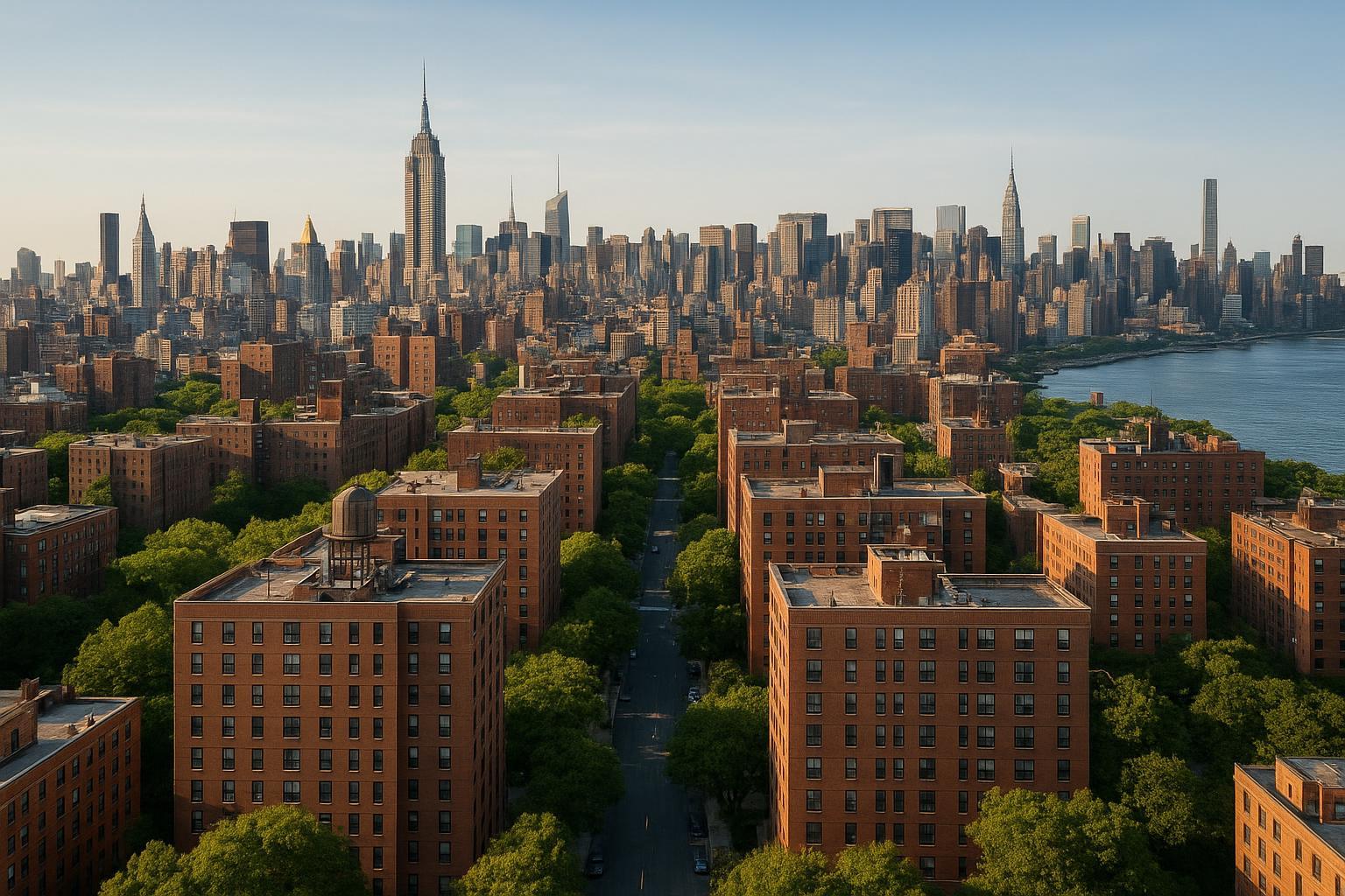
Drone photography captures a residential neighborhood with rows of brick buildings in the foreground, set against a backdrop of a sprawling city skyline and a river.
Drone Photography Real Estate: Elevating NYC Listings with Professional Aerial Media
Drone photography real estate has quickly become a game-changer for property marketing in New York City, New Jersey, and beyond—helping agents, brokers, and property managers win attention in one of the world’s most competitive real estate markets. In this article, you’ll discover how professional aerial real estate imagery (sometimes known as real estate aerials) transforms listings, solves persistent marketing problems, and provides New York’s professionals with a concrete edge online. As a team that lives and breathes property photography in the field, we’ll share hands-on experience, practical insights from countless shoots, and why more of our clients are making drone media standard in both residential and commercial listings.
The Real-World Problem: Why Listings Underperform Without Aerial Media
It’s a truth anyone working in NYC, Brooklyn, Jersey City—or anywhere buyers are scrolling through endless listings—knows all too well. Most property photos still start and end at ground level. Agents upload standard shots of the exterior, a handful of rooms, maybe a backyard or roof deck, and call it a day.
The problem? In today’s fast-paced digital market, static ground-level imagery leaves a lot to be desired:
- Properties get lost in a sea of similar-looking thumbnails—especially high-rises, multi-families, or new developments.
- Weak first impressions: Listings with only basic interior shots struggle for clicks on platforms like StreetEasy, Zillow, or LoopNet.
- Limited context: Traditional images make it hard for buyers to understand a property’s position on the block, access to parks, or skyline views—the unique elements that drive NYC and NJ demand.
- Empty spaces struggle to attract imagination, while striking amenities or roof decks go unnoticed without the right perspective.
- Marketing for multi-unit buildings, retail, or offices suffers: Legends like “corner exposure” or “rooftop potential” don’t translate visually.
Most crucially, conventional photography often fails to reflect a property’s true scale, lifestyle appeal, or investment potential. Whether for sale or lease, these missing visual stories mean slower engagement, longer days on market, and more initial showings resulting in “just browsing” rather than real, qualified interest.
What Experienced Media Teams Know: Lessons from the Field
With thousands of property shoots under our belt, RealtaSnap’s media team knows that stunning real estate aerials rarely happen by accident. Here’s what we’ve learned hands-on:
- Timing isn’t just luck: The difference between a washed-out, shadowy facade and a crisp, glowy hero shot? Smart scheduling. For drone imagery, late morning or late afternoon produces balanced rooftop details without blowing out windows or casting harsh shadows onto courtyards.
- Preparation is as important as perspective: Before we even launch the drone, we coordinate with building management, secure roof access when possible, and walk the perimeter to identify the best angles. High-rise drone work in Manhattan, for example, often means negotiating with staff for both time and space—and dealing with the realities of ever-changing NYC weather.
- Framing is everything: A skilled aerial photographer doesn’t just fly up and snap; they choose viewpoints that reveal the property’s selling points—like orienting the camera to capture both the garden and the Manhattan skyline, or angling a commercial building to highlight foot traffic and proximity to subway lines.
- Raw footage isn’t ready for marketing: Professional post-processing matters. That means blue sky replacement on gray days, vertical line correction, and matching aerial color balance to ground-level shots for a seamless listing look.
- Turnaround time and coordination: The pace of NY/NJ real estate rarely allows for a slow, multi-week editing pipeline. Our operations are tuned for rapid delivery—often within 24-48 hours—without sacrificing on consistency or visual fidelity【20:1†RealtaSnap_Rate_Sheet_MASTER.docx】.
We’ve seen firsthand how proper aerial real estate media sparks more clicks, more in-person showings, and faster inquiries—whether it’s a Brooklyn brownstone, Midtown condo conversion, or sprawling Jersey City warehouse.
How RealtaSnap Solves It: Real-World Process, Professional Results
At RealtaSnap, our aerial and drone services are built specifically for the needs of modern NYC and NJ professionals. Here’s how we address the challenges above while raising the bar for listing quality:
- Every shoot, every market—NY, NJ, urban or suburban—starts with a tailored site assessment. We handle logistical checks, evaluate airspace restrictions, and ensure compliance with FAA Part 107 regulations for safe, legal drone operations【20:6†RealtaSnap_Service_Execution_Policy_MASTER.docx】.
- Collaboration is core. We communicate with property managers, superintendents, or building teams to get proper access, coordinate flight windows, and avoid interruptions, even in controlled or restricted urban airspace.
- Visual quality is non-negotiable. All RealtaSnap drone imagery is captured in high dynamic range (HDR) for vivid colors and sharp detail. We perform blue sky replacement as needed, and ensure seamless editing—so our aerials don’t just “stand out,” they match and elevate your entire visual package【20:4†RealtaSnap_Rate_Sheet_MASTER.docx】.
- Fast, consistent turnaround, even for last-minute listings: Standard drone packages—10 photo HDR set for $209, 1-minute 4K aerial video for $229, or both for $299—can typically be delivered in 24-48 hours (all prices and information are subject to change. Information is deemed reliable but not guaranteed)【20:1†RealtaSnap_Rate_Sheet_MASTER.docx】.
- Integrates seamlessly with other marketing tools: Need matching ground photos, video tours, or virtual staging? We coordinate all services under one roof, so you maintain a strong, consistent brand presence across every listing platform.
To see our latest aerial gallery and learn how our process works for your next NYC, NJ, or Westchester property, visit www.realtasnap.com/drone-photography-videography-nyc.
Benefits of Choosing RealtaSnap’s Drone Photography
- Elevates your listing above standard ground-level media
- Increases buyer clicks and tour requests with compelling aerials
- Accurate, honest depiction—no over-promising, no misrepresentation
- Fully compliant with FAA regulations and local restrictions
- Seamless integration with ground, twilight, and virtual tour packages
- 24–48 hour average turnaround for most drone shoots
- Blue sky replacement and full HDR color correction included
- Scalable for single-family, multi-unit, or commercial properties
- Experienced team—zero learning curve for clients
- Support throughout permitting and access logistics (when needed)
- Multiple media options: Photo, video, or full aerial marketing kits
Why This Matters in the NYC / NJ Market
Aerial photography isn’t just a “nice to have” in New York and New Jersey—it’s often the single differentiator that makes a listing memorable. Here’s why:
- Complex urban context: Many properties are closely packed, with architectural features, roof decks, terraces, or location benefits (think proximity to Central Park, transit, or the Hudson River) invisible from ground shots.
- Residential and commercial diversity: NYC’s unique landscape—lofts, townhouses, co-ops, retail, and new construction—demands media that adapts to each property’s strengths.
- Informed and competitive buyers: Purchasers and renters in New York and Jersey City typically browse dozens of listings per session. Aerials immediately spotlight curb appeal and nearby amenities, attracting sharper and more qualified leads.
- Platform impact: Listings with high-quality drone imagery on major portals routinely outperform those without, driving engagement and shares, especially for new developments or penthouses that need to show rare outdoor space.
Simply put: In this market, “mediocre” is fatal for both high-end listings and value-driven deals.
Comparison with Traditional or Lower-Quality Alternatives
Standard phone photos, rushed ground-level walkthroughs, or poorly color-corrected images simply can’t compete with the depth and context of drone media. We’ve seen clients lose momentum when trying to “DIY” aerials with consumer-grade drones or apps; outcomes include:
- Tilted horizons and distorted buildings (distracting buyers)
- Inconsistent lighting or color balance—making exteriors look gloomy, even on sunny days
- Delayed listing launches due to editing issues or lack of regulatory compliance
- Missed key features, like setbacks, gardens, or building amenities
RealtaSnap delivers not just quality, but reliability: every aerial is thoughtfully composed, color-matched to your brand, and delivered on schedule for maximum impact.
Conclusion & Call to Action
Drone photography real estate has reshaped how NYC and NJ property professionals market listings—solving old problems, meeting new buyer expectations, and offering a strategic edge in today’s crowded online world. For residential, commercial, and luxury listings alike, professionally captured real estate aerials put space and lifestyle front and center, helping prospects imagine the possibilities from the very first click.
Ready to add powerful aerial visuals to your next property campaign? Explore your options and see real-world results at realtasnap.com/drone-photography-videography-nyc or learn more about full-service media packages at www.realtasnap.com.
Frequently Asked Questions
1. Can I use drone photography for any NYC property, or are there restrictions?
Due to NYC’s dense urban environment and varying airspace restrictions, not every property can safely or legally be photographed by drone. RealtaSnap evaluates every site for feasibility, obtains required airspace clearance, and always acts in compliance with FAA Part 107. If a location isn’t flyable, we help clients explore creative alternatives like rooftop access or elevated camera work—so you’re never left in the dark.
2. What’s the typical turnaround time for drone media?
Once a shoot is scheduled and completed, RealtaSnap delivers edited drone photos and video—usually within 24–48 hours. We understand the fast tempo of New York and New Jersey real estate, so our workflow is built for speed without sacrificing professional quality.
3. Is professional drone photography worth the investment for smaller properties or rentals?
Absolutely. Even modest listings can benefit from aerial shots that show proximity to parks, transit, or unique outdoor space. Aerials help rental units stand out, supporting both faster lease-up for landlords and stronger presentation for agents—without breaking the budget. RealtaSnap offers clear, transparent pricing, so you can select exactly what you need without surprises.
For dependable, truly professional drone photography real estate in NY, NJ, and surrounding markets, RealtaSnap helps your listings rise above the rest.


