Drone Photography in NYC: Enhancing Property Listings Through Aerial Perspective
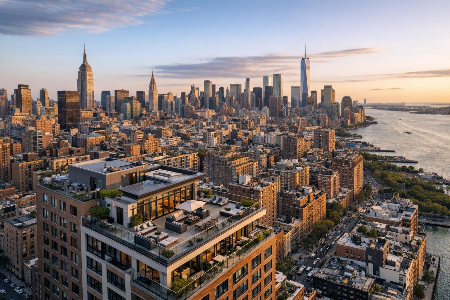
Captured through drone photography, NYC's iconic skyline unfolds with skyscrapers towering over the densely packed cityscape beside the river at sunset.
Why Drone Photography in NYC is Transforming Real Estate Marketing
Drone photography NYC isn’t just a buzzword—it’s rewiring the way real estate professionals capture, present, and ultimately move properties in the city and surrounding markets. Whether you’re looking at single-family homes in New Jersey, historic brownstones in Brooklyn, or modern condos in Manhattan, integrating high-quality aerial visuals is now a proven path to enhanced listing appeal, better property context, and more compelling online presence. In this article, we’ll explain why New York-area agents are embracing real estate aerial photography, draw from in-the-field experience, reveal what truly matters during production, and show how RealtaSnap’s solutions close the gap between standard and standout listings.
The Real-World Problem: When Listings Don’t Fly
Ask any seasoned broker, host, or agent in NYC or New Jersey about the pains of property marketing, and the same themes keep cropping up:
- Listings languish with low click-through rates because cover images don’t spark curiosity.
- Weak first impressions—those quick, three-second glances as buyers scroll—mean leads slide right past well-priced properties.
- Dim lighting, awkward angles, or blank, empty rooms leave buyers guessing about space and context.
- Online buyers, especially in fast-paced urban markets, often struggle to visualize location or grasp the full value of unique features.
- Rental and sales competition is relentless: properties with inconsistent branding or hurried, phone-shot photos simply don’t keep up.
- Media that fails to accurately reflect a home’s scale, setting, or amenities leads to mismatched expectations (and more wasted showings).
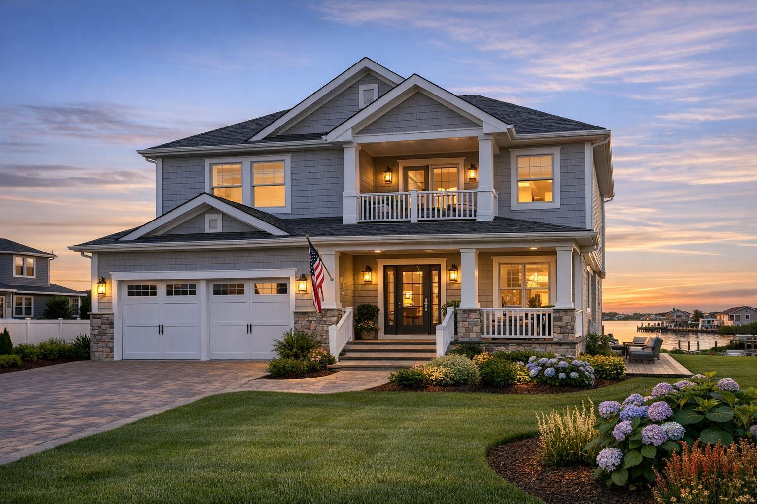
We’ve had clients call us after months of weak engagement, only to discover that their old photos never showed off the rooftop view, the garden, or even the proximity to transit. Without an aerial perspective, a listing can feel cut off from its real environment, underselling not just the property itself, but the NYC lifestyle buyers crave.
What Experienced Media Teams Know
Years in the field have taught our team a few things you just don’t get from stock photos or casual snapshots. Real estate visual media is about more than having a nice camera—it’s about process, timing, and technique:
- Lighting and Timing: The best aerial photos often require careful planning for time of day. We aim for late afternoon or "golden hour" when buildings pop against the skyline, shadows are soft, and reflections bring out roof decks, terraces, and communal amenities.
- Room and Site Prep: Exterior spaces look best if the property is staged—lounge chairs arranged neatly, garbage bins hidden, patios swept. It’s the kind of detail that’s invisible in the final shot, but essential backstage.
- Framing, Angles, and Distortion Fixes: Our FAA-certified drone pilots understand the nuances of framing within the cityscape, including the need to minimize distortion, keep vertical lines true (crucial for multi-story facades), and capture both context and detail.
- Post Production Reality: In-house editing makes the difference. Balancing window exposure is standard—nobody wants bright skies with blown-out details or dark, muddy side streets.
- Speed and Reliability: Agents regularly tell us speed is king. They ask, “If we shoot today, can I have finished aerials in time for tomorrow’s MLS update?” Answer: Yes, our workflow is built for that pace.
With this workflow, listing photos do much more than mark an address—they tell a visual story that resonates with digitally-driven urban buyers.
How RealtaSnap Solves It
At RealtaSnap, we built our NYC/NJ real estate aerial photography and media services specifically for demanding local agents, hosts, and property managers who can’t afford to wait or settle for “good enough.” Here’s how we deliver consistent, high-impact results:
- Every drone shoot includes up to 10 crisp, curated aerial photos for $209—a straightforward package that brings high-end visuals to any listing. For those who want a full suite, our combo media packages pair drone, stills, floor plans, and video for seamless marketing.
- Scheduling is streamlined and transparent: book online at any time, choose your preferred time slot, and see upfront pricing (with no surprise fees).
- Certified, insured FAA drone pilots ensure every shoot meets local and federal guidelines—no cut corners, no liability headaches.
- We prep, fly, shoot, and deliver in-house. Because editing and selection are never outsourced, you get color-consistent, brand-accurate output every single time.
- Our turnaround isn’t just quick; it’s designed to sync with the actual listing process. Most agents receive finished media within 24 hours, so they can launch fast and stay ahead on launch day or re-listings.
- We don’t just “get the shot.” We collaborate—flagging weather concerns, prepping properties, or recommending angles based on listing priorities. It’s a hands-on, feedback-driven approach built for NYC and New Jersey property professionals.
- To see examples, featured package options, or to schedule, visit our NYC drone photography page or review our full menu of real estate media services.
Benefits of Choosing RealtaSnap
- FAA-certified and locally insured pilots on every NYC/NJ drone shoot
- 10 professionally edited aerial photos for $209 (pricing as of this writing)
- Flexible combo packages for all property types
- In-house color editing and rapid 24-hour turnaround
- Online booking—choose time slots and services with transparent pricing
- Consistent vertical corrections and window exposure balance in all photos
- Expert staging suggestions before every on-site visit
- Convenient file delivery formatted for major listing platforms
- Clear licensing and image rights for agent, broker, or owner use
- Scalable for everything from single-townhouse listings to multi-site portfolios
All prices and information are subject to change. Information is deemed reliable but not guaranteed.
Why This Matters in the NYC / NJ Market
The NYC and New Jersey real estate world moves fast—and it’s visually competitive. Brooklyn and Manhattan agents know buyers expect context, scale, and lifestyle in every shot. Suburban New Jersey listings often rely on aerials to showcase lot size, pool placement, or school proximity. Urban condos compete on rooftop views, park adjacency, and neighborhood feel. Even seasoned sellers realize that without drone media, a listing risks looking anonymous on crowded rental or sales platforms. Real estate aerial photography isn’t a luxury here—it’s the modern standard.
Comparison with Traditional or Lower-Quality Alternatives
We’ve seen the difference, firsthand, between DIY phone shots and professional aerials. Phone photos from a window might capture the skyline... if you don’t mind glare, reflection, or skewed lines. Rushed “next day” providers may deliver uncorrected tilts, washed-out images, or photos where the building is barely distinguishable from its neighbors. Outsourced editing can mean mismatched lighting, inconsistent color, or files incompatible with MLS, StreetEasy, or syndication portals.
With RealtaSnap, every detail—vertical lines, shadow control, neighborhood context, even property prep—is factored in by experienced, NYC/NJ-specific media teams. It’s about consistency, credibility, and freeing agents to focus on selling rather than fixing media issues after the fact.
Conclusion & Call to Action
Drone photography isn’t the future of NYC and New Jersey real estate marketing—it’s the new now. Listings succeed or stall based on first impressions, buyer trust, and the ability to create a sense of place quickly and credibly. At RealtaSnap, our commitment is to bring professional, local expertise and hands-on guidance to every shoot—delivering drone, still, video, and combo packages tailored to the unique needs of this market.
Ready to transform your next listing with aerial visuals that move buyers to action? Discover your options and book directly through our NYC/NJ drone photography service.
Frequently Asked Questions
1. Is drone photography allowed everywhere in NYC and New Jersey?
Many locations in NYC and NJ have airspace restrictions, especially near airports or major urban centers. RealtaSnap’s team works with FAA-certified pilots who handle the permitting process and know how to secure aerial shots legally and safely. We’ll advise if there are limitations at your address and suggest the best timing or alternative shots if needed, so you’re always covered.
2. How quickly can I get my drone photos after a shoot?
Most clients receive their finished, fully edited aerial images within 24 hours of the shoot. We design our workflow to fit the rhythm of rapid-fire NYC and NJ listing activity, so agents and hosts can launch or update listings with zero downtime. RealtaSnap’s in-house editing keeps everything efficient, reliable, and consistent.
3. What’s included with the $209 aerial photography service?
Our core drone package provides 10 carefully selected and professionally edited aerial images, all delivered ready for MLS and marketing use. The price covers the shoot, in-house editing, and image licensing. You can also combine this with our full media packages for comprehensive listing coverage. Pricing is clear and upfront, with no surprise add-ons—making it easy to budget and plan ahead.
All prices and information are subject to change. Information is deemed reliable but not guaranteed.